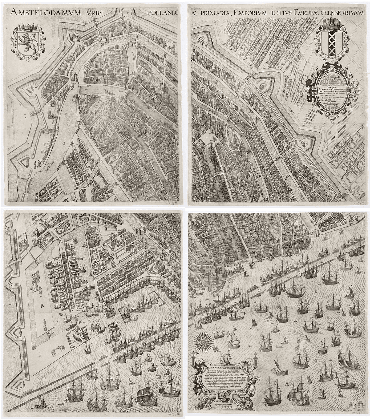
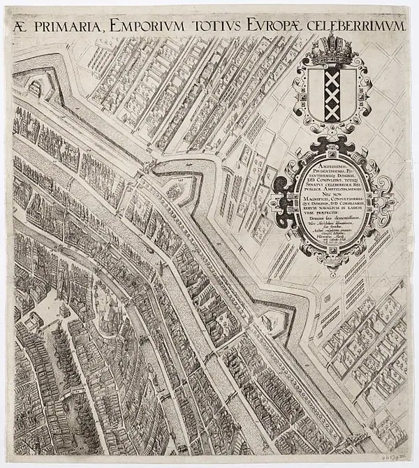
The 1599 map of Amsterdam by Pieter Bast represents a monumental leap in the technical and artistic quality of Dutch cartography. Published at the very end of the 16th century, this four-sheet copperplate engraving arrived at a critical turning point for the city. Amsterdam was no longer just a regional trading port; it was rapidly transforming into a global commercial hub. While earlier maps like the 1544 woodcut were charming but relatively simple, Bast’s work introduced a level of precision and intricate detail that set a new standard for urban planning and documentation.
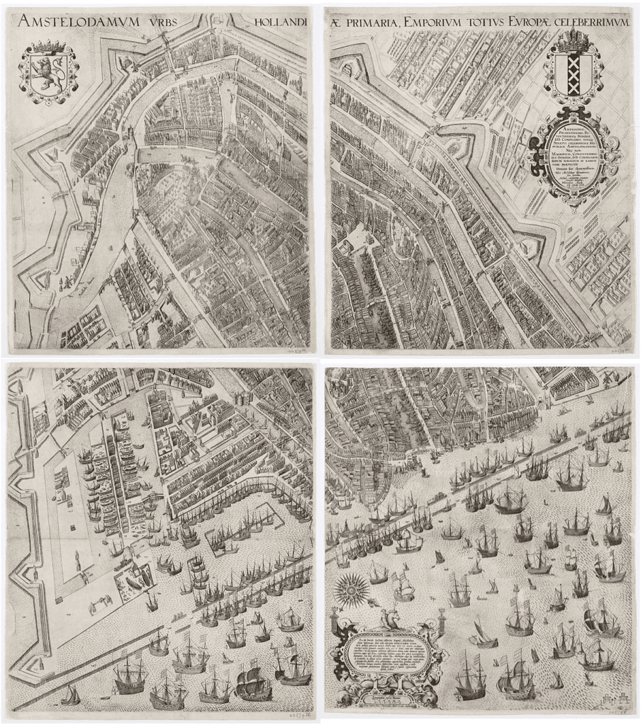
What makes the 1599 map particularly significant is its timing. It captures Amsterdam just before the “Grote Uitleg” (Great Expansion) of the 17th century began in earnest. In this map, we see the city still largely contained within its medieval fortifications, but with clear signs of the pressure for growth. The harbor is teeming with a new generation of larger ships—vessels capable of reaching the East Indies—and the city’s canals are shown crowded with the infrastructure of a booming economy. Bast’s perspective is a sophisticated hybrid of a map and a panoramic view, allowing us to see the architectural details of individual buildings and the precise layout of the city’s defense works.
Technically, Bast was one of the first to utilize copperplate engraving for a large-scale Amsterdam city plan. This allowed for much finer lines and more text than the traditional woodcut method. Because the map was printed in four separate parts, it could be assembled into a massive wall map, serving as a powerful status symbol for the city’s ruling elite. The level of detail is so high that one can identify specific windmills on the bastions and the varying heights of the gables along the Warmoesstraat. It is, in many ways, the first “modern” map of the city, focusing on topographic accuracy as much as visual splendor.
For historians, the 1599 Bast map is the ultimate “before” picture. It provides a detailed record of the city’s medieval boundaries—including the old city walls and gates—just years before they were demolished to make way for the world-famous Canal Belt. It also features a decorative border often filled with the city’s coat of arms and allegorical figures, emphasizing Amsterdam’s rising naval power. By documenting the city at the exact dawn of the Golden Age, Pieter Bast created a bridge between the medieval past and the spectacular urban future of the Dutch capital.


Explore the Evolution of Amsterdam
The 17th-century cartography of the Dutch Republic is a testament to the city’s rapid global expansion. This post is part of our comprehensive chronological archive.
- ← Previous Map: 1544 Anthonisz
- Main Collection: Maps of Amsterdam: A Chronological Guide
- Next Map: → 1625 Van Berckenrode

This 1599 map of Amsterdam by Pieter Bast is a key part of our Chronological Guide to the Maps of Amsterdam, which documents the city’s growth from a medieval port to a global capital.
Disclaimer: These works are in the public domain in their country of origin and other countries and areas where the copyright term is the author’s life plus 100 years or fewer.