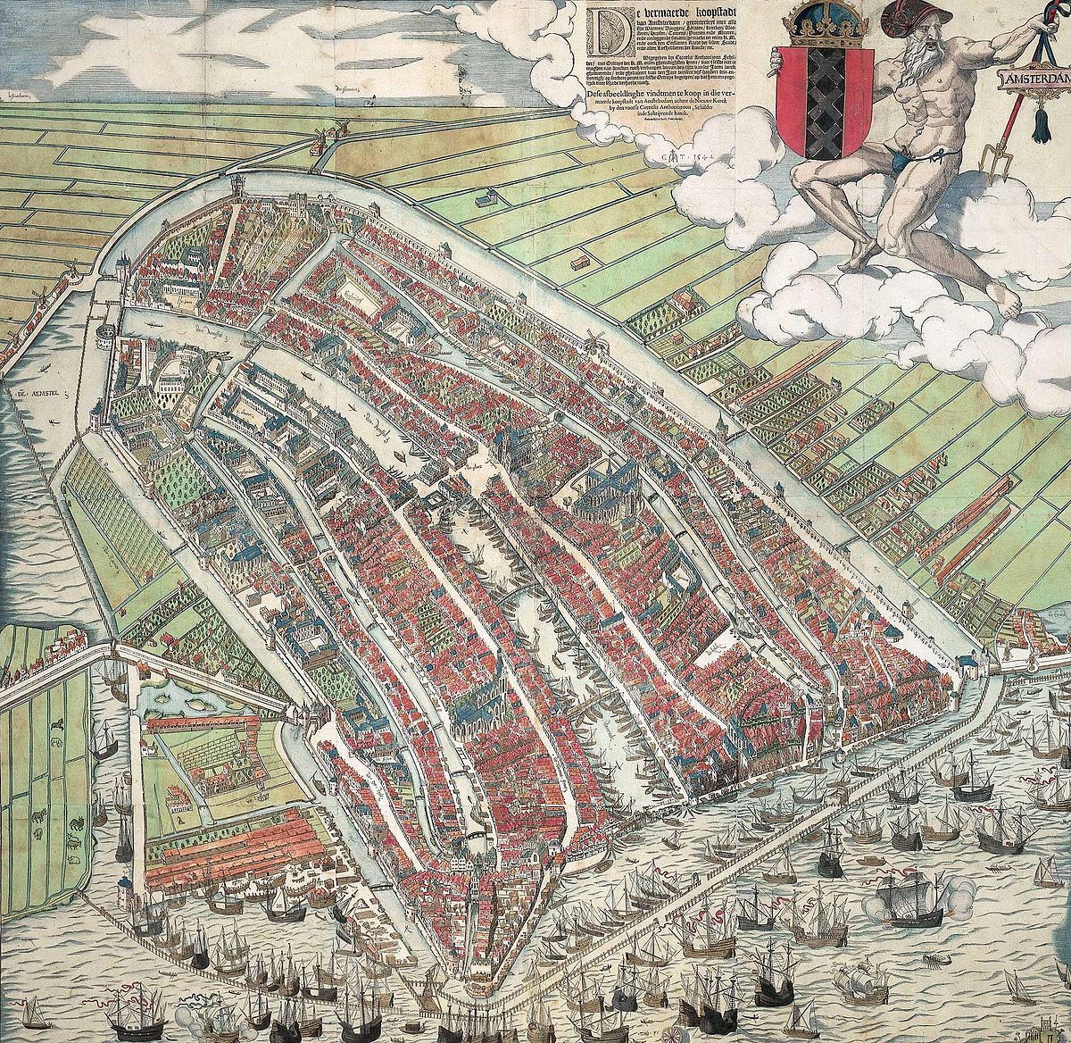
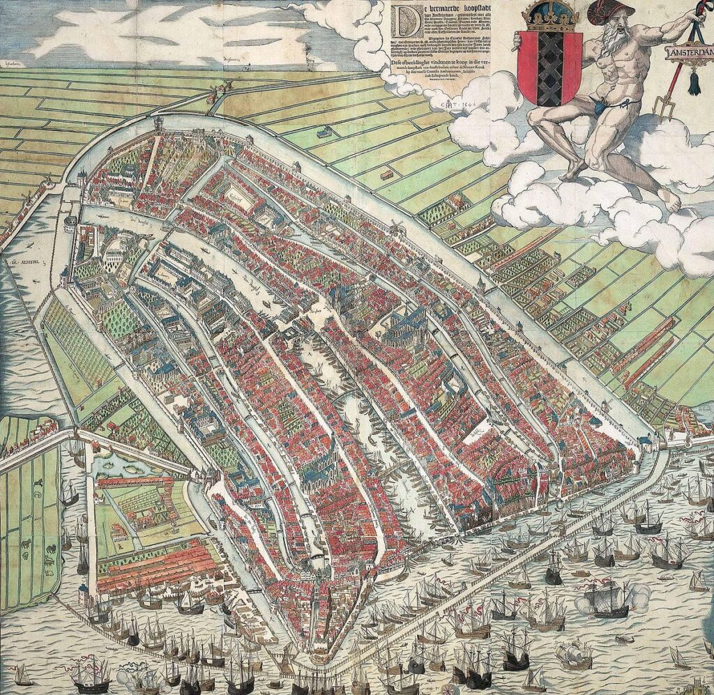
While the 1538 painting was a singular treasure, the 1544 woodcut by Cornelis Anthonisz. is the work that truly put Amsterdam on the map—literally. As the first printed map of the city, this twelve-block woodcut allowed for multiple copies to be produced, spreading the image of Amsterdam’s growing importance across Europe. The hand-colored versions of this print are particularly prized, as they bring the 16th-century cityscape to life with vibrant hues that distinguish the red-tiled roofs, the grey stone of the Gothic churches, and the deep blue of the IJ waterfront.
Anthonisz. utilized a breathtaking birds-eye perspective, a feat of imagination and mathematical skill during the Renaissance. From this vantage point, viewers can trace the city’s medieval origins, seeing a compact urban center still defined by its original walls and the Singel canal. Every detail is rendered with care, from the bustling activity of the merchant ships in the harbor to the individual houses along the Warmoesstraat. This map serves as a vital historical record, capturing the city just before the massive 17th-century expansions that would eventually create the famous Canal Belt.
The 1544 colored woodcut is more than just a geographic tool; it is a work of civic pride. By showing the city from above, Anthonisz. presented Amsterdam as an orderly, prosperous, and defensible maritime power. Today, the surviving hand-colored prints, such as the famous one held by the Amsterdam Museu, are considered some of the most important artifacts in Dutch cartography, offering a colorful window into a world of wooden masts, narrow alleys, and the early stirrings of a global trade empire.
Explore the Evolution of Amsterdam
The 17th-century cartography of the Dutch Republic is a testament to the city’s rapid global expansion. This post is part of our comprehensive chronological archive.
- ← Previous Map: 1538 Anthonisz
- Main Collection: Maps of Amsterdam: A Chronological Guide
- Next Map: → 1599 Pieter Bast
This 1544 woodcut of Amsterdam by Cornelis Anthonisz. is a key part of our Chronological Guide to the Maps of Amsterdam, which documents the city’s growth from a medieval port to a global capital.
Disclaimer: These works are in the public domain in their country of origin and other countries and areas where the copyright term is the author’s life plus 100 years or fewer.