The Last Bridge Over the Herengracht, at the Western Bank of the Amstel
Bridge 35 and Bridge 36 are neighbours in the most precise sense: they stand side by side on the western quay of the Amstel, separated by barely fifty metres of cobbled waterfront, each spanning the mouth of one of Amsterdam’s two great inner canals. Between them they mark the southern terminus of the Herengracht and the Keizersgracht, the two deepest and most prestigious waterways of the Golden Age city. Both bridges are named after members of the small team of civic professionals who made those canals possible. Both carry Anno stones dating from the 18th century. And both have been subtly shaped by the same practical necessity: the proximity of the Weesperveer quay, which required the bridges here to be built higher than elsewhere on the canal, so that barges loading and unloading at the ferry terminal behind them could pass underneath without obstruction.
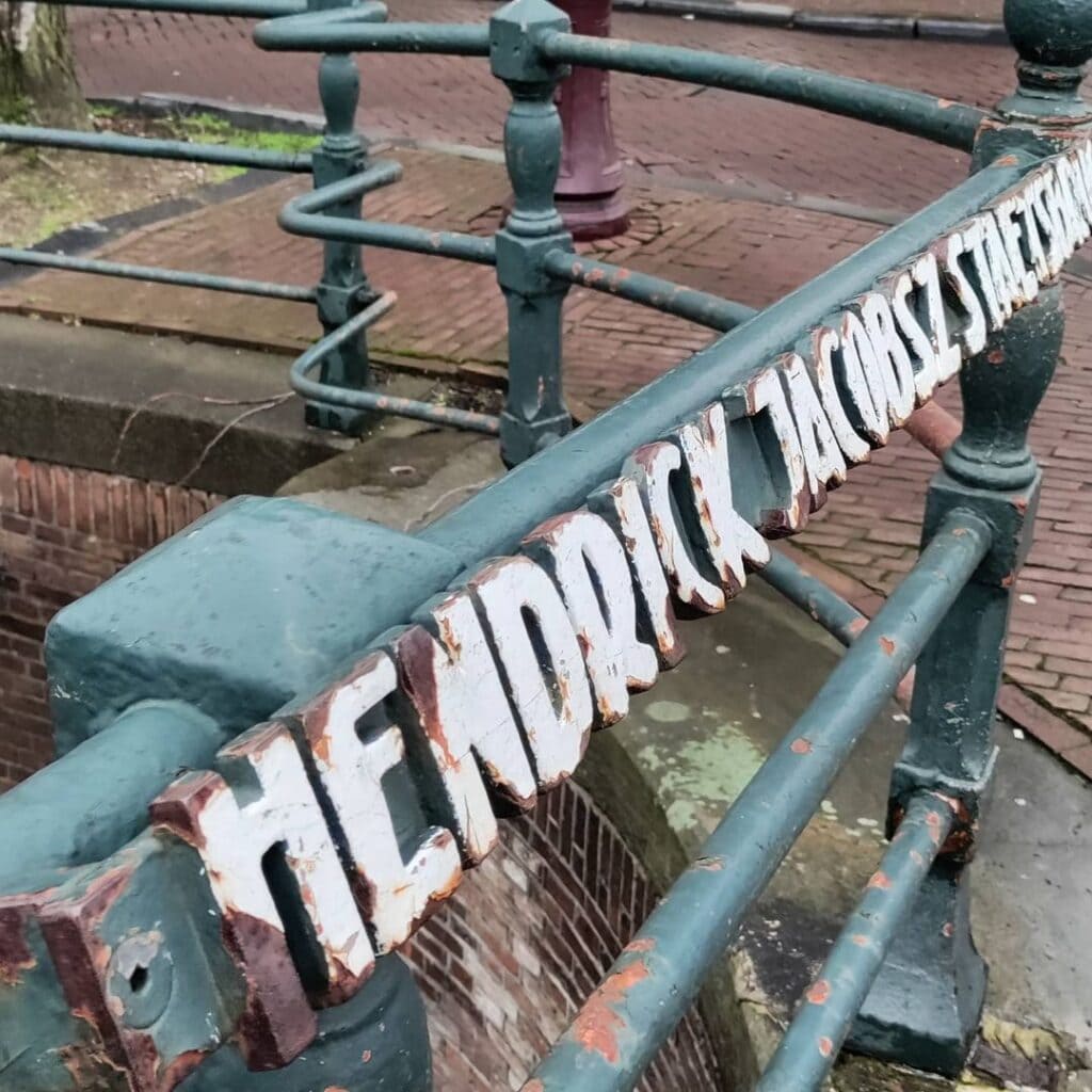
Where Bridge 36 (the Lucas Jansz. Sinckbrug) honours the city surveyor who drew the plans, Bridge 35 honours the man who built them: Hendrick Jacobsz. Staets, city carpenter, master builder, and one of the most consequential figures in the practical realisation of the Amsterdam canal belt.
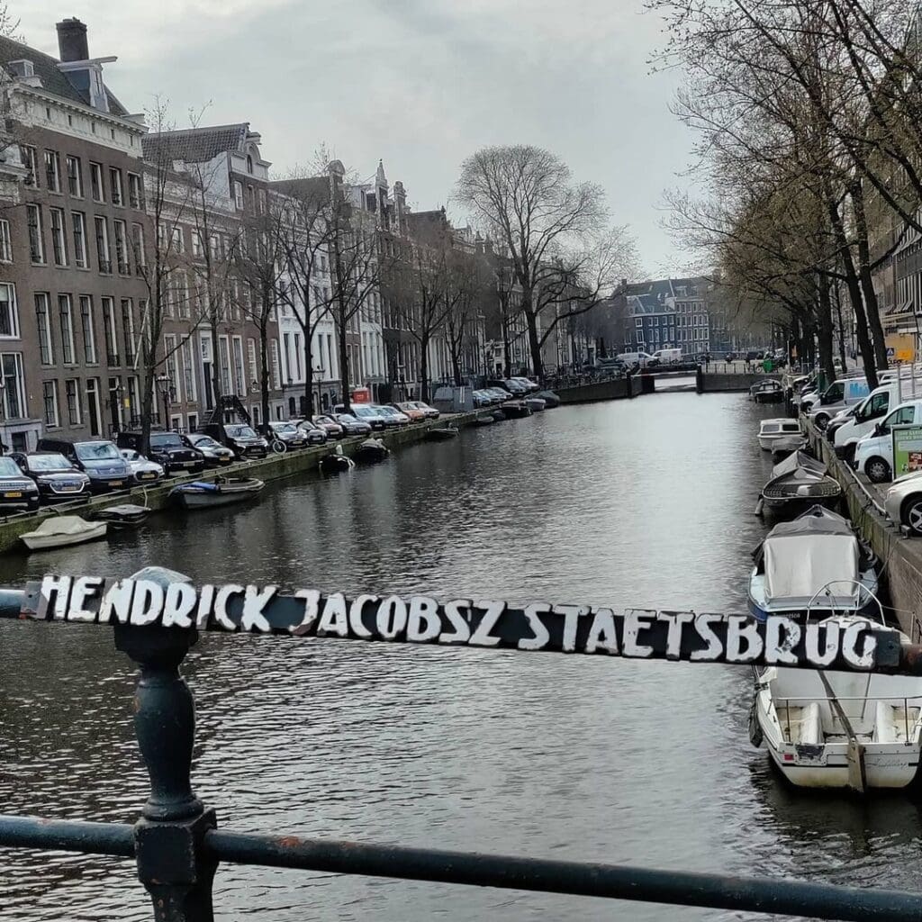
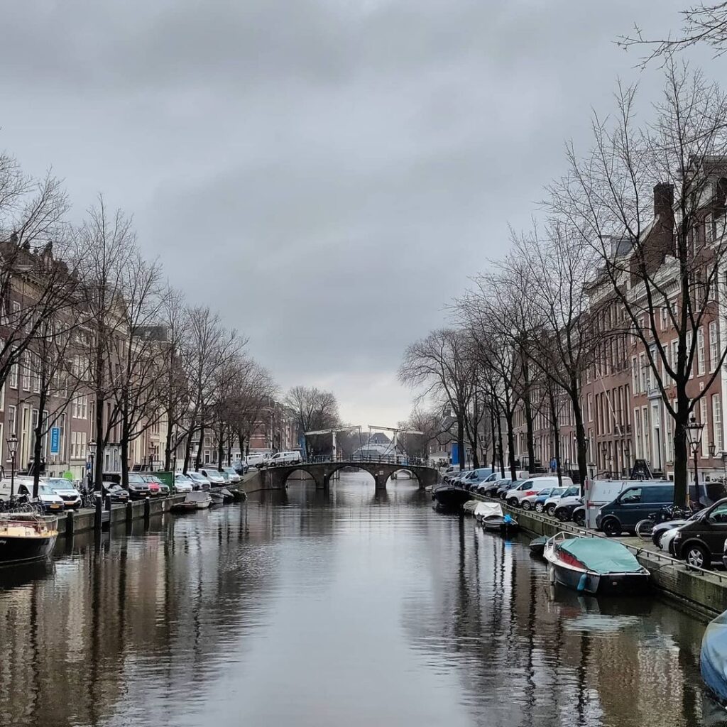
The bridge is located on the west bank of the Amstel and spans the Herengracht , which ends here. On the other side the canal continues, but under the name Nieuwe Herengracht , starting at the Walter Süskind Bridge.
Bridge 35 is named after Hendrick Jacobsz. Staets (circa 1558/1559 – circa 1630/1631) who was a city carpenter of Amsterdam and in that capacity one of the main responsible for the design of the canal belt of Amsterdam. Staets worked together with the city master stonemason Hendrick de Keyser and the city master mason Cornelis Danckertsz. the row. As a city master carpenter, he was closely involved in the construction of the Noorderkerk and the Zuiderkerk there.


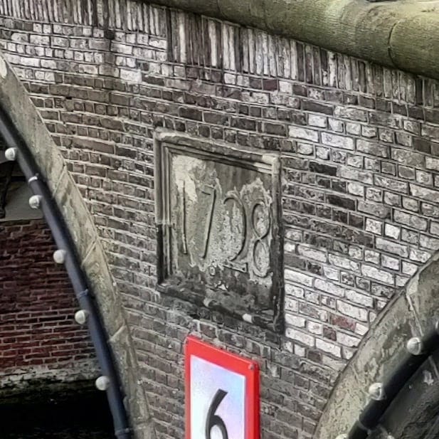
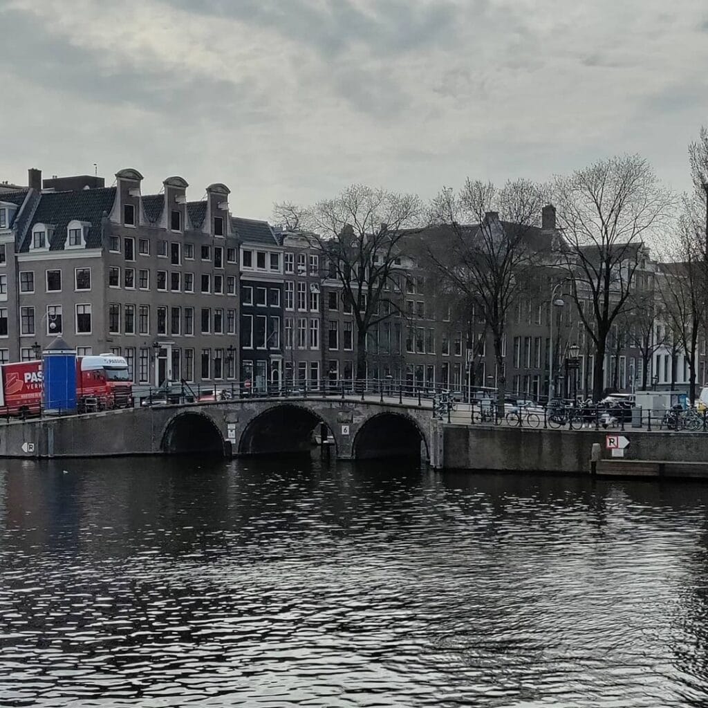

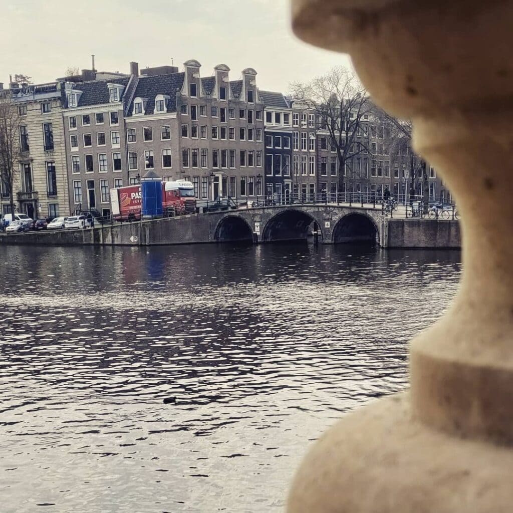
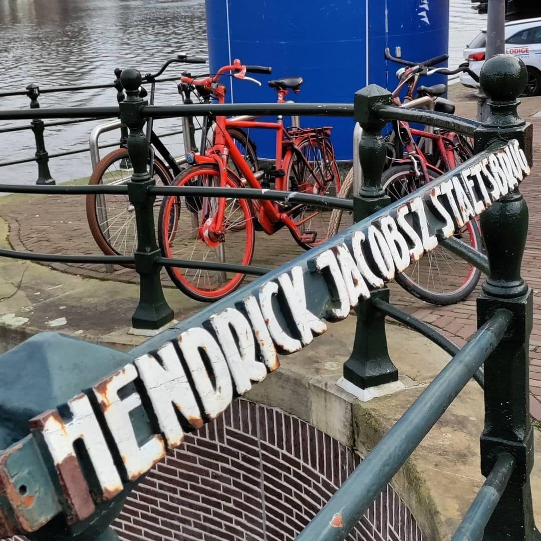
The present bridge proudly showcases two inscribed stones on the Amstel side, bearing the markings “Anno” and “1728,” flanking the middle passageway. Its historical significance was highlighted when it played a crucial role in the construction of bridge 34 in Utrechtsestraat. Skippers were puzzled by their ability to pass under this bridge but were subsequently obstructed by the low bridge 34. The bridge carries an antiquated charm, but in 1972, it underwent modernization with the reinforcement of reinforced light concrete from within, while its foundations were strengthened in 1977. This architectural gem has held the status of a municipal monument since 1995, proudly preserving its heritage and enriching the city’s cultural landscape.
1. Etymology and Naming: The City Carpenter, the Grachtenboek Engraver, and a Name Now Lost
This fixed bridge is named after Hendrick Jacobsz. Staets (1558 to 1631). He was the city carpenter who, together with Lucas Sinck, Hendrick de Keyser, and Frans Oetgens, prepared and partly executed the Uitleg (Expansion) of 1612, laying the foundation of the Amsterdam canal belt. He also completed the Noorderkerk after the death of Hendrick de Keyser.
Peter Korrel proposed the name for this bridge. The naming belongs to the same commemorative programme that produced the Lucas Jansz. Sinckbrug at Bridge 36, placing the two great canal belt planners side by side on the Amstel waterfront in permanent stone.
The biography of Staets deserves careful attention, because he is one of the least recognised major figures in Dutch architectural history despite being directly responsible for the physical form of the Herengracht, the Keizersgracht, and the Prinsengracht. Hendrick Jacobsz. Staets was the city carpenter (stadstimmerman) of Amsterdam and in that capacity one of the principal persons responsible for the design of the canal belt. Staets was one of the three city masters at the beginning of the 17th century, alongside city mason Cornelis Danckertsz. and stone and figure sculptor Hendrick de Keyser. As city master carpenter, he was closely involved in the construction of the Noorderkerk and the Zuiderkerk.
An original intention in the design of the Keizersgracht was to make it a promenade along which the citizenry could stroll. The residents of the Keizersgracht, however, wanted to continue reaching their houses by boat, which meant the plans of 1610 had to be drastically revised. This detail is one of the most revealing in the entire story of the canal belt’s creation: the canal that became the city’s grandest residential address was nearly turned into a walking boulevard. Staets’s practical adjustment of that plan, accommodating the insistence of Amsterdam’s wealthy residents on waterborne access, is part of why the Keizersgracht took the form it did.
The bridge also carried a previous informal name that has now entirely vanished from use. An old name for this bridge was the Caspar Philipssluis, named after Caspar Philips Jacobszoon (1732 to 1789), an Amsterdam engraver who is best known for his Grachtenboek of 1771.
The Grachtenboek is a book of engraved plates with architecturally correct renditions of housefronts on the canals of Amsterdam, most notably the Herengracht and Keizersgracht. It was published in instalments between 1768 and 1771 with 1,400 engravings based on Philips’ and others’ drawings. On the basis of these scale drawings, the 18th-century state of the facades along both canals can be seen. The drawings of Caspar Philips were intended partly as a model book for builders, carpenters, masons, stonemasons, painters, and blacksmiths. The book has been reissued in 1922, 1930, 1936, 1967, and 1979.
The Caspar Philipssluis name was in use because Philips lived near the bridge and is believed to have depicted it in his Grachtenboek. The name was never official, and under Amsterdam’s July 2016 policy abolishing unofficial bridge names, it has been entirely replaced by the Hendrick Jacobsz. Staetsbrug designation. Of the two names, the newer one tells the larger story.
2. Structural Evolution: Stalpaert’s Plan of 1662, an Anno Stone of 1728, and Reinforcement in 1972 and 1977
There has been a structure here for centuries. City architect Daniël Stalpaert had already drawn the bridge in the design section of his map of 1662, but at that point it was still predominantly empty land at this location. On Jacob Bosch’s map with the Fourth Expansion of around 1679, a bridge is already drawn here. The bridge needed to be relatively high, because behind it lay the quay of the Weesperveer.
The Weesperveer was a ferry and cargo landing serving boat traffic between Amsterdam and the town of Weesp. Its quay directly behind the bridge created a practical loading and unloading zone that required vessels to pass under the bridge at a reasonable height. This necessity explains why Bridge 35, like its neighbour Bridge 36, was built and maintained at a higher arch profile than most other Herengracht crossings, and is part of why both bridges avoided the 19th-century flattening that transformed so many canal belt bridges into low plate structures for tram traffic.
The physical date marker confirms the age of the current primary structure with unusual precision. The current bridge still carries, on the Amstel side, two stones with the designations “Anno” and “1728” on either side of the central navigation opening. The Hendrick Jacobsz. Staets Bridge is a road bridge, semi-circular arch bridge and masonry bridge that was completed in 1728. This date places Bridge 35 in the same generation as its neighbour Bridge 36 (Anno 1734 stone visible in the shared quay wall at Bridge 27, the Beulingsluis) and in the same 18th-century wave of arch bridge construction that replaced earlier wooden or less durable structures across the canal belt.
The bridge’s outward appearance is deceptive in a way that the Dutch Wikipedia article notes with precision. The bridge looks old on the outside, but was internally reinforced with lightweight reinforced concrete in 1972, and its foundations were reinforced in 1977. The bridge is a semi-circular arch bridge and masonry bridge: the masonry facing is original 18th-century material, or a close facsimile of it, while the structural core is 20th-century concrete. This combination, common to several bridges in this series that were similarly reinforced in the 1968 to 1981 period, means that what visitors see is authentically old in appearance and scale while being structurally modern beneath the surface.
The bridge also played an indirect role in the raising of Bridge 34, as noted in the Bridge 34 post. The bridge featured in the discussion about the raising of Bridge 34 in the Utrechtsestraat, because shipping operators found it strange that they could pass under Bridge 35 but then encountered the lower Bridge 34 barely 100 metres away. The height difference between the two adjacent crossings was a practical navigation problem, and Bridge 35’s relative height was one of the arguments used to justify raising Bridge 34 in the 1880s.
3. Architectural Lineage: Pre-Amsterdam School, Semi-Circular Arch, Municipal Tradition
No individual architect is confirmed for Bridge 35 in any source consulted for this post. The bridge belongs to the Dienst der Publieke Werken’s 18th-century bridge-building tradition, and its semi-circular arch profile, brick abutments, and natural stone arch facing are characteristic of that tradition. The three-span layout, with Anno stones flanking the central opening on the Amstel side, is a form that appears at Bridge 36 and at several other canal-mouth bridges along the Amstel waterfront.
The bridge predates the Amsterdam School movement by approximately 190 years. Piet Kramer’s 1917 appointment and Johan van der Mey’s 1911 appointment at Publieke Werken came long after Bridge 35’s form was established. There are no Amsterdam School design elements here: no custom wrought iron balustrades by Kramer, no Hildo Krop sculptures, no granite nose stones. What there is instead is a coherent 18th-century civic bridge, built to last, reinforced to last further, and maintained in an appearance that has changed very little since the Anno stone was set in 1728.
The bridge has been a municipal monument since 1995. The Wikidata entry for the bridge additionally records the Amsterdam Monumentenstad ID as 10575 and the Structurae structure ID as 20006363.
The bridge has also had an unexpected moment of cultural visibility. The Wikimedia Commons category for Bridge 35 includes two photographs from the Amsterdam Light Festival 2017, showing the bridge illuminated as part of that year’s installations. The image of the semi-circular arches lit from within, reflected in the Amstel’s dark water on a winter evening, gives some sense of why this relatively modest bridge has accumulated 22 separate images in its Wikimedia Commons category, more than several more celebrated bridges in this series.
4. Urban and Social Context: The Amstel Waterfront, the Nieuwe Herengracht, and the Walter Süskindbrug
The bridge is located on the western bank of the Amstel and spans the Herengracht, which ends here. On the other side the canal continues, but under the name Nieuwe Herengracht, starting at the Walter Süskindbrug.
The transition from Herengracht to Nieuwe Herengracht at this point is not merely a naming convention. It reflects a genuine discontinuity in the canal belt’s history: the Herengracht, from Brouwersgracht to the Amstel, was laid out in the first and second phases of the great expansion, between 1612 and roughly 1665. The Nieuwe Herengracht on the far bank was part of the third and final expansion, extending the city eastward into the area that became Amsterdam’s Jewish quarter. In the last expansion, the section east of the Amstel was laid to the water of the IJ. This last part, located in the prosperous part of Amsterdam’s Jewish quarter, was named Nieuwe Herengracht.
The Walter Süskindbrug, which connects the Nieuwe Herengracht to the Amstel on its eastern side, was named in 2012 after Walter Süskind, a German-Jewish businessman who worked as a liaison between the Jewish Council and the SS deportation command during the Second World War. Süskind used his position to smuggle Jewish children out of the Hollandsche Schouwburg theatre, which was used as a deportation point, saving hundreds of lives. He was deported himself in 1944 and did not survive. The Walter Süskindbrug and the Hendrick Jacobsz. Staetsbrug thus face each other across the Amstel, one named for a 17th-century builder who created the city and one named for a man who risked and lost his life to save some of its inhabitants from destruction.
The Amstel waterfront at this point is one of the most historically saturated stretches of the city. The Magere Brug is visible a short distance upstream. The Hermitage Amsterdam building (now repurposed) at Amstel 51 faces the bridge from the eastern bank. The Museum Willet-Holthuysen at Herengracht 605, with its canal garden and preserved 18th-century interior, is a few minutes’ walk along the Herengracht to the west.
5. Technical Specifications
Based on confirmed sources, the following can be stated:
- Bridge type: Fixed semi-circular arch bridge (vaste halfronde welfbrug), masonry facing with reinforced concrete internal structure
- Location: Western quay of the Amstel, spanning the mouth of the Herengracht, Amsterdam-Centrum
- Canal crossed: Herengracht (UNESCO World Heritage Canal Belt, listed 2010); the canal ends here; directly opposite, the Nieuwe Herengracht begins at the Walter Süskindbrug
- Position on the Amstel: Adjacent to Bridge 36 (Lucas Jansz. Sinckbrug over the Keizersgracht); together the two bridges mark the southern termini of the Herengracht and the Keizersgracht on the Amstel’s western quay
- Cartographic record: Daniël Stalpaert’s city map, 1662 (planned, in largely empty land); Jacob Bosch’s Fourth Expansion map, around 1679 (completed bridge)
- Height: Higher than most Herengracht bridges due to the proximity of the Weesperveer quay and the need for barge traffic to pass underneath
- Anno stone: “Anno 1728,” two stones on the Amstel side flanking the central navigation opening; current primary structure completed 1728
- Structural reinforcement: Internal reinforcement with lightweight reinforced concrete, 1972; foundation reinforcement, 1977
- Designer: Dienst der Publieke Werken (18th-century tradition); no individual architect confirmed
- Amsterdam School attribution: None; predates the movement by approximately 190 years
- Monument status: Gemeentelijk monument (municipal monument) since 1995
- Amsterdam Monumentenstad ID: 10575
- Structurae structure ID: 20006363
- Wikidata: Q35200301
- Former informal name: Caspar Philipssluis (after engraver Caspar Philips Jacobszoon, 1732 to 1789, author of the Grachtenboek); abolished under Amsterdam’s 5 July 2016 policy on unofficial bridge names
- Named by: Peter Korrel (bruggenvanamsterdam.nl)
- Coordinates: 52°21’56.3″N, 4°54’1.8″E
Sources Consulted
- Bruggenvanamsterdam.nl, bridge register entry for Brug 35: www.bruggenvanamsterdam.nl/herengracht_hoek_amstel.htm
- Wikipedia (nl), “Hendrick Jacobsz. Staetsbrug”: nl.wikipedia.org/wiki/Hendrick_Jacobsz._Staetsbrug
- Wikipedia (nl), “Hendrick Jacobsz. Staets”: nl.wikipedia.org/wiki/Hendrick_Jacobsz._Staets
- Bridges.cramberts.com, “De Hendrick Jacobsz. Staetsbrug, Bridge 35, Amsterdam”: bridges.cramberts.com/2022/04/03/de-hendrick-jacobsz-staetsbrug-bridge-35-amsterdam/
- Structurae, “Hendrick Jacobsz. Staets Bridge (Amsterdam, 1728)”: structurae.net/en/structures/hendrick-jacobsz-staets-bridge
- Wikipedia (en), “Herengracht”: en.wikipedia.org/wiki/Herengracht
- Wikipedia (en), “Keizersgracht”: en.wikipedia.org/wiki/Keizersgracht
- Wikipedia (en), “Prinsengracht”: en.wikipedia.org/wiki/Prinsengracht
- Wikipedia (en), “Grachtenboek”: en.wikipedia.org/wiki/Grachtenboek
- Wikipedia (en), “Caspar Jacobsz Philips”: en.wikipedia.org/wiki/Caspar_Jacobsz_Philips
- Wikipedia (en), “Hendrick de Keyser”: en.wikipedia.org/wiki/Hendrick_de_Keyser
- Mokums.nl, “Hendrick Jacobsz. Staets”: www.mokums.nl/hendrick_jacobsz_staets.html
- Amsterdam Monumentenstad, “Grachtenboek van Caspar Philips (1768)”: www.amsterdam-monumentenstad.nl/database/grachtenboek_tekst.php?id=34
- Wikidata, “Hendrick Jacobsz. Staetsbrug” (Q35200301): www.wikidata.org/wiki/Q35200301
- Wikimedia Commons, Category: Brug 35, Hendrick Jacobsz. Staetsbrug: commons.wikimedia.org/wiki/Category:Brug_35,_Hendrick_Jacobsz._Staetsbrug
- Frank V. Smit, “Bruggen in Amsterdam,” 2008, Uitgeverij Matrijs (cited in Wikipedia nl, “Hendrick Jacobsz. Staetsbrug”)
Public Domain Images

1. “Driebogenbrug over Amsterdamse gracht bij de Amstel, Bestanddeelnr 903-4135.jpg,” Nationaal Archief / Anefo This photograph, listed in the Wikimedia Commons category for Bridge 35 as “Driebogenbrug over Amsterdamse gracht bij de Amstel, Bestanddeelnr 903-4135.jpg,” shows the three-arch profile of the bridge from the Amstel side. It is from the Nationaal Archief’s Anefo press photography collection and is available under a Creative Commons Attribution licence (CC BY). URL: https://commons.wikimedia.org/wiki/File:Driebogenbrug_over_Amsterdamse_gracht_bij_de_Amstel,_Bestanddeelnr_903-4135.jpg Attribution: “Nationaal Archief / Anefo. Available under Creative Commons Attribution (CC BY).”

2. “Brug 35, Hendrick Jacobsz. Staetsbrug IMG 5151.jpg,” Wikimedia Commons This large-format contemporary photograph (5,969 by 3,973 pixels, 22.32 MB) is one of the highest-resolution images of any bridge in this series. It shows the bridge from the Amstel in full detail, with the arch profile, masonry facing, and Herengracht canal visible beyond. Available under a free licence in the Wikimedia Commons category for the bridge. URL: https://commons.wikimedia.org/wiki/File:Brug_35,_Hendrick_Jacobsz._Staetsbrug_IMG_5151.jpg Attribution: “Wikimedia Commons, File: Brug 35, Hendrick Jacobsz. Staetsbrug IMG 5151.jpg. Available under the licence specified on the file’s description page.”

3. Caspar Philips Jacobszoon, “Grachtenboek,” 1768 to 1771, Rijksmuseum Open Access collection The Grachtenboek was published in instalments between 1768 and 1771, with 1,400 engravings depicting housefronts on the Herengracht and Keizersgracht. The Rijksmuseum holds a complete set of the Grachtenboek plates in its open-access collection, released under a CC0 (public domain) licence. The plates showing the Herengracht at its Amstel junction, the area directly beside Bridge 35, are among the most relevant for this post’s subject matter. URL: https://www.rijksmuseum.nl/en/collection/set/Amsterdam-Caspar-Jacobsz-Philips-s-Grachtenboek-Canal-Bo–b698b0ab-896b-4fd8-9da2-08dd024ac88f Attribution: “Caspar Philips Jacobszoon, Grachtenboek, 1768 to 1771. Rijksmuseum Amsterdam. Open Access / CC0.”
Map and location of Bridge 35 The Hendrick Jacobsz. Staetsbrug
The bridge is located on the west bank of the Amstel and spans the Herengracht, which ends at this point. On the other side the Amstel it continues but under the name Nieuwe Herengracht starting at the Walter Süskind Bridge .
There has been a bridge here for centuries. A bridge was already drawn here on the map of Jacob Bosch of circa 1679. This bridge had to be relatively high, because behind the bridge was the Weesperveer quay. City architect Daniël Stalpaert had also drawn the bridge in the design part of his map of 1662, but it was still mainly empty area here at the time.


De Hendrick Jacobsz. Staetsbrug History and Information
Bridge 35 is named after Hendrick Jacobsz. Staets (circa 1558/1559 – circa 1630/1631) who was a city carpenter of Amsterdam and in that capacity one of the main responsible for the design of the canal belt of Amsterdam. Staets worked together with the city master stonemason Hendrick de Keyser and the city master mason Cornelis Danckertsz. the row. As a city master carpenter, he was closely involved in the construction of the Noorderkerk and the Zuiderkerk there.
The current bridge still has two stones on the Amstel side with “Anno” and “1728” on either side of the middle passage. The bridge also played a role in the raising of bridge 34 in the Utrechtsestraat, because skippers found it strange that they could pass under this bridge, but were then stopped by the low bridge 34. The bridge looks old, but is made of inside in 1972 reinforced with reinforced light concrete, the foundations were reinforced in 1977. The bridge has been a municipal monument since 1995. De Hendrick Jacobsz. Staetsbrug History and Information
Bridge 35 is named after Hendrick Jacobsz. Staets (circa 1558/1559 – circa 1630/1631) who was a city carpenter of Amsterdam and in that capacity one of the main responsible for the design of the canal belt of Amsterdam. Staets worked together with the city master stonemason Hendrick de Keyser and the city master mason Cornelis Danckertsz. the row. As a city master carpenter, he was closely involved in the construction of the Noorderkerk and the Zuiderkerk there.
The current bridge still has two stones on the Amstel side with “Anno” and “1728” on either side of the middle passage. The bridge also played a role in the raising of bridge 34 in the Utrechtsestraat, because skippers found it strange that they could pass under this bridge, but were then stopped by the low bridge 34.


In 2017 the bridge was part of Amsterdam Light Festival Editie #6 WHOLE HOLE by Paul Vendel & Sandra de Wolf
Photos Whole Hole