The Moat That Became an Address: Amsterdam’s Oldest Canal, Its Fourteen Bridges, and the Myths It Attracts
Every canal in Amsterdam’s famous ring was dug on purpose, to a plan, as an act of speculative property development. The Singel was not. It was dug to keep people out.
This is the oldest of the canals we cover on this site, and the only one that began as a weapon. It is also the one that attracts the most confident misinformation, about the narrowest house in the world, about which canal is which, and about a flower market that is not quite what the postcards say. It carries fourteen of the numbered bridges, including the widest in the city, and it once had a prison in it.
Origins: The Moat of 1428
Digging began in 1428, and the canal was extended in 1450. Its purpose was defensive: it formed the western limit of medieval Amsterdam, a moat guarding a city that was still, at that point, a compact settlement clustered around the Dam and the mouth of the Amstel.
For more than a century and a half it held that line. The Singel was the western border of Amsterdam until the expansion of 1585, when the city finally outgrew it and began pushing west. Everything beyond it is later: the Herengracht, the Keizersgracht, the Prinsengracht, the Jordaan. All of it was built outside a defensive line that had by then become obsolete.
That sequence explains the shape of the Singel, which is the one thing about it that puzzles visitors who have learned to expect Amsterdam’s canals to run in tidy concentric arcs. The Singel curves the way it does because it followed a defensive perimeter rather than a drawing board. It is a fortification line that happens to have houses on it.
It is worth holding on to the scale of what came next. After 1585, and especially through the seventeenth century, Amsterdam’s population rose from roughly fifty thousand to around two hundred thousand in sixty years. The canal ring was the physical answer to that growth. The Singel is what the city looked like immediately before it.
The Singel Is Not the Singelgracht
This is the confusion worth clearing up before anything else, because it defeats a great many visitors and quite a few maps.
The Singel is the innermost canal, the medieval moat of 1428. The Singelgracht is a different and much later waterway: the outer moat that encircles the whole seventeenth-century canal ring, reinforced in its day by a series of star-shaped bastions. When UNESCO inscribed Amsterdam’s canal ring as a World Heritage Site in 2010, the designation was for the seventeenth-century canal ring area inside the Singelgracht, the outer one.
Two moats, then, three centuries apart, with confusingly similar names: one marking where the medieval city stopped, the other marking where the Golden Age city stopped. The Singel is the inner ring; the Singelgracht is the outer boundary. Both were defensive, and neither defends anything now.
The Torensluis: The Widest Bridge, the Vanished Tower and the Cells Beneath
The most remarkable structure on the Singel is Bridge 9, the Torensluis, and it is remarkable in three separate ways.
It is the widest bridge in Amsterdam, at roughly forty-two metres across, wide enough that it does not read as a bridge at all but as a small square that happens to have water underneath it. It is also among the oldest, dating to 1648, the year of the Peace of Münster that ended the Eighty Years’ War and confirmed Dutch independence.
The width has a reason, and the reason is gone. The bridge was built to carry the Jan Roodenpoortstoren, a defensive tower that stood on it until 1892. The bridge is broad because it was a foundation for a building. When the tower was demolished the bridge kept its footprint, which is why Amsterdam’s widest bridge is wide for a structure that no longer exists.
Then there are the cells. One of the bridge’s arches was used as a prison, and the old dungeons survive beneath the deck, the barred windows at water level mark them. They have periodically been opened to the public. A café now puts tables out on the deck above; the holding cells are directly underneath.
On the bridge stands a statue of Multatuli, the pen name of Eduard Douwes Dekker, whose 1860 novel Max Havelaar exposed the brutality of the Dutch colonial system in the East Indies and remains the most consequential book in Dutch literature. The statue was unveiled in 1987 by Queen Beatrix. It is a fitting spot: the bridge that carries his likeness once carried a tower and a gaol.
Four Churches and a Hidden One
For a canal of modest length, the Singel carries an unusual concentration of religious architecture, and the reasons are historical rather than devotional. This was the edge of the old city, the place where communities that were tolerated but not entirely welcome could establish themselves.
The Oude Lutherse Kerk stands at Singel 411, on the corner of the Spui. It was built in 1632–1633, under Wessel Becker and Willem van Daelen, on the site where the Lutheran community had previously kept a house church. Its afterlife is one of the most pleasing reuses in the city: it now serves as the Aula, the ceremonial hall of the University of Amsterdam, where doctorates are conferred. A church built by a religious minority is now where the city’s scholars are made.
Further north, the Ronde Lutherse Kerk, the Round Lutheran Church, also called the Koepelkerk, puts its copper dome over the water and gives the northern Singel its most distinctive silhouette. It is one of the few genuinely circular churches in the Netherlands, and its dome is the landmark that orients you when the canal’s curve has confused your sense of direction. That the Lutherans built two churches on the same canal, and made the second one round and domed, says a good deal about how far the community’s confidence had travelled between the seventeenth century and the eighteenth.
De Krijtberg, at Singel 446, is the Roman Catholic entry, and it is the most theatrical building on the canal, a neo-Gothic church designed by Alfred Tepe and opened in 1883, its twin spires shooting up out of a canal frontage that has no business accommodating them. The name means “chalk hill,” after a merchant’s house that once stood on the site. Its significance is in the timing: Catholic worship had been driven underground in Amsterdam for two centuries, and a church this assertive on a main canal was only possible after Dutch Catholics regained the right to build openly in the nineteenth century.
What that suppression looked like is still visible a few doors along at Singel 452, where the Singelkerk is a schuilkerk, a hidden church, of Amsterdam’s Mennonite community. Hidden churches were the compromise of the Dutch Republic: worship outside the official Reformed church was illegal but tolerated, provided it was not visible from the street. So congregations built their sanctuaries behind ordinary façades, invisible to a passer-by and perfectly well known to the authorities. The Singel holds both halves of that story within a hundred metres: the church that had to hide, and the church that no longer needed to.
The Munttoren, and Where the Numbering Begins
At the southern end, where the Singel meets the Amstel, stands the Munttoren, the Mint Tower, the most recognisable landmark on the canal. It began as part of the Regulierspoort, a gate in the medieval city wall, and acquired its name in the 1670s when the French occupation of much of the Republic cut Amsterdam off from the national mints and the city struck its own coin here.
This end of the canal matters for our purposes because it is where Amsterdam’s bridge numbering starts. Bridge 1, the Muntsluis, is here. When the city numbered its bridges it began at the centre of the web, the point where the oldest canal meets the river the city grew on, and worked outward. The Singel, as the innermost ring, takes the lowest numbers, which is why bridges 1 through 14 are almost all on this one canal.
The Bloemenmarkt: Floating Since 1862
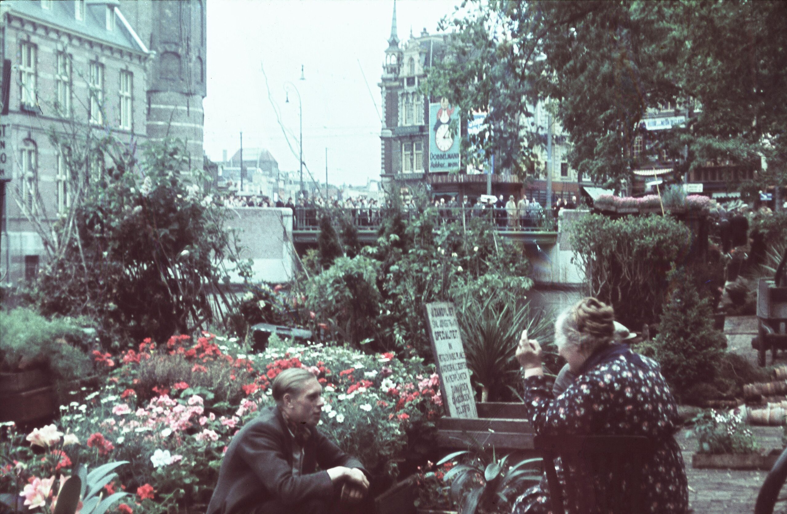
Between the Muntplein and the Koningsplein sits the Bloemenmarkt, commonly described as the world’s only floating flower market. Traders have sold blooms from boats on this stretch since 1862, when growers brought their stock into the city by water and sold it directly from the barges.
The “floating” description now needs a caveat. The stalls rest on permanent structures built out over the water rather than on working boats, so what floats is the platform rather than the shop. And the trade has shifted decisively towards tulip bulbs, seeds and souvenirs aimed at visitors rather than cut flowers for Amsterdammers.
None of which makes it less worth seeing, but it is a good example of the Singel’s particular character: a genuinely old thing that has been polished into a slightly different thing, with the original explanation still attached.
Singel 7 and the Truth About the Narrowest House
The most repeated claim about the Singel is that number 7 is the narrowest house in the world. It is repeated on tours, on signs and in a great many guidebooks, and it is not quite true.
What is true is that Singel 7 has the narrowest façade, just over a metre wide. But that is the rear façade. The front of the house, on the other side, is of entirely ordinary width, and the interior is a normal Amsterdam house. What you are photographing is the back of a building, not a building.
The genuinely narrow house is elsewhere: Oude Hoogstraat 22, whose bell gable measures 2.02 metres across and which is about five metres deep. That is a whole house, front to back, and it is the narrowest in Europe.
The reason the confusion is so persistent is itself a piece of Amsterdam history. Property tax was historically levied on the width of a house’s canal frontage, the front side, facing the water. That single fiscal rule produced the tall, narrow, deep houses that define the city, and it is why width, and claims about width, became a local obsession. Singel 7 turns the rule on its head by being narrow at the end nobody was taxing.
De Poezenboot
De Poezenboot, the Cat Boat, is a converted houseboat moored on the Singel that has operated for decades as a refuge for the city’s stray and abandoned cats. It is generally described as the only floating animal sanctuary in the world, and it takes visitors.
It is also, in its unassuming way, a genuine piece of Amsterdam. A city that solved its space problem by living on the water eventually applied the same logic to everything else: the flower market went onto the water, the houses went onto the water, and so, in the end, did the animal shelter.
Walking the Singel
The Singel runs from the Muntplein in the south, where the Munttoren stands and the canal meets the Amstel, north to the Haarlemmersluis and the IJ waterfront. It is a walk of well under an hour.
Taken from south to north it gives you, in order: the Munttoren and Bridge 1, the flower market, the Krijtberg and the hidden Mennonite church opposite, the Oude Lutherse Kerk at the Spui, the Torensluis with its dungeons and its statue, the round dome of the Koepelkerk, the cat boat, the narrowest façade in the city at number 7, and finally the Haarlemmersluis at the top. Fourteen numbered bridges, four churches, two flotillas and one persistent myth.
Bridges that cross the Singel
- Bridge 1: Muntsluis
- Bridge 2: De Heiligewegsluis
- Bridge 4: Heibrug
- Bridge 5: Joes Kloppenburgbrug
- Bridge 6: Brug Zes
- Bridge 8: Brug Acht
- Bridge 9: Torensluis
- Bridge 10: Lijnbaansbrug
- Bridge 12: Corsgenbrug
- Bridge 13: Brug dertien
- Bridge 14: Haarlemmersluis
- Bridge 58: Haringpakkersbrug
A Note on Bridges 3 and 11
Bridge 3 is missing from the list above, and the reason is a useful illustration of how Amsterdam’s bridges are counted.
The Krijtbergbrug sits on the Singel, it carries the canal’s bank, but what it actually spans is the Beulingsloot, the short cut of water running between the Singel and the Herengracht. A bridge on a canal and a bridge over a canal are two different things, and the numbered bridges of Amsterdam include plenty of both.
The name gives the game away, and ties the bridge back to the canal it stands on: it is named for De Krijtberg, the Jesuit church at Singel 446, a few steps from the bridge deck. Bridge 27, De Beulingsluis, is the other crossing of that same short waterway.
The same is true of Bridge 11, which stands on the Singel’s western quay but spans the Blauwburgwal, the short canal running east from it. Both bridges belong to the Singel without crossing it.
Sources Consulted
- Singel (Amsterdam), Nederlandstalige Wikipedia
- UNESCO World Heritage Centre: Seventeenth-Century Canal Ring Area of Amsterdam inside the Singelgracht (list 1349)
- Grachtenmuseum: history of the Amsterdam canals
- Smallest house in Amsterdam, Wikipedia; I amsterdam: Amsterdam’s narrowest house
- Oude Lutherse Kerk, Wikipedia and Rijksmonumenten.nl (monument 5241)
- Ronde Lutherse Kerk, Wikipedia
- De Krijtberg, Wikipedia
- Singelkerk: Doopsgezinde Gemeente Amsterdam
- Torensluis, municipal and monument records
- De Poezenboot; Bloemenmarkt historical records from 1862