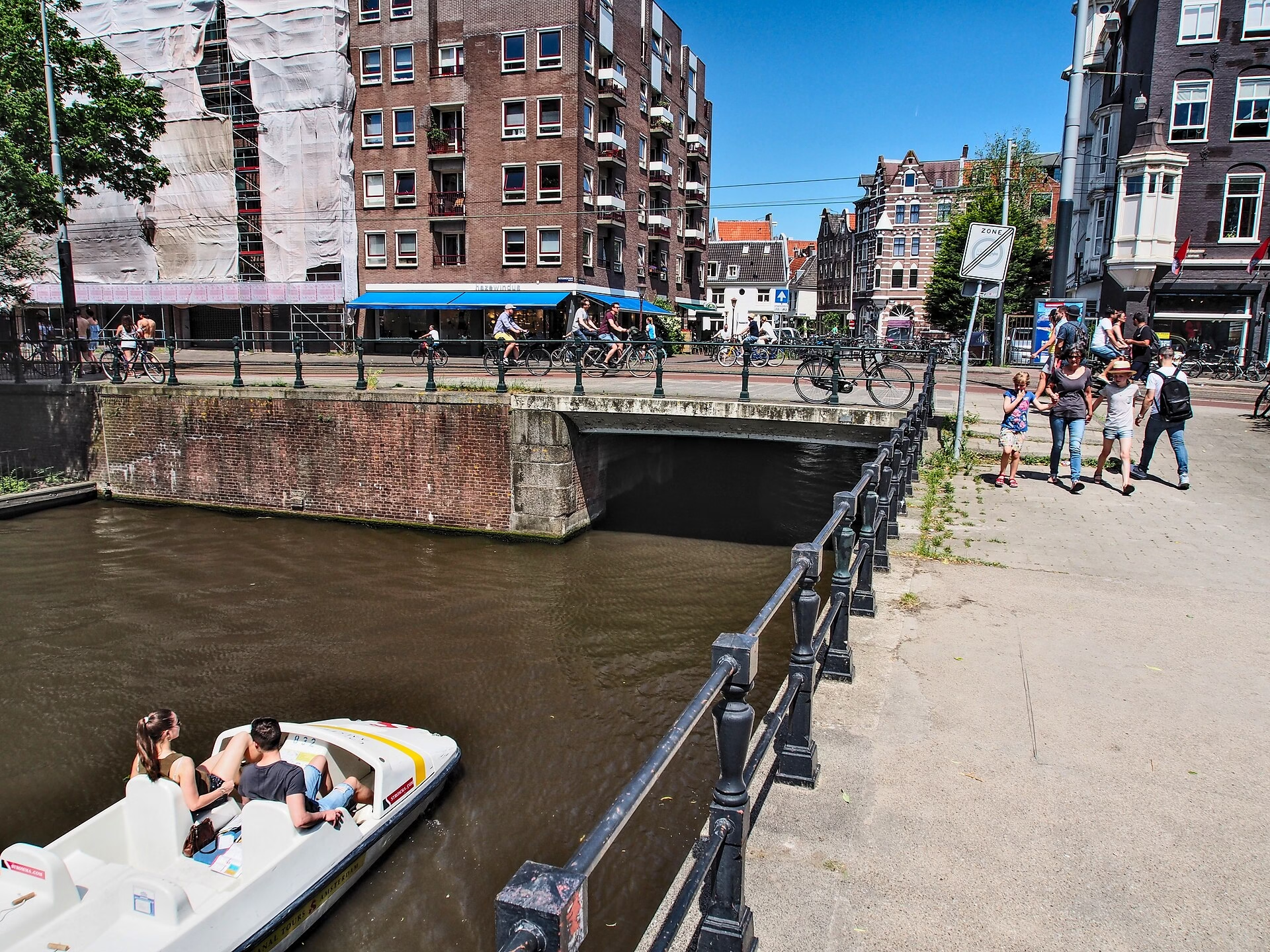
The Gate That Is Not There: Brug 90, the Weteringpoort
The Weteringpoort is named after a city gate that was demolished long before the bridge was built, over a waterway that gave the whole district its name. Brug 90 carries the Weteringschans across the Wetering and the Weteringwaterkering, lock 209, and at nearly 24 metres wide it is more road junction than bridge.
Etymology: Wetering, Schans and Poort
Three words, each recording something that has gone.
A wetering is a drainage watercourse, the sort of channel dug across wet ground to carry water away, and this one predates the city’s expansion here. It is the reason for every other name in the neighbourhood: the Weteringschans, the Weteringstraat, the Weteringplantsoen, the Weteringbuurt, the Weteringcircuit.
A schans is an earthwork or rampart. The Weteringschans runs along the line of the seventeenth-century city defences, and the street exists because the fortifications were demolished in the nineteenth century and the ground they occupied became available.
The Weteringpoort itself was a city gate, and by the standards of Amsterdam’s gates a small one. It has been gone for generations, and the bridge inherited the name of the hole it once filled.
One survivor stands nearby: the commiezenhuis at Weteringschans 30, a rijksmonument. A commies was an excise officer, and the little house is where goods entering the city were taxed. It is the last physical trace of what a city gate was actually for.
Structural Evolution: 1866 to 1959
The first bridge here went in around 1866, an iron structure on wooden beams. Its problem was the standard one: the timber failed, and traffic grew faster than anyone building in 1866 had allowed for. By the 1910s it needed replacing.
The replacement did not come until 1958 and 1959, and it came as part of something larger. The Weteringschans was being developed as a ring road, and the bridge was rebuilt in concrete to suit, at a width of 23.73 metres.
That width is the whole story. A crossing of a drainage ditch became a section of arterial road, and the water underneath became an inconvenience to be spanned as widely as possible.
Still Doing Water Management
Unusually for a bridge of this sort, the structure beneath it still has a job. The Weteringwaterkering, lock 209, is a water barrier, part of the system that manages levels across the Amsterdam canal network.
The canals are not decorative. They are a working drainage and flushing system, and the locks along them are operated to move water through the city and keep it fresh. Brug 90 sits on top of a piece of that machinery, which is a more honest description of its function than the road markings suggest.
The Trams Came Back
On 22 July 2018, tram lines 1, 7 and 19 began running over the bridge.
The date is not arbitrary. That summer Amsterdam reorganised its entire tram network around the opening of the Noord/Zuidlijn metro, and routes across the city were redrawn. A bridge widened in 1959 for cars acquired tram tracks in 2018, which is the same reversal visible on the Museumbrug, where a crossing built up for trams in 1913 was narrowed for bicycles in 2023.
Amsterdam has spent a century adding capacity for one mode and then handing it to another. The bridges record every change of mind.
What Happened to Amsterdam’s Gates
The Weteringpoort was one of a ring of gates set in the earthworks that enclosed the seventeenth-century city. They controlled who entered, when, and what duty they paid on what they carried, and they were shut at night.
Almost none survive. Amsterdam demolished its fortifications through the nineteenth century, once it was clear that earth ramparts were useless against modern artillery and that the land they occupied was worth more as building plots. The gates went with the walls, and the ring road that replaced them, the Weteringschans among its sections, follows the line where the defences stood.
What is left is mostly names: the Muiderpoort, the Haarlemmerpoort, the Utrechtsepoort, attached now to squares, streets and bridges rather than to buildings. Amsterdam kept the vocabulary of a walled city long after it stopped being one, which is why so much of the map still describes a place that was pulled down.
Technical Specifications
- Bridge number: 90
- Name: Weteringpoort
- Type: Fixed traffic bridge
- Carries: Weteringschans
- Spans: The Wetering and the Weteringwaterkering, lock 209
- District: Amsterdam-Centrum
- Coordinates: 52.3600 N, 4.8870 E
- Width: 23.73 m
- Material: Concrete
- First bridge: circa 1866, iron on wooden beams
- Current structure: 1958 to 1959
- Trams: Lines 1, 7 and 19 since 22 July 2018
- Nearby monument: Commiezenhuis, Weteringschans 30, rijksmonument
Sources Consulted
- Featured image: Weteringpoort, Bridge 90, Amsterdam by Alf van Beem, 2017, via Wikimedia Commons, Public domain
- Weteringpoort, Nederlandstalige Wikipedia
- Weteringschans, Nederlandstalige Wikipedia
- Noord/Zuidlijn, Nederlandstalige Wikipedia
- Amsterdamse Historische Vereniging, Weteringpoort
- Bruggen van Amsterdam
- Stadsarchief Amsterdam, Beeldbank
- Frank V. Smit, Bruggen in Amsterdam (2008), Uitgeverij Matrijs