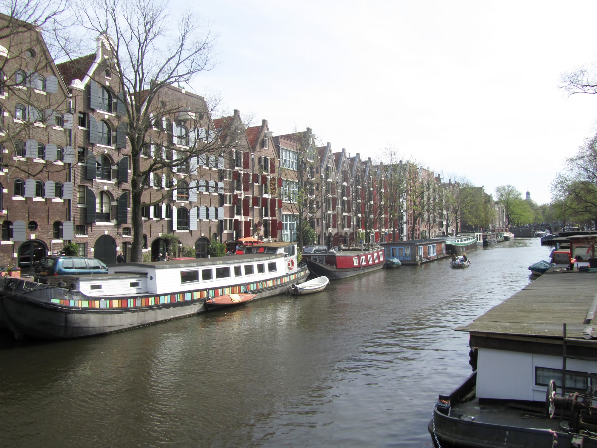
The Canal at the Top of the Ring
Look at a map of Amsterdam’s canal ring and the four great canals all seem to begin at the same short stretch of water across their northern ends. That water is the Brouwersgracht, the Brewers’ Canal. It runs from the Singel westward to the Singelgracht, it marks the north-western edge of the canal ring, and between the Prinsengracht and the Singelgracht it is the northern boundary of the Jordaan.
It is also where the city starts counting. The house numbers on the Singel, the Herengracht, the Keizersgracht, the Prinsengracht and the Lijnbaansgracht all begin at the Brouwersgracht. Eight numbered bridges cross it, and three more stand on its quays over the canals that meet it.
Breweries, Barges and the Start of the Canal Ring
The canal has carried its name since 1594, after the many breweries that stood in this neighbourhood in the sixteenth and seventeenth centuries. They depended on the water. Just to the east, the Haarlemmersluis was completed in 1602 as a sluice in the sea dyke where the Singel met the IJ, and it became a busy junction at once: barges came and went for the markets along the Singel, the milk boats from Waterland, the ferries, and the breweries on the Brouwersgracht.
The canal ring itself was dug from here. In 1612 or 1613 (Dutch Wikipedia’s articles give both years) the city began excavating the Herengracht, Keizersgracht and Prinsengracht southwards from the Brouwersgracht, raising the plots on either side with sand and selling them as building land. That is why the great canals open off the Brouwersgracht like the teeth of a comb, and why their numbering runs from this end.
The Brouwersgracht stayed a working canal. It lies on the water route from the Westerdok and the IJ into the city, and the junction with the Prinsengracht is described as one of the busiest water crossings in Amsterdam. Goods came by boat to the warehouses along its banks, and those warehouses, with their wide loading doors and hoisting beams, are still what gives the canal its look.

Warehouses With Names
Amsterdam’s warehouses were named rather than numbered, and the Brouwersgracht keeps a long run of them. Numbers 188 to 196 include De Appel, the Grouwe Valk, the Groene Valk, de David and Koning David. Spitsbergen is at 204, followed by three green harts at 206 to 210: Het kleine groene Hert, Het 5e groene Hert and Het grote groene Hert. De Eendracht is at 177, De Liefde at 199, and De Vijfhoek, De Vierhoek and De Driehoek (Pentagon, Square and Triangle) at 200, 205 and 207. Most of these buildings, built to store goods, have long since been converted into homes.
The later warehouses at numbers 158 to 162 were built for a trade in stockfish, dried cod from Norway. Albert Smit, a stockfish dealer since 1821, bought number 162 in 1888 and added 158 and 160 in 1891 and 1895 to designs by F.M.J. Caron. He named them after Norwegian ports: Bergen, Tromsø and Hammerfest. The firm left for Weesp in 1970 and the buildings became flats. They are municipal monuments.
The canal also has houses worth stopping for. Number 218, Het Geloof (Faith), built in 1650, is a small neck gable of the type associated with Philips Vingboons, with Doric pilasters, a triangular pediment and three round attic windows. It was one of three sister houses: Geloof, Hoop and Liefde (Faith, Hope and Charity) at 218, 220 and 222. Only Faith survives in its original form. Number 220 was given a bell gable in the eighteenth century and number 222 was demolished. At number 132 a narrow passage once led to a hidden Old Catholic church, Johannes en Willibrordus, behind the houses.
Saving the Canal
By the middle of the twentieth century many of these buildings were run down. In 1957 number 86, on the corner of the Binnen Brouwersstraat, became the first property acquired by Stadsherstel, the company founded the year before to buy and restore historic buildings in Amsterdam. Number 276, which once housed the government office for weights and measures, is now home to the Mondriaan Fund. Since 1782 the canal has had a distillery, De Ooievaar, by the Driehoekstraat, which Dutch Wikipedia describes as the last jenever distillery in Amsterdam.
The result is a canal that people like to live on. In 2007 readers of Het Parool chose the Brouwersgracht from 150 nominations as the most beautiful street in Amsterdam. It is quieter than the great canals, lined with houseboats, with a view south down each of the main canals as you cross their mouths.
From the Singel to the Prinsengracht
The first bridge over the canal, at the Singel end, is bridge 15, over the narrowest part of the Brouwersgracht and barely ten metres long. It appears on Dirck Cornelisz. Swart’s map of 1623, so it probably dates from the digging of the canal. In 1880 the city replaced the movable bridge here with a fixed one, which had to be renewed again in 1897. Around the corner is the much larger Haarlemmersluis, bridge 14, which crosses the Singel.
Where the Herengracht opens off the canal, two bridges cross the Brouwersgracht side by side and none crosses the Herengracht. The Melkmeisjesbrug (Milkmaids’ Bridge), bridge 16, on the east quay, is a footbridge named after a milk market once held here and, later, a tavern with a milkmaid on its sign. A pedestrian drawbridge was replaced by a fixed bridge in 1883, an iron parabolic girder bridge followed in 1903, and the present steel version dates from 1966. Dutch Wikipedia says this is probably where the first Amsterdammertje, the city’s familiar cast-iron bollard, was placed. The West-Indische huisbrug, bridge 17, on the west quay, links the Herengracht with the Herenmarkt and is named after the West India House beside it. It was rebuilt in 1900 by Publieke Werken with arches at both ends and a girder span in the middle. In 2016, when the city reviewed its unofficial bridge names, it briefly appeared on the wrong list, and a proposal to name it after Hans van Mierlo, who lived nearby, revealed the mistake. It kept its name; bridge 18 became the Hans van Mierlobrug in 2021.
At the Keizersgracht, bridge 56 links the east quay with the Binnen Brouwersstraat. Berckenrode drew a bridge with five openings here around 1625. A drawing in the monument office’s archive records the inscriptions “no. 56” and “Ao. 1795” on the piers, which Jacob Olie also photographed in 1891, before the bridge was widened in 1911 and the inscriptions disappeared behind the extensions. It shares a quay wall with the Pastoorsbrug, bridge 55, which stands on the Brouwersgracht’s south quay and crosses the Keizersgracht.

The Papiermolensluis, bridge 57, links the east quays of the Prinsengracht and the Korte Prinsengracht. (“Sluis” is the old Amsterdam word for a stone bridge, though there was once a lock here too.) Frank V. Smit dates the stone bridge to 1781, and Publieke Werken judged in 1946 that it could still carry the traffic. It was given a concrete span in 1976. The name comes from a paper dealer’s sign, “de Papiermolen”, on the corner house; it was also known as the Oliekoekensluis, after the women who sold doughnuts and pancakes from stalls here. Opposite, on the south quay, the Lekkeresluis, bridge 59, crosses the mouth of the Prinsengracht, with a view up to the Westertoren.
The Jordaan Stretch: Twin Drawbridges and a Water Spook
West of the Prinsengracht the canal divides the Jordaan from the Haarlemmerbuurt, and here it keeps two of the city’s iron drawbridges. The Oranjebrug, bridge 146, carries the line of the Binnen Oranjestraat across to the Willemsstraat, and bridge 148, known until 2016 as the Dommersbrug, carries the Binnen Dommersstraat across to the Palmgracht. Both land slightly off line on the south side, because the streets they meet were canals when the bridges were first built: the Willemsstraat was the Goudsbloemgracht and the Palmgracht was filled in 1895. Berckenrode’s map of 1625 shows two bridges at each point, a small one over the side canal and a long one over the Brouwersgracht.
The two are twins. Timber drawbridges designed by Jan Galman were built at both points in the 1830s, and in 1898 and 1899 both were replaced by iron drawbridges, probably designed by Wichert Arend de Graaf, with iron from Penn & Bauduin of Dordrecht. Queen Wilhelmina crossed the new Oranjebrug with her procession on 13 April 1899. Both bridges carry stone balusters on the pier that supports only the deck, whose purpose nobody has worked out in more than a century. They were declared municipal monuments in 1995 and renovated together around 1997.
The last bridge before the Singelgracht is the Bullebak, bridge 149, a double bascule bridge carrying the Marnixstraat. The name comes from a water spook of Amsterdam folklore, the Bullebak, who was said to lurk in the vaults by the old sluices and drag careless passers-by and children into the canal. In 1940 the city discovered it had two bridges known as the Bullebakssluis, this one and bridge 160 over the Bloemgracht, and could not settle from old maps which deserved the name. This one, officially the kleine Brouwers Schutsluis, became the Bullebak. The present bridge dates from around 1889, replaced the former sluice, and was adapted in 1900 for Amsterdam’s first electric tram line. When the city proposed replacing it with a removable concrete slab in 1977, the people on some 25 houseboats and the neighbours protested with posters reading “Houdt onze Bullebak open” (keep our Bullebak open). It was restored instead in 1985.
The Bridges Across the Brouwersgracht
From the Singel westward to the Singelgracht:
- Bridge 15, at the Singel
- Bridge 16: Melkmeisjesbrug, east quay of the Herengracht
- Bridge 17: West-Indische huisbrug, west quay of the Herengracht to the Herenmarkt
- Bridge 56, Keizersgracht to the Binnen Brouwersstraat
- Bridge 57: Papiermolensluis, Prinsengracht to the Korte Prinsengracht
- Bridge 146: Oranjebrug, Binnen Oranjestraat to the Willemsstraat
- Bridge 148 (formerly Dommersbrug), Binnen Dommersstraat to the Palmgracht
- Bridge 149: Bullebak, Marnixstraat
Three more bridges stand on the canal without crossing it: the Haarlemmersluis (bridge 14) over the Singel at the eastern end, the Pastoorsbrug (bridge 55) over the Keizersgracht and the Lekkeresluis (bridge 59) over the Prinsengracht. Every bridge documented so far is listed in the bridge index.
Sources Consulted
- Brouwersgracht (Amsterdam), Nederlandstalige Wikipedia
- Grachtengordel (Amsterdam) and Uitleg van Amsterdam in de 17e eeuw, Nederlandstalige Wikipedia
- Haarlemmersluis (Amsterdam), Nederlandstalige Wikipedia
- Brug 15, Melkmeisjesbrug, West-Indische huisbrug, Brug 56, Nederlandstalige Wikipedia
- Papiermolensluis, Pastoorsbrug, Lekkeresluis, Nederlandstalige Wikipedia
- Oranjebrug (Amsterdam), Brug 148, Bullebak, Nederlandstalige Wikipedia
- Lijst van bruggen in Amsterdam, Nederlandstalige Wikipedia
- Stadsherstel Amsterdam: Brouwersgracht 86
- Het Parool: Mooiste Amsterdamse straat, 2007 (archived copy)
- Brouwersgracht, Amsterdam, Wikimedia Commons
- Frank V. Smit, Bruggen in Amsterdam (2008), Matrijs
- Featured image: warehouses and houseboats on the Brouwersgracht, Jvhertum, 2011, public domain