
A historical investigation into the oldest surviving bridge structure at the Brouwersgracht’s canal ring crossings, its documentary heritage, and its quietly remarkable neighbourhood.
Bridge 56 (Brug zesenvijftig)
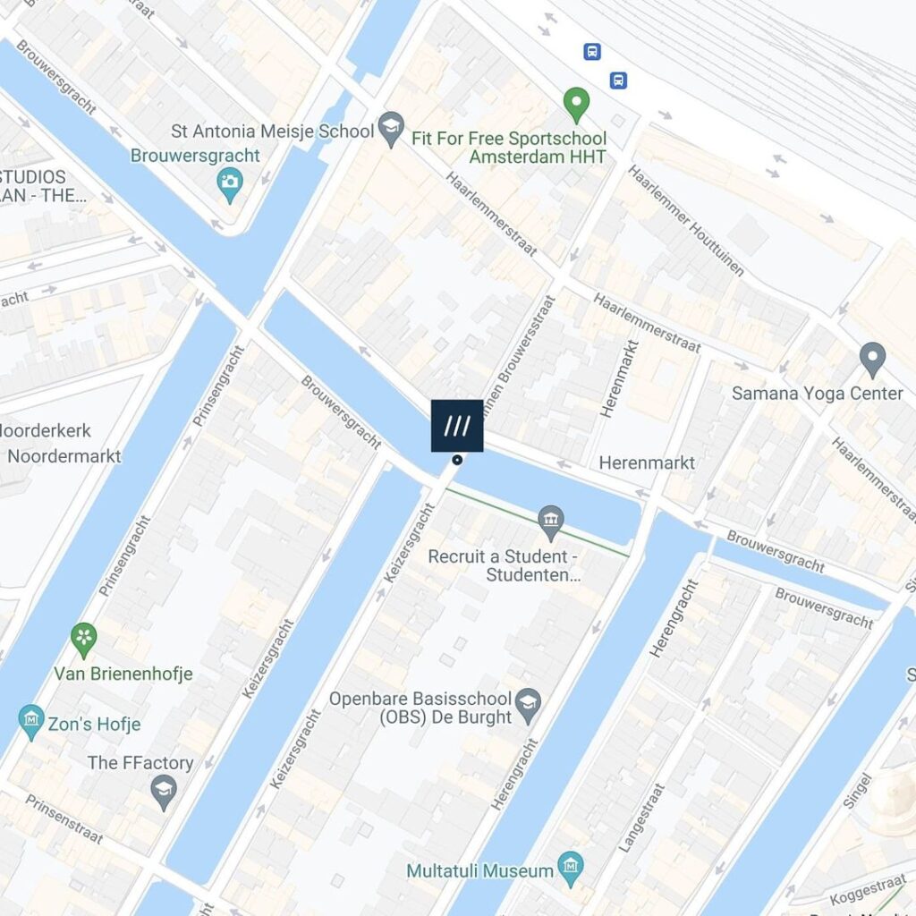
This road bridge connects the eastern quay of the Keizersgracht with the Binnen Brouwersstraat spanning Brouwersgracht and shares its southwestern quay wall with the previous bridge #Pastoorsbrug aka #brug55
The bridge has been a municipal monument since 1995.


Etymology: A Bridge Without a Proper Name
Of the three canal bridges numbered 54, 55, and 56 that cluster at the northern end of the Keizersgracht and along the Brouwersgracht, Bridge 56 is the only one to carry no proper Dutch name at all. Brug 54 is the Noordsche Compagniebrug, linked to the great Arctic whaling cartel. Brug 55 is the Pastoorsbrug, its title almost certainly traceable to the Jesuit fathers of the nearby hidden church. Brug 56 is recorded in municipal registries simply as “Brug 56,” described functionally by its route: the crossing that connects the eastern quay of the Keizersgracht to the Binnen Brouwersstraat, spanning the Brouwersgracht.
This apparent anonymity is, in itself, a small historical puzzle worth examining. Many of Amsterdam’s canal ring bridges acquired popular names over the centuries that were later formalised, often derived from adjacent buildings, trades, prominent local families, or religious institutions. The Binnen Brouwersstraat, the street on the Haarlemmerbuurt side of the bridge, takes its own name from the same brewing trade that gave the Brouwersgracht its identity, with “Binnen” (inner) distinguishing it from the parallel Buiten Brouwersstraat further north, both streets lying within the same dense block of the Derde Uitleg (Third Expansion) of the city, laid out from 1613 onwards. According to Wikidata, the Binnen Brouwersstraat itself dates as a formally recorded street to 1625, precisely the year that the earliest detailed map of Amsterdam documented this bridge.
The bridge’s lack of a popular name may simply reflect its utility: rather than sitting adjacent to a conspicuous institution, a famous church, or a renowned warehouse, Brug 56 occupies a position that is functionally vital but architecturally subordinate, giving pedestrians and cyclists a short-cut between the Haarlemmerbuurt’s interior streets and the canal ring’s northern edge, without being prominently associated with any one landmark.
A Crossing Older Than the Canal Ring: Cartographic Evidence
Despite its anonymity, the evidence for a bridge at this precise location stretches back to the very birth of the canal ring. The great cartographer Balthasar Florisz. van Berckenrode, working from 1625 on his celebrated nine-sheet isometric map of Amsterdam, recorded a bridge with five passages (vijf doorvaarten) at the junction of the Keysers Graft and the Brouwers Graft. This is an extraordinary detail. A five-passage arch bridge in this location in the early 17th century suggests a structure of considerable ambition for what was then still the northern building frontier of the new canal ring, a crossing serving traffic between the emerging Haarlemmerbuurt and the first plots of the Keizersgracht.
The 1625 Van Berckenrode map, held in the Rijksmuseum and regarded as one of the most important primary documents for understanding Amsterdam’s early 17th-century urban form, was more than a geographic instrument. It was a luxury object, often hand-coloured and displayed in the homes of regents and wealthy merchants, a portrait of the city at the height of its confidence. That a five-passage bridge appears at this location on that map confirms that a substantial crossing existed here within a decade of the Keizersgracht being dug, in the summer of 1615.
By around 1875, the five-passage structure had long since been superseded. The Amsterdam photographer Andries Jager, one of the most important early documentarians of the city’s built environment, photographed the bridge at this period and recorded a still relatively tall fixed bridge with three passages (drie doorvaarten), a considerable reduction from the original five openings, suggesting at least one major structural replacement had occurred in the intervening centuries.
Structural Evolution: From Five Arches to Iron Girders, and the 1910 Widening
The step from Jager’s three-passage bridge to the structure that stands today was gradual but decisive. By the late 19th century, the bridge that Jager photographed was no longer adequate for the volume of road traffic crossing the Brouwersgracht at this point. The Dienst Publieke Werken (Public Works Department), which managed Amsterdam’s expanding infrastructure with a mixture of engineering pragmatism and increasing aesthetic consciousness, determined that the structure needed to be widened on both sides.
In 1910, the municipality opened a public tender for the “widening on both sides of fixed bridge no. 56.” The work was modest in cost: a single contractor was able to carry out all the necessary works for under 6,500 guilders, a relatively small sum even by the standards of the time, suggesting that the core structure was retained and only the deck width and parapets were extended. The bridge was closed to traffic from 1 February 1911 through to 31 May 1911, a four-month closure. Contemporary municipal records suggest that during the same works, the bridge was also probably slightly lowered, reducing its profile to better accommodate the modernising streetscape and the increasing pressure of horse-drawn and later motorised vehicle traffic.
It is this widened, slightly lowered structure that forms the basis of what stands today: a fixed iron bridge (vaste ijzeren brug) spanning the Brouwersgracht between the Keizersgracht quay and the Binnen Brouwersstraat. The bridge is a fixed girder bridge, carrying its roadway on iron structural members rather than on masonry arches, making it a representative survival of the 19th-century engineering type that replaced the earlier masonry crossings across much of the Amsterdam canal ring. Unlike many of its counterparts on the Keizersgracht, it was never subjected to the “verwelving” (arch reconstruction) programme that swept the canal ring in the 1970s and 1980s, converting iron girder bridges back into masonry arch forms for aesthetic reasons. Brug 56 has remained an honest iron bridge, and it is precisely this authenticity that earned it heritage recognition.
In September 1995, following a comprehensive inventory of Amsterdam’s inner-city bridge stock compiled through a graduation project in 1988 and subsequently submitted to the municipal council by the Bureau Monumentenzorg, Brug 56 was formally designated as a gemeentelijk monument (municipal heritage monument). The designation acknowledged it as a genuine and largely unaltered example of the functional iron bridge type that characterised the canal ring before the era of arch reconstruction. It shares its southwestern quay wall with the neighbouring Pastoorsbrug (Brug 55), and both bridges sit together at the point where the Brouwersgracht meets the Keizersgracht, forming a paired presence at the canal junction.
Drawn by Breitner, Photographed by Jager: The Bridge in Art and Documentation
One of the most compelling aspects of Brug 56’s history is the quality of the artistic and photographic attention it received in the late 19th century. The bridge at the Binnen Brouwersstraat crossing appears in the sketchbooks of George Hendrik Breitner (1857-1923), the Amsterdam Impressionist who settled in the city in 1886 and devoted his career to recording its streets, canals, and working population in sketches, paintings, and photographs. The Rijksmuseum holds a sketch by Breitner, executed between 1886 and 1903, explicitly titled “Brug over de Brouwersgracht te Amsterdam ter hoogte van de Binnen Brouwersstraat,” a drawing from a sketchbook of 27 leaves. Breitner’s interest in this particular canal junction is consistent with his broader practice of recording the working-class and artisan streets of the Jordaan and Haarlemmerbuurt, neighbourhoods he regarded as the authentic heart of the city’s popular life.
Breitner, who described himself as “le peintre du peuple” (the people’s painter), preferred grey, rainy weather, the snow, the dark days of autumn and winter, and the hurrying figures of labourers and servant girls to the grand set-pieces of bourgeois Amsterdam. A bridge on the Brouwersgracht, with its converted warehouses, moored barges, and unglamorous working activity, was precisely the kind of subject he sought. His sketch of Brug 56 is thus not only a visual record of the bridge’s mid-to-late-19th century form, but also a document of the artistic and social values that shaped Amsterdam’s engagement with its own urban fabric in that period.
Andries Jager’s photographs from around 1875 provide the complementary documentary evidence, showing the bridge in its pre-widening state with three passages, and situating it within the visual geography of the Brouwersgracht that was so different from what the 17th-century five-arch crossing would have presented.
The Bridge’s Corner and the Birth of Stadsherstel
Standing at the eastern end of Brug 56, where the bridge meets the Keizersgracht quay, the view north along the Brouwersgracht takes in one of the most concentrated displays of 17th-century warehouse architecture surviving anywhere in Europe. The converted warehouses, with their stepped and spout gables, loading hooks, painted shutters, and carved stone name plaques, line both sides of the canal. Several have been documented for centuries: the “Groenlandse” warehouses and their whale oil pits to the south, and on the Brouwersgracht itself the long rows of named warehouses (De Appel, Groene Valk, Grauwe Valk, Spitsbergen, Groot Hert) that recall the extraordinary diversity of commodities, from grain and beer to leather, fish, whale oil, and exotic spices, that flowed through this district during Amsterdam’s Golden Age.
But the corner immediately adjacent to Brug 56 carries its own specific historic charge. The house at Brouwersgracht 86, directly at the corner of the Binnen Brouwersstraat, is not merely a 17th-century canal house. It is the founding monument of one of Amsterdam’s most important conservation organisations. The corner building at Brouwersgracht 86, originally constructed around 1618-1650 and associated in its early history with a beer broker (bierschooier) named Dirck Jansz van der Meulen, was purchased by the Amsterdamse Maatschappij tot Stadsherstel on 22 May 1957, for the sum of 12,377 guilders and 63 cents. It was the very first acquisition of that organisation, established in 1956 on private initiative with the threefold aim of enhancing the cityscape, purchasing and restoring 17th- and 18th-century canal houses, and achieving a modest financial return. Stadsherstel went on to purchase, restore, and manage more than 750 historic properties across Amsterdam, and its founding purchase at Brouwersgracht 86 is now commemorated as the starting point of a movement that helped define Amsterdam’s approach to urban heritage conservation for the second half of the 20th century.
The building has a particularly unusual surviving feature: one of the very few wooden external staircases (houten buitentrappen) remaining on a canal house anywhere in Amsterdam, giving access to the upper floors from the side of the building. The structure was restored in 1960 and subsequently provided with a neck gable sourced from the Bureau Monumentenzorg’s salvage yard, one of several historic gable fragments rescued from demolished properties and rehomed on mutilated facades across the city.
[IMAGE PLACEHOLDER 3: The corner house at Brouwersgracht 86, on the north-east side of Bridge 56, with its surviving wooden exterior staircase, the first property acquired by Stadsherstel in 1957.]
Urban Character and the Bridge Today
Brug 56 functions today as a practical traffic bridge, carrying mixed pedestrian, cycle, and vehicle traffic across the Brouwersgracht between the canal ring’s eastern quay and the Binnen Brouwersstraat. It does not carry tram lines. It has no integrated bridge-keeper’s house, no Amsterdam School sculptural ornamentation, and no commemorative plaques or “zinloos geweld” memorials associated with it. Its dimensions are modest, its profile low, and its character emphatically functional.
What it offers, to the attentive visitor, is something rarer than architectural grandeur: an almost unmediated view of the Brouwersgracht at the point where that canal intersects with the Keizersgracht, a junction that has carried bridges since at least the first decade of the 17th century. To stand on Brug 56 and look west along the Brouwersgracht is to see the canal that was, in 2007, voted the most beautiful street in Amsterdam by readers of Het Parool, framed at its best angle: the warehouse facades tapering into the distance, houseboats moored in the foreground, and the four great parallel canals of the ring visible in succession through the gaps between bridges.
The Brouwersgracht, and the small cross-streets like the Binnen Brouwersstraat that Bridge 56 connects to it, remain distinctly different in character from the tourist-dense streets further south and east. This part of the northern canal ring retains a genuinely residential quality, its buildings mostly converted to apartments rather than hotels or museums, its bridges still used primarily by people going about their daily lives. Brug 56, the bridge without a name, is the municipal monument at the heart of that quietly persisting urban fabric.
Technical Profile
Brug 56 is a fixed iron bridge (vaste ijzeren brug/liggerbrug) spanning the Brouwersgracht, connecting the eastern quay of the Keizersgracht to the Binnen Brouwersstraat. The bridge was widened on both sides in a municipal works programme of 1910-1911, closed to traffic from 1 February to 31 May 1911, at a contract cost of under 6,500 guilders. It was probably slightly lowered during the same works. The bridge carries no integrated bridge-keeper’s house, no Amsterdam School ornamental ironwork, and no documented commemorative plaques. It shares its southwestern quay wall with Brug 55 (the Pastoorsbrug). Since September 1995 it has been designated a gemeentelijk monument (municipal heritage monument). The bridge is catalogued as number 56 in the Index of Bridges in Amsterdam, located at approximately 52°22’50″N, 4°53’20″E.

Brug 56 map and location
///circling.owners.idea
Adjacent to the #Pastoorbrug this bridge connects the eastern quay of the Keizersgracht with the Binnen Brouwersstraat over the Brouwersgracht.
There has been a bridge here for centuries. Balthasar Florisz. van Berckenrode drew a bridge with five passages on his map of circa 1625 at the Keysers Graft and Brouwers Graft. Photographer Andries Jager captured a fairly high fixed bridge with three passages around 1875.


Bridge 56 information and history
The modern history of the bridge started in 1910 with the municipality of Amsterdam issuing a tender for the “widening of the fixed bridge no. 56 on both sides”. A contractor could perform this work for less than 6500 guilders. From February 1, 1911, to May 31, 1911, the bridge was out of service for traffic. The bridge was probably lowered during this work. According to a drawing in the archives of the Bureau Monumentenzorg, (see image 1) “no. 56” could be read on one bridge pier and “Ao. 1795” on the other which was also captured in a photo of July 1891. Because cantilevers were used during the widening, these texts are not visible now. Incidentally, that drawing also shows what the bridge would look like if it had been given five passages.


Photos from the archive
1. Drawing in the archives of the Bureau Monumentenzorg with number and date highlight.
2. Brouwersgracht 118-130 (d.) (left, from left) seen in an easterly direction to Brug 56 for Keizersgracht 1-5 (right) with the tower of the Ronde Lutherse Kerk in the background. Braun, Gaston, Braun et Cie. 1864
Sources and Archival References
- Wikipedia (Dutch): “Brug 56.” Documents the full structural history: five-passage bridge on Van Berckenrode’s 1625 map, three-passage bridge photographed by Andries Jager around 1875, 1910 municipal tender for widening, closure 1 February to 31 May 1911, cost under 6,500 guilders, probable slight lowering, gemeentelijk monument from 1995. Available at: https://nl.wikipedia.org/wiki/Brug_56
- Rijksmuseum: “Brug over de Brouwersgracht te Amsterdam ter hoogte van de Binnen Brouwersstraat,” sketch by George Hendrik Breitner, 1886-1903. Sketchbook page 22 of 27 leaves. Persistent URL: http://hdl.handle.net/10934/RM0001.COLLECT.528207
- Wikidata: “Binnen Brouwersstraat” (Q18954130). Confirms the street’s formal inception date of 1625, coordinate location 52°22’48.360″N, 4°53’26.520″E, and postal codes.
- Stadsherstel Amsterdam: “Brouwersgracht 86.” Documents the first purchase of Stadsherstel on 22 May 1957 for 12,377 guilders and 63 cents, the building’s 17th-century origins, the surviving wooden external staircase, and the 1960 restoration. Available at: https://stadsherstel.nl/monumenten/brouwersgracht-86/
- Stadsherstel Amsterdam: “De Amsterdamse stoep van Brouwersgracht 86.” Documents the building’s history, the beer broker Dirck Jansz van der Meulen (1650), and the Stadsherstel restoration. Available at: https://stadsherstel.nl/nieuws/de-amsterdamse-stoep-van-brouwersgracht-86/
- Stadsherstel Amsterdam: “Binnen Brouwersstraat 2.” Documents the street’s naming derivation from the brewing trade and its relationship to the Haarlemmerbuurt. Available at: https://stadsherstel.nl/monumenten/binnen-brouwersstraat-2/
- Wikipedia (English): “Brouwersgracht.” Confirms the canal’s 1594 naming, the 2007 Het Parool vote as most beautiful street, and the list of associated bridges including Brug 56. Available at: https://en.wikipedia.org/wiki/Brouwersgracht
- MforAmsterdam Tours: “Brouwersgracht.” Confirms Bridge 56 connects the Keizersgracht to the Binnen Brouwersstraat. Available at: https://mforamsterdam.com/brouwersgracht/
- Amsterdam op de Kaart (contentecontent.com): Entry for Stadsherstel, noting Brouwersgracht 86 as the first acquisition. Available at: https://amsterdamopdekaart.nl/p/247/Stadsherstel
- Vereniging Vrienden van de Amsterdamse Binnenstad: Frank V. Smit, “De ideale stenen welfbrug” (vervolg). Documents the 1995 heritage inventory of Amsterdam’s inner-city bridges and the monument designations arising from the 1988 graduation project. Available at: https://www.amsterdamsebinnenstad.nl/binnenstad/301/ideale-stenen-welfbrug.php
- Amsterdam Stadsarchief, Beeldbank: “Bouwtekening van Brug 56 over de Brouwersgracht voor de Binnen Brouwersstraat.” Construction drawing. Available at: https://archief.amsterdam/beeldbank/detail/e0bfa22a-c7c1-3da2-404c-02e3b70bae8c
- UNESCO World Heritage Centre: “Seventeenth-Century Canal Ring Area of Amsterdam inside the Singelgracht,” WHC reference 1349. Inscribed 2010. Available at: https://whc.unesco.org/en/list/1349/