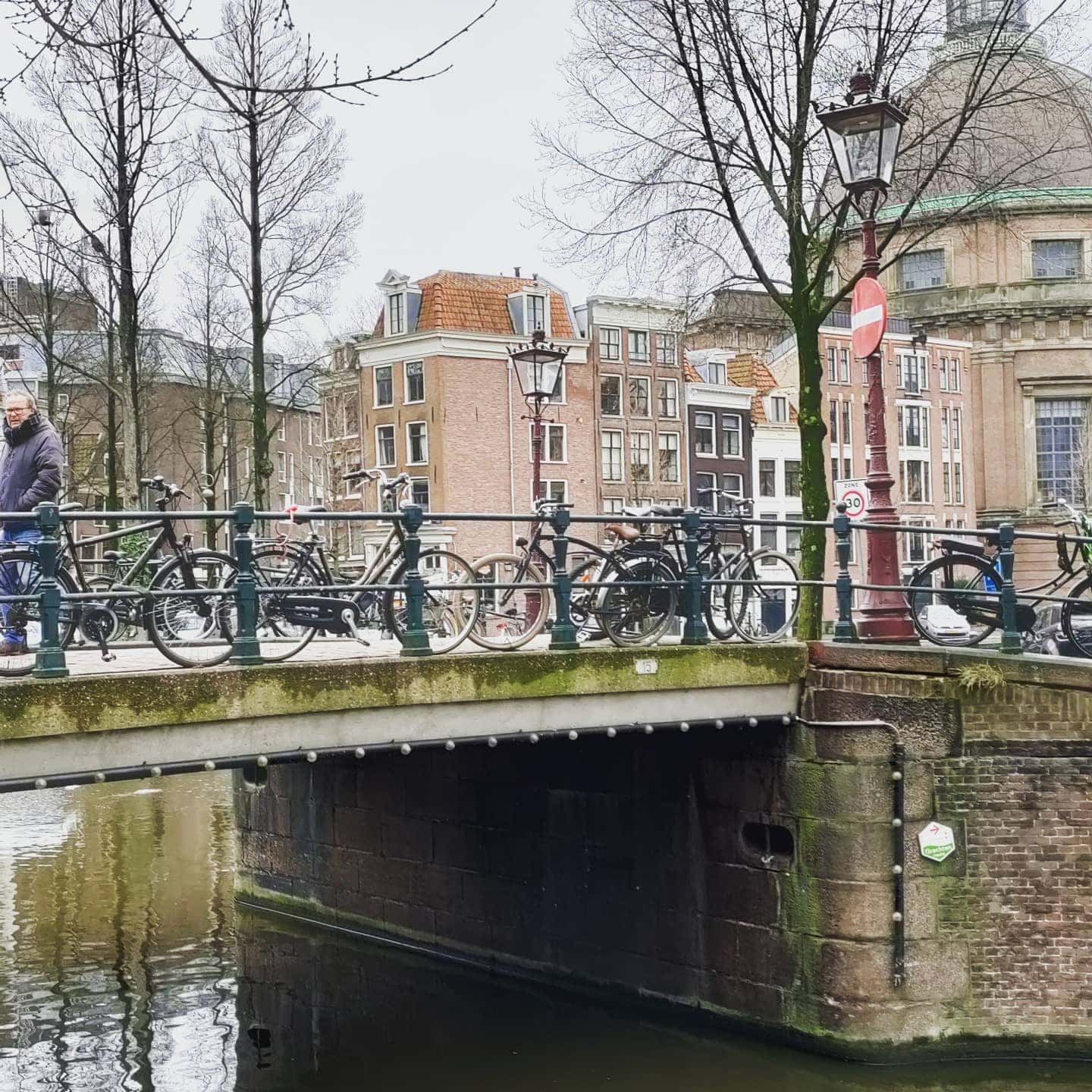
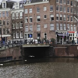
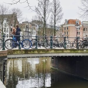
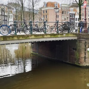
Bridge 15 is unnamed and located in the western quay of the Singel where it spans the Brouwersgracht. It is located across the narrowest part of that canal and is barely 10 meters wide it’s around the corner from the much larger Haarlemmersluis (bridge 14).

The Modest Marvel at the Meeting of Waters: A Deep Dive into the History of Amsterdam’s Brug 15
In the urban tapestry of Amsterdam, where over 1,200 bridges stitch together the city’s historic fabric, it is often the grand, sculptural masterpieces of the Amsterdam School that capture the limelight. But step away from the crowds, to the quiet, northwestern edge of the Canal Belt, and you will find a structure that speaks a different kind of truth. This is Brug 15, a small, unassuming span where the Singel canal meets the Brouwersgracht. Don’t let its modest dimensions fool you. For over four centuries, this crossing has been a silent witness to the city’s evolution, from a swampy edge of a burgeoning world port to a picturesque backdrop for modern Amsterdam. Let’s pull back the cobblestones, metaphorically speaking, and delve into the deep history of this hidden gem.
A Nameless Bridge with a Storied Past: Etymology and Origins
Unlike many of its counterparts, Brug 15 does not carry a flamboyant moniker like the “Torensluis” or the “Magere Brug”. In the efficient, bureaucratic language of the city’s Public Works Department (Publieke Werken), it is simply Brug 15, its number a designation from a bygone era of municipal cataloging. This anonymity, however, is not a sign of insignificance. It points to its age and its purely functional origins.
To understand its context, one must look to the streets it connects: the Singel and the Brouwersgracht. The Brouwersgracht, or “Brewers’ Canal,” is our first and most crucial clue. Dug around 1612 during the explosive expansion of Amsterdam in the early 17th century, this waterway became the vital artery for the city’s powerful brewing industry. Barley, hops, and fresh water were transported here, and the finished product—the lifeblood of the city—was shipped out. The bridge was born of pure necessity, a simple crossing for the workers and horses that serviced the wharves and warehouses lining these new canals.
The earliest cartographic evidence, the 1623 map by Dirck Cornelisz. Swart, clearly shows a bridge at this precise location. As the Wikipedia article on the bridge notes, on that same map, the Westerkerk is still depicted surrounded by scaffolding, under construction . This image perfectly frames the bridge’s genesis: it was a humble but essential piece of infrastructure built in the shadow of Amsterdam’s Golden Age grandeur, serving the gritty, industrial trade that fuelled it. There is no record of a hidden church or a lost city gate here. The name, or lack thereof, is its history: this is, and always was, a worker’s bridge, a functional pivot point between the bustling breweries and the city’s main thoroughfare, the Singel. It is the “first bridge over the Brouwersgracht one passes when heading out of the city,” a gateway from the urban core to the industrial fringe .
From Wooden Draw to Iron Fixed: A Structural Evolution
The Brug 15 we cross today is a product of constant, and sometimes chaotic, reinvention. For over 250 years, it was almost certainly a wooden, movable bridge (een ophaalbrug) . This was typical for a canal lined with masted ships that needed to access the breweries and warehouses further inland. You can imagine the bridge-keeper cranking the mechanism, the creak of wood and clank of chains, as a merchant vessel laden with timber or grain passed through.
This all changed in the late 19th century. The rise of steam power and larger, more efficient ships, combined with the decline of local barge traffic, made the movable bridge obsolete. In 1879, the city made a pivotal decision: replace the old wooden drawbridge with a fixed, iron bridge . This is the moment the bridge began its transformation into the structure we see today.
The project, however, was a masterclass in 19th-century municipal procrastination. After the order was given in 1879, nothing happened for a year. It wasn’t until September 1880 that the tender was finally announced. The city, ever mindful of the purse, opted for a relatively cheap design costing 3,800 guilders, plus an additional 7,000 kilograms of iron beams . By November of that same year, the new bridge was nearly finished; workmen were busy laying the pavement.
But this new iron bridge proved to be a textbook example of “penny wise, pound foolish.” Within less than two decades, it was already failing. By 1897, it had to be completely renewed. During these repairs, a temporary wooden bridge was erected for pedestrians and carts. Adding to the drama, the work was delayed when the pile-drivers went on strike in October 1897. Ever resourceful, the foreman and a few loyal friends reportedly rolled up their sleeves and did the job themselves .
Further repairs followed in 1924, but the bridge’s structural story seemed to settle after that. The most evocative image from its 20th-century history comes from 1935, when a coachman lost control of his horse and cart from the delivery firm Van Gend & Loos, plunging into the Brouwersgracht. In a moment of pure Amsterdam resilience, both man and horse were rescued . This anecdote is a charming reminder of the bridge’s role in the daily, and sometimes unpredictable, life of the city.
The Pragmatic Hand of Publieke Werken
This is where the investigation takes an interesting turn for those expecting flamboyant Art Nouveau or Expressionist brickwork. Brug 15 is not a Piet Kramer bridge. The Wikipedia article on the bridge makes no mention of him, and for good reason. Kramer, the master of the Amsterdam School style, began his legendary tenure at the Public Works Department in 1917 . While he would go on to design some 200 bridges, often with sculpted granite, whimsical ironwork, and integrated bridge keeper’s houses , the foundational changes to Brug 15 occurred in 1880 and 1897, well before his time.
The bridge’s lineage, therefore, connects to an earlier, more utilitarian phase of Publieke Werken. The 1880 design was the work of a city engineer, not a celebrated architect. Its sole purpose was function: to provide a cheap, durable, and low-maintenance crossing that would not impede the increasingly heavy road traffic. The “flattening” (verlaagd) of the bridge, implied by the change from a movable to a fixed structure, was done for the ease of horse-drawn trams and, later, automobiles.
Today, you can see this pragmatic lineage in its simple, riveted iron girders and unadorned masonry. It is a fixed girder bridge, a straightforward engineering solution. Yet, even in its simplicity, it possesses a quiet beauty. Its low profile and modest span (barely 10 meters wide and long) allow it to nestle unobtrusively between the monumental warehouses that flank it. The brickwork of the abutments, while repaired and replaced over the centuries, blends seamlessly with the 17th-century gabled facades that surround it. This is its genius: it is not a statement, but a servant to its spectacular setting.
The Confluence of History: Urban and Social Context
Standing on Brug 15 is to stand at one of the most photographed and cherished intersections in Amsterdam. It marks the point where the Singel, the first and innermost of the city’s major canals, flows into the Brouwersgracht, the northern boundary of the famed Jordaan neighborhood.
This location is its true masterpiece. To the south, the Singel stretches back towards the bustling heart of the city and the flower market. To the north, the Brouwersgracht opens up, its waters lined with massive, painted warehouses that once stored spices, herring, and timber from the Dutch East India Company (VOC). These buildings, now converted into coveted apartments, are all rijksmonumenten (national heritage sites) . Look west, and you’ll see the spire of the Westerkerk, Rembrandt’s final resting place, piercing the sky. Just around the corner to the east lies the grand Haarlemmersluis (Brug 14) , a larger and more imposing lock complex .
Its role in the neighborhood is twofold. For residents of the Jordaan and the western Canal Belt, it is an essential, quiet thoroughfare for cyclists and pedestrians. It carries no tram lines, preserving its peaceful character. For visitors, it is an endpoint. People don’t just cross it; they stop on it. They lean over its iron railings to capture the perfect photograph down the Brouwersgracht, a view often voted one of the most beautiful in the city. It functions less as a “plein” and more as a photographic vantage point, a quiet stage from which to admire the urban theater.
Technical Details and Hidden Traces
For the architectural detective, Brug 15 offers subtle details rather than bold signatures.
Type: Vaste brug (Fixed bridge). Specifically, a girder bridge with a deck of steel and asphalt.
Materials: The superstructure is steel, resting on brick and stone land piers (landhoofden). The railings are simple, functional wrought iron, a far cry from the elaborate designs of the Amsterdam School. There are no integrated granite “nose” stones or sculpted figures by artists like Hildo Krop, who so often collaborated with Kramer .
Dimensions: Exceptionally compact. Its span is negligible, as it simply connects the quay walls of the Singel across the narrow mouth of the Brouwersgracht .
One modern feature worth noting is the absence of any memorial plaques or “zinloos geweld” (senseless violence) memorials, which are common on other Amsterdam bridges. Its small size and residential-adjacent location keep it free of such public memorialization.
In conclusion, Brug 15 is a testament to the layers of history that define Amsterdam. It began as a wooden drawbridge for brewers, was refashioned as a cheap iron crossing in a fit of 19th-century cost-cutting, and has since settled into its role as a quiet, elegant frame for one of the city’s most iconic views. It may lack the artistic pedigree of a Kramer creation, but it possesses something equally valuable: an authentic, unbroken connection to the working-class soul of the Gouden Eeuw. It is a bridge built not for show, but for life. And in Amsterdam, that is the highest compliment one can pay.
Bridge 15 is located in the western quay of the Singel and spans the Brouwersgracht. On the map of Dirck Cornelisz. Swart from 1623, bridge 15 is drawn, so it probably dates from the time when the Brouwersgracht was dug (circa 1612)
The modern history of the bridge 15 starts in 1879. Then the municipality of Amsterdam ordered the replacement of the movable bridge with a fixed one. Then nothing happened for a year, which I am coming to realise is a typically Dutch trait. The tender did not follow until a year later, in September 1880. Not typical for infrastructure though as early as November 1880 it was reported that the bridge was almost completed. That bridge did not last long, perhaps due to the rushed build and already in 1897 the bridge had to be renewed. In 1924 the bridge was again out of service for a while for works.


Sources and Further Reading
Primary Sources & Archival References
Stadsarchief Amsterdam (Amsterdam City Archives)
Archief van de Publieke Werken (Public Works Department archives), dossiers betreffende brug 15, 1879-1924
Bouw- en vergunningstekeningen (Building and permit drawings), inventory numbers 10019 and 10020
Cartographic Sources
Swart, Dirck Cornelisz. (1623). Kaart van Amsterdam. Stadsarchief Amsterdam, collectie kaarten en plattegronden.
Functionele kaarten van het Centrum (Functional maps of the city center), various editions 1850-1950
Municipal Registries
Basisregistratie Adressen en Gebouwen (BAG), gemeente Amsterdam
Rijksmonumentenregister (National Monument Registry), entries for surrounding warehouses and buildings along Brouwersgracht and Singel
Wikipedia & Online Encyclopedias
Wikipedia contributors. (2018, December 8). “Brug 15 (Amsterdam).” Wikipedia, De vrije encyclopedie. https://nl.wikipedia.org/wiki/Brug_15
Wikipedia contributors. “Brouwersgracht.” Wikipedia, De vrije encyclopedie.
Wikipedia contributors. “Piet Kramer.” Wikipedia, De vrije encyclopedie.
Historical Context & Further Reading
Mak, Geert. (1995). Een kleine geschiedenis van Amsterdam. Uitgeverij Atlas. (Provides essential context on Amsterdam’s 17th-century expansion and the role of the Brouwersgracht).
Gawronski, J., & Veenman, R. (2018). *De Amsterdamse bruggen: Bouw en ontwikkeling 1850-1950*. Uitgeverij Thoth. (Definitive work on Amsterdam bridge construction and the role of Publieke Werken).
Bakker, T., et al. (2004). Amsterdam in de 17de eeuw. Stadsuitgeverij Amsterdam. (For understanding the urban development during the period when Brug 15 was first built).
Van der Velden, H. (2001). De Jordaan: Geschiedenis van een Amsterdamse volksbuurt. Uitgeverij Boom. (Provides neighborhood context for the Brouwersgracht area).
Image Collections
Wikimedia Commons. “Categorie: Brug 15 (Amsterdam).” https://commons.wikimedia.org/wiki/Category:Brug_15_(Amsterdam)
Beeldbank Stadsarchief Amsterdam. Photographs of Brug 15 and surrounding area, various dates 1880-present. https://archief.amsterdam/beeldbank/