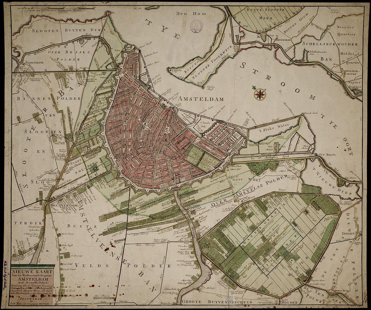
While many historical maps of Amsterdam focus on the grand architecture of the Canal Belt, the 1770 map by Jan Mol (often associated with the engraver Pieter Mol) offers a refreshingly different perspective. Published during a period of relative stability, this map is less of a formal administrative record and more of a “lifestyle” guide for the 18th-century Amsterdammer. It captures the city at a moment when the wealthy elite were looking outward, seeking fresh air and recreation in the surrounding countryside.
The true charm of Mol’s work lies in its meticulous detail of the areas just outside the Singelgracht. While the inner city is accurately rendered, the map’s real value is in its labeling of the “vermaakelijke wegen” (pleasant roads) and the numerous buitenhuizen (country estates) that lined the Amstel and the roads to Diemen and Sloten. It provides a rare, granular look at the rural-urban fringe, documenting the windmills, footpaths, and gardens that defined the city’s immediate environment before 19th-century industrialization swallowed the landscape.
A fascinating technical inclusion in the 1770 map is the Honderdgaardenlijn (the Hundred-Yards Line). This legal boundary, roughly 375 meters from the city walls, dictated strict building regulations to ensure clear sightlines for the city’s defensive cannons. By highlighting this line, Mol illustrates the tension between Amsterdam’s peaceful expansion and its military readiness. For historians and enthusiasts alike, Jan Mol’s map remains the definitive guide to the “green” history of Amsterdam, showing a city that lived as much in its gardens and paths as it did on its famous canals.
Explore the Evolution of Amsterdam
The 17th-century cartography of the Dutch Republic is a testament to the city’s rapid global expansion. This post is part of our comprehensive chronological archive.
- ← Previous Map: 1737 Gerrit de Broen
- Main Collection: Maps of Amsterdam: A Chronological Guide
- Next Map: → 1782 Gerrit de Broen
This 1770 map of Amsterdam by Jan Mol is a key part of our Chronological Guide to the Maps of Amsterdam, which documents the city’s growth from a medieval port to a global capital.
Disclaimer: These works are in the public domain in their country of origin and other countries and areas where the copyright term is the author’s life plus 100 years or fewer.