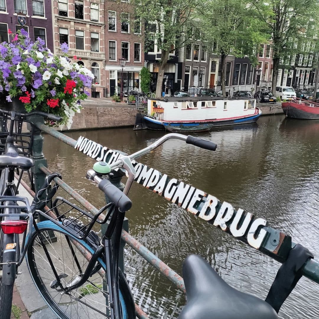
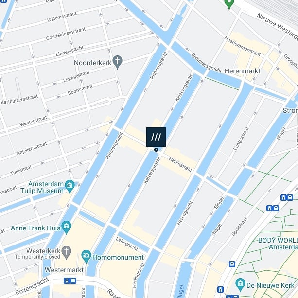
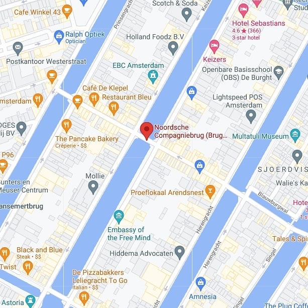
Noordsche Compagniebrug (Northern Company Bridge number 54) AKA Noordschebrug.
Spanning Keizersgracht #bridge54 connects Herenstraat with Prinsenstraat.
The bridge has been a municipal monument since 1995 and is named after Noordse Compagnie who had three warehouses along Keizersgracht between this bridge and the #Pastoorsbrug located to the north. Of the five warehouses, three lay along this stretch with Keizersgracht 40-44 being the only one left as the other two burned down in the 19th century.
Unlike previous bridges over the Keizersgracht, this bridge has not been returned to its “old” appearance and has all the characteristics of the bridges that were laid down around 1893. The bridge number can be read above the widening of the middle bridge pier.


A Name Forged in Arctic Waters
To cross the Noordsche Compagniebrug is to step, almost without knowing it, over one of Amsterdam’s most commercially consequential addresses. The bridge’s full name, used interchangeably with the shorter “Noordschebrug,” translates loosely as the “Northern Company Bridge,” and the company in question was no modest merchant guild. The Noordsche Compagnie (the Northern Company, also known as the Groenlandsche Compagnie, or Greenland Company) was a powerful Dutch cartel, founded on 27 January 1614 on the island of Vlieland by investors from Amsterdam, Delft, and Medemblik. Its purpose was single-minded and enormously profitable: to monopolise the hunting of whales in the Arctic waters around Spitsbergen, Jan Mayen, and Bear Island, and to render the blubber of those whales into traan (whale oil), one of the most sought-after commodities of the Golden Age.
For three decades, the Noordsche Compagnie held the exclusive patent granted by the States General to operate in Arctic coastal waters. At its peak, Dutch ships accounted for roughly forty percent of all captured Greenland whales. The administration of the Amsterdam chamber of the Compagnie was centred not far from where you now stand. In 1621, a consortium of investors, led by prominent shareholder IJsbrant Dobbe (also recorded as Ysbrand Dobbesz), constructed five large warehouses on the plots we now know as Keizersgracht 36 through 44. Three of those warehouses survive today as the celebrated “Groenlandse Pakhuizen,” their stepped brick gables still rising above the canal. Beneath the ground floors, sixty brick-lined traanputten (whale oil pits) were sunk into the earth, each roughly eight feet square and nearly nine feet deep, capable of holding approximately 10,000 litres of rendered blubber apiece. The stench alone, reported across the neighbourhood for generations, must have been unforgettable.
The Compagnie was dissolved in 1642, overtaken by competition from private whalers and Danish rivals, but it left an indelible mark on this corner of the canal ring. The bridge that now connects the Herenstraat to the Prinsenstraat carries that legacy in its name. Even on a map drawn in 1773, the cartographer P. van der Kloet recorded a structure at this precise crossing, confirming that a bridge has served this spot since at least the early 18th century, and almost certainly from the time the Keizersgracht itself was dug as part of the great canal ring expansion of 1613.
From Five Arches to Iron Girders: A Structural History
The oldest documented bridge at this location was a masonry arch structure with no fewer than five passages (doorvaarten), recorded as spanning the Keizersgracht “between the Heere Straet and the Prince Straet” in historical sources. Five-passage arch bridges were characteristic of the Keizersgracht’s crossings in their earliest form, their height designed to accommodate the masted vessels and laden barges that were the lifeblood of Amsterdam’s commercial waterways.
By the mid-19th century, the balance between shipping and land traffic had shifted decisively. More people were now crossing over the bridge than vessels were passing under it. The arch was by then also considered too high for the practical needs of a busier, more pedestrian and cart-driven streetscape. In 1887, the municipality lowered the existing arch bridge as a temporary measure to accommodate the changed traffic patterns. Discussions about a more fundamental rebuild began immediately, but the city of Amsterdam, characteristically, was slow to act: budget constraints meant that by 1889 the question of a full reconstruction was still only being talked about.
In 1891, the work finally commenced. The quays and bridge piers were rebuilt from the foundations, and an ijzeren liggerbrug (iron girder bridge) was installed in place of the old masonry arch. This was precisely the kind of pragmatic engineering decision being made across Amsterdam at that moment. Confidence in arch bridges had collapsed, sometimes quite literally: in 1894, just a few years after Bridge 54’s reconstruction, the neighbouring Bridge 46, also over the Keizersgracht, fell into the canal under its own weight, the victim of subsidence that had been quietly developing in several of these structures. The iron girder solution was the municipal answer to that structural anxiety. It was also carried out simultaneously with similar renovations to the nearby Bridges 18 and 19 over the Herengracht at the Blauwburgwal, indicating a coordinated programme of canal-bridge modernisation being driven from within the Dienst Publieke Werken (Public Works Department).
What makes Brug 54 particularly striking from an architectural-historical perspective is what did not happen to it. From the 1970s and 1980s onwards, Amsterdam’s Public Works Department undertook a series of restorations across the canal ring, rebuilding the flat iron-girder profiles of many 19th-century bridges back into rounded arch forms to recreate the aesthetic of the Golden Age. Critics, with some justification, called this practice an “architectonische leugen,” an architectural lie. Brug 54 was never given this cosmetic makeover. Unlike most of its neighbours on the Keizersgracht, the bridge has retained every characteristic of the late 19th-century iron-girder type: the honest, unembellished profile of a working bridge built in the 1890s, with its distinctive cast-iron corbelled cantilevers projecting from the bridge piers. The bridge number 54 is legible above the widened section of the middle pier, a detail that reads, to the attentive observer, like an identity plate of the Public Works Department’s industrial confidence.
Architecture and the Character of 1891
The current structure of the Noordsche Compagniebrug is a fixed steel girder bridge (vaste stalen liggerbrug), carrying its deck on steel beams supported by masonry piers whose quay faces are enriched by cast-iron (gietijzeren) cantilever brackets. These corbelling elements are one of the bridge’s most telling details: they serve a structural function in widening the pier head to support the full width of the roadway, but they are also finished with a degree of ornamental care that signals the transitional moment in which the bridge was built, somewhere between Victorian industrial pragmatism and the decorative confidence of the late 19th century.
This bridge is emphatically not a product of the Amsterdam School. The Amsterdam School, the expressive, brick-rich movement associated above all with architects Piet Kramer (1881-1961), Michel de Klerk, and Jo van der Mey, and nurtured within the Dienst Publieke Werken from 1916 onwards, produced many of Amsterdam’s most recognisable canal bridges, with their sweeping brick abutments, integrated bridge-keeper’s houses, sculpted lamp standards, and ornate wrought-iron railings. Piet Kramer alone made drawings for over 500 bridges during his tenure, with around 220 realised designs scattered across the city’s canal network. Brug 54, however, predates Kramer’s involvement by a quarter-century: it was conceived and built squarely within the late 19th-century engineering tradition of the Public Works Department, before the Amsterdam School aesthetic had been articulated.
What the bridge does share with that later tradition is a quality of civic seriousness, a sense that even a fixed pedestrian and vehicle crossing deserves care in the treatment of its materials. The masonry piers are faced in brick with stone detailing, and the overall composition has a solidity that sits comfortably within the canal ring’s broader architectural fabric, despite being structurally very different from the arch bridges that dominate the visual vocabulary of the grachtengordel.
Neighbourhood, Context, and the View from the Parapet
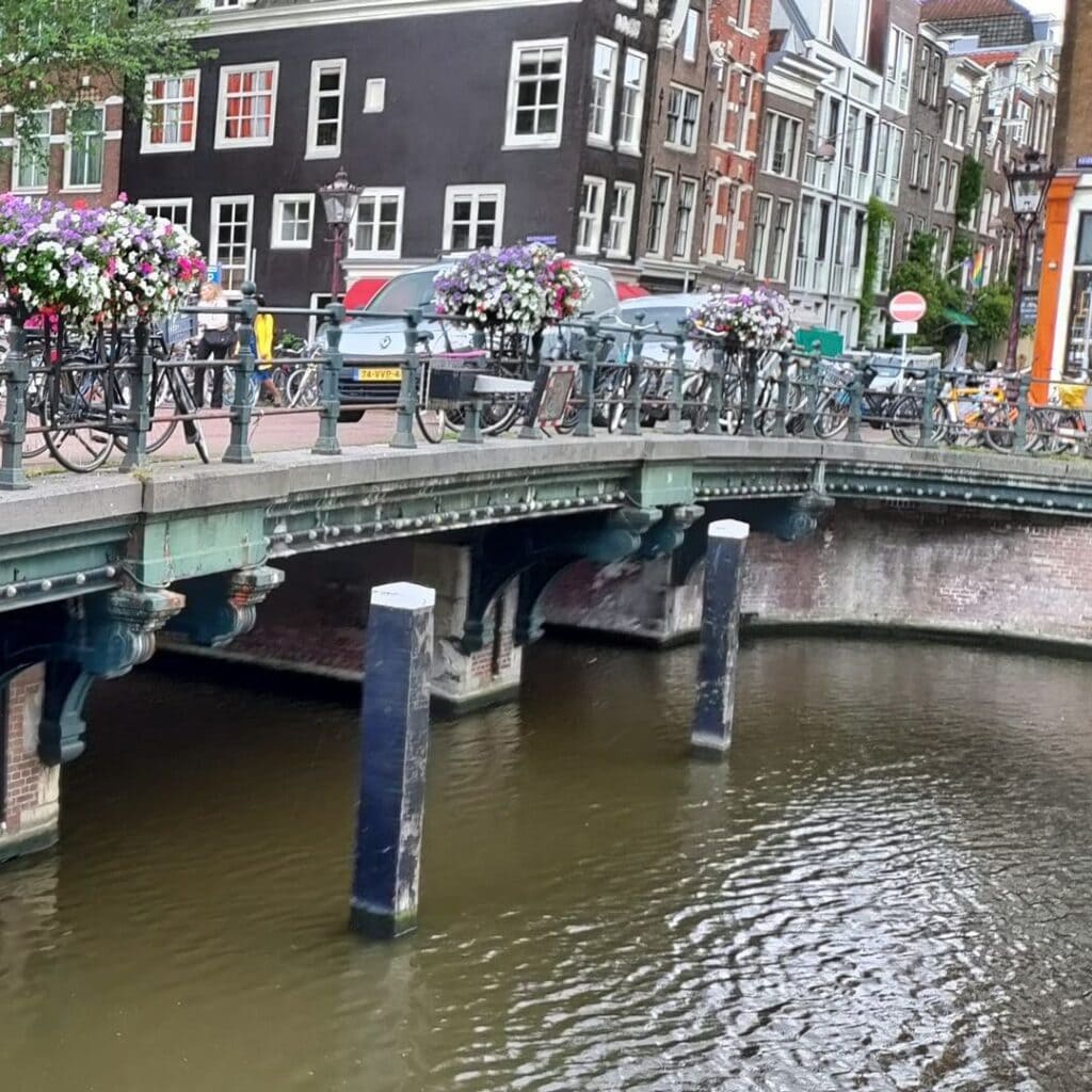
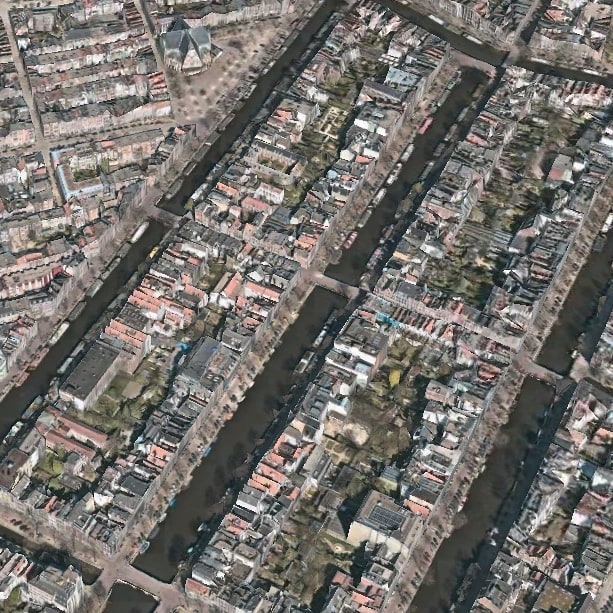
Stand on the Noordsche Compagniebrug on any morning and the geography of Amsterdam’s northern canal ring arranges itself around you with almost theatrical clarity. The bridge links the Herenstraat (on the eastern, Keizersgracht side) to the Prinsenstraat (on the western, Prinsengracht side), two of the so-called “dwarsstraten” (cross-streets) that connect the great parallel canals of the ring. These cross-streets, laid out in the 17th century, still preserve much of their original scale and intimacy: narrow, brick-paved, shaded by canal house facades that lean gently towards one another across the pavement.
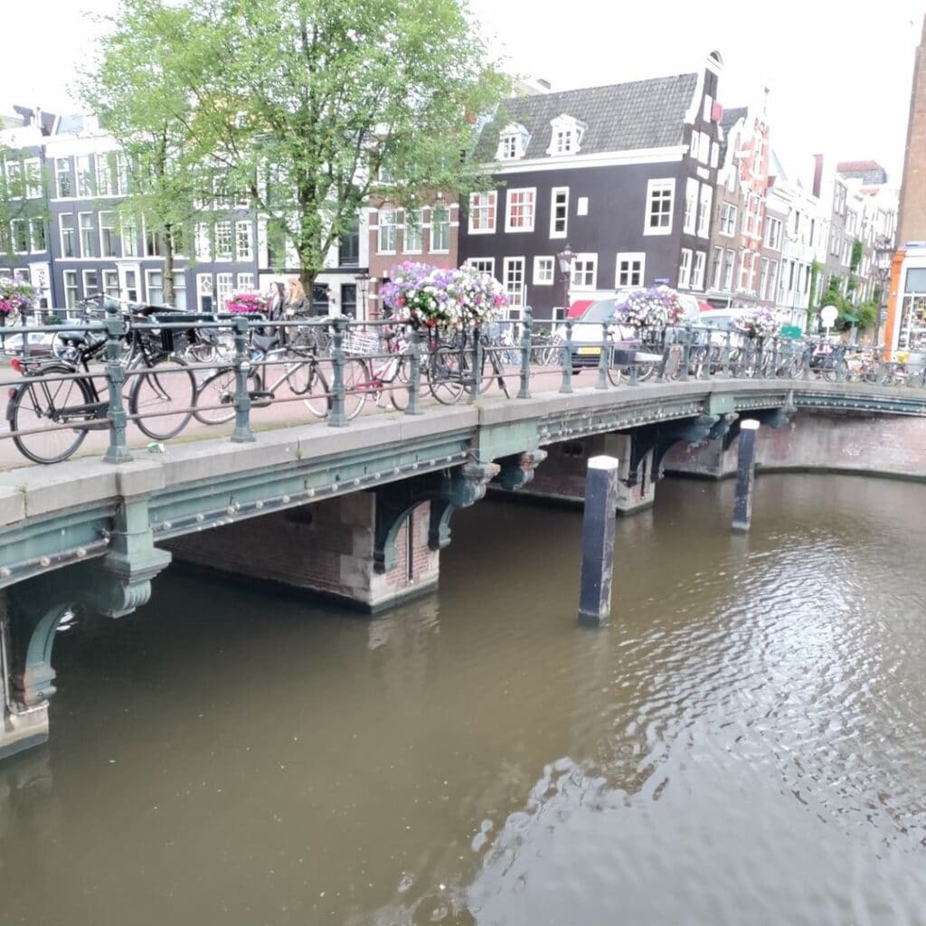
Looking north from the bridge’s parapet, on a clear day, the tower of the Noorderkerk is visible above the roofline, its squat, powerful silhouette anchoring the view towards the Noordermarkt. The Noorderkerk, completed in 1623 to a design by Hendrick de Keyser and his son Pieter, was built to serve the Reformed Protestant congregation of the Jordaan, and it remains one of the most architecturally important early 17th-century churches in Amsterdam. It appears in the background of archival photographs of Bridge 54 taken in 1970 by the Dienst Publieke Werken, the church tower serving then, as now, as an orienting landmark in a dense urban neighbourhood.
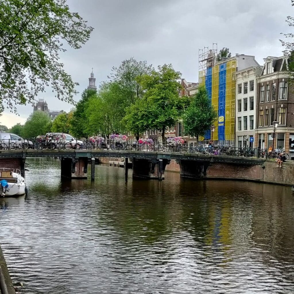
To the south, the Keizersgracht stretches towards the Westerkerk and the broader canal ring, its waters reflecting the stepped gables of the houses on either bank. On the immediate southwestern corner of the canal, the surviving Groenlandse Pakhuizen at numbers 40-44 still carry their original 17th-century stepped gables, a rare example in Amsterdam of warehouse architecture from the earliest period of the canal ring. Just slightly further down the canal, the Remonstrant Church at Keizersgracht 102 adds another layer of religious and architectural history to the immediate neighbourhood.
[IMAGE PLACEHOLDER 3: View looking northward from the bridge parapet towards the Prinsenstraat, with the tower of the Noorderkerk visible in the background.]
The bridge today carries mixed foot and cycle traffic, consistent with the character of the cross-streets it connects. It does not carry tram lines, and its modest width precludes the kind of vehicular pressure that heavier bridges in the city centre must absorb. Instead, it functions as a gentle transition point between the Jordaan neighbourhood to the west and the quieter southern reaches of the Herenstraat to the east, a crossing that most of its daily users traverse without pausing, though the view in every direction rewards those who do. Amsterdam’s canal ring was inscribed as a UNESCO World Heritage Site in 2010, precisely because of the survival of this kind of layered, intact urban fabric, and Bridge 54 is a small but genuine part of that inscription.
Technical Profile and Monument Status
The Noordsche Compagniebrug is classified as a vaste brug (fixed bridge), meaning it does not open or swing to allow navigation, consistent with the shallow draft of vessels using this section of the Keizersgracht. Its primary structural material is steel (in the girder beams), combined with brick masonry piers detailed with cast-iron corbelling. There is no bridge-keeper’s house integrated into the design, as there is for many of Piet Kramer’s later works, and no documented commemorative plaques or “zinloos geweld” memorial inscriptions have been recorded at this crossing.
In 1995, the municipality of Amsterdam awarded Brug 54 the status of a gemeentelijk monument (municipal heritage monument), recognising its significance as an unusually intact example of the late 19th-century iron-girder bridge type within the canal ring. This places it in an interesting position: a monument not because it was designed to be beautiful, but because it survived without being prettified. It is surrounded on all sides by rijksmonumenten (national heritage monuments), the canal houses and warehouses whose protections date back decades further. The bridge itself is the honest functional thread connecting them.
The bridge’s coordinates are 52°22’39.000″N, 4°53’16.300″E, and it is catalogued under bridge number 54 in the Index of Bridges in Amsterdam maintained by the municipality.
Brug 54 Noordsche Compagniebrug map and location
///plastic.vitamins.all
Like most of our bridges in the Amsterdam Canal Ring, there has been a bridge here for centuries. Balthasar Florisz. van Berckenrode drew a bridge on his map from 1625. An arch bridge with five passages then lies between Heere Straet and Prince Straet and leads over the Keysers Graft. Spanning Keizersgracht #bridge54 connects Herenstraat with Prinsenstraat.
Bridge 54 Noordsche Compagniebrug information and history
The modern history of #bridge54 begins in 1887 when a (too) high arch bridge was lowered in connection with the changing traffic (more traffic took place over the bridge than shipping under the bridge). There was already talk of a bridge with three passages. The municipality is not in a hurry, because they did not have the money and in 1889 it was still being talked about. In 1891 the time has come, when the quays and bridge piers are being erected again and an iron girder bridge was built. Confidence in arch bridges was not great at the time (a number of those bridges showed subsidence at the time) resulting in the collapse of #bridge46 also over the Keizersgracht, in 1894. Arch bridges were therefore replaced by girder bridges but as we know then some were made to look like the old arched bridges again in the early 1970s/1980s.
Unlike the previous bridges over the Keizersgracht, this bridge has not been returned to its “old” appearance and retains all the characteristics of the bridges that were laid down around 1893. So no architectural lie here.


Bridge 54
Photos from the archive
1 The Keizersgracht seen in a northerly direction to the Noordschebrug (bridge 54) in front of the Prinsenstraat 1881 t/m 1898, Andreas Theodorus Rooswinkel (1838-1909)
2 Seen to the east, with the Noorderkerk at the bottom left, the Prinsengracht and the Prinsenstraat in the middle, and the Keizersgracht with the Noordschebrug (bridge 54) at Herenstraat. Right below the Westerstraat. Dienst Publieke Werken. 20 april 1970
3 Noordschebrug (bridge 54) over the Keizersgracht at the height of the Herenstraat 1953 ca. t/m 1995 ca.
4 On the left Keizersgracht 114, 112 and lower and at number 102 the Remonstrant Church. In the distance the Noordschebrug (Brug 54) between Prinsenstraat and Herenstraat, Anoniem Onbekend c1900.
5 Noordschebrug (bridge 54) between Prinsenstraat (left) and Herenstraat (right). Half-stereo photo. 1860 ca. t/m 1870 ca.
Sources and Archival References
- Amsterdam op de Kaart (contentecontent.com): “Brug 54, de Noordsche Compagniebrug,” entry for Herenstraat/Noordsche Compagniebrug. Available at: https://amsterdamopdekaart.nl/1850-1940/Herenstraat/Noordsche_Compagniebrug
- Bruggen van Amsterdam (bruggenvanamsterdam.nl): Entry for Bridge 54, Keizersgracht hoek Prinsenstraat. Available at: https://www.bruggenvanamsterdam.nl/keizersgracht_hoek_prinsenstraat.htm
- Cramberts Bridge Archive (bridges.cramberts.com): “Noordsche Compagniebrug: Bridge 54, History and Information,” with archival photographs including images by Andreas Theodorus Rooswinkel (1838-1909) and the Dienst Publieke Werken (20 April 1970). Available at: https://bridges.cramberts.com/2022/04/05/noordsche-compagniebrug-bridge-54-history-and-information/
- Wikipedia (Dutch): “Noordsche Compagniebrug,” nl.wikipedia.org. Documents municipal monument status (1995), structural evolution from arch bridge to girder bridge (1887-1891), and the collapse of neighbouring Bridge 46 (1894).
- Wikipedia (English): “Noordsche Compagnie.” Documents the founding (27 January 1614), dissolution (1642), whaling monopoly, and the construction of Amsterdam warehouses by the company’s investors.
- Amsterdamse Grachtenhuizen (amsterdamsegrachtenhuizen.info): Entries for Keizersgracht 40 and Keizersgracht 44, documenting the construction of the five Groenlandse Pakhuizen in 1621, the sixty whale oil pits, and the role of IJsbrant Dobbe as a lead shareholder.
- Wikidata: Noordsche Compagniebrug (Q41710926). Confirms bridge number 54, coordinates 52°22’39.000″N, 4°53’16.300″E, and the bridge’s crossing of the Keizersgracht.
- Wikipedia (English): “Piet Kramer.” Confirms Kramer’s tenure at the Dienst Publieke Werken from 1916 to 1952 and his design of over 220 bridges in Amsterdam.
- UNESCO World Heritage Centre: “Seventeenth-Century Canal Ring Area of Amsterdam inside the Singelgracht,” WHC reference 1349. Inscribed 2010. Available at: https://whc.unesco.org/en/list/1349/
- Theo Bakker’s Domein (theobakker.net): “Fotoquiz 2015, Week 03: Groenlandse Pakhuizen.” Documents the traanputten, their dimensions, and their discovery during 20th-century restoration work.
- Cramberts Bridges: “Piet Kramer: Bridges of Amsterdam.” Available at: https://bridges.cramberts.com/home/piet-kramer-pieter-lodewijk-kramer/