An Arch Bridge on the Northern Quay of the Leidsegracht, Spanning the Keizersgracht, and the Memory of Amsterdam’s Greatest Baroque Sculptor
Bridge 46 is the bridge that fell down. Not in the so so distant past, not in some undocumented catastrophe, but on the night of 11 to 12 November 1894, when the middle arch of the then-standing stone bridge quietly slid away and sank into the Keizersgracht. The event was documented, photographed, and reported. It caused panic about every other arch bridge in the neighbourhood, directly triggering the replacement of Bridges 44 and 45 with plate structures. And it created, for the engineers and bridge historians who came after, one of the most precisely dated and richly documented structural failures in Amsterdam’s canal belt history.
The bridge also carries the memory of the man who worked around the corner from it during Amsterdam’s Golden Age: the sculptor Artus Quellinus (1609 to 1668), who had his workshop on the Molenpad, around the corner from the bridge. That workshop produced some of the most significant sculptural work in the Dutch Republic, and its presence in this immediate neighbourhood connects Bridge 46 to the building that stands at the very centre of Amsterdam’s civic identity: the Royal Palace on Dam Square, formerly the Town Hall, which Quellinus spent fifteen years adorning with hundreds of marble and bronze sculptures that contemporaries called the Eighth Wonder of the World.
This now arched bridge is located in the northern quay of the Leidsegracht and spans the Keizersgracht. Around the bridge there are buildings on all eight quays that have been designated a national monument the bridge however is not. The unofficial name of the bridge was the Quellijnbrug named after the sculptor Artus Quellinus . He had his workshop on the Molenpad (around the corner from the bridge). This bridge connects #bridge44 and #bridge45 and all three bridges were replaced by arch bridges in the 1970’s although at the time seen as an architectural lie they now seem more aesthetically pleasing for the historic city centre. The bridges may have an old appearance but all three have a concrete span and a concrete foundation


1. Etymology and Naming: The Quellijnbrug, a Name Abolished, and the Neighbour Who Cast the Bells and the Man Who Carved the Marble
Until 5 July 2016, this bridge was unofficially known as the Quellijnbrug, named after the sculptor Artus Quellijn (1609 to 1668), who had his workshop on the Keizersgracht near the Molenpad.
The abolition of the name followed the same logic as the Hemonybrug (Bridge 44) and the Oetgenssluis (Bridge 38): there is already a Quellijnstraat in Amsterdam, situated in Amsterdam-Zuid in De Pijp, which only received its name at the end of the 19th century. The bridge does not lie near the Quellijnstraat, which is situated in Amsterdam-Zuid, De Pijp, and only received its name at the end of the 19th century. This discrepancy in location from the street was one of the reasons that the Quellijnbrug was raised in 2016 at the college of mayor and aldermen of Amsterdam. During a check on bridge names, it emerged that the name did not meet the guidelines required for inclusion in the Basic Registration of Addresses and Buildings.
The connection between Artus Quellinus and his Keizersgracht neighbourhood is made more vivid by one detail: he was a neighbour of Pieter and François Hemony, the bell founders. The Hemony brothers, whose former workshop gave the informal name to Bridge 44 until 2016, worked at the Molenpad alongside Quellinus. Two of the most significant artistic presences in 17th-century Amsterdam occupied adjacent workshops around the corner from a bridge whose numbering system did not yet exist. The sculptor who carved the marble of the Town Hall and the bell founders who tuned the carillons of the Westertoren worked within earshot of each other, and of the bridge that would eventually bear the sculptor’s name for a century and a half.
Artus Quellinus I was born in Antwerp in 1609. Following a period in Rome, he was invited by the Amsterdam city council to decorate its newly built city hall. From 1650 onwards, he worked for fifteen years on the new city hall together with the lead architect Jacob van Campen. He decorated the then Amsterdam Town Hall with hundreds of expressive marble and bronze statues. Partly because of this, the building acquired an un-Dutch grandeur and became known as the Eighth Wonder of the World. Between 1650 and 1665, working closely with the architect Jacob van Campen, Quellinus and his highly skilled workshop created in Amsterdam’s massive town hall a sculptural Gesamtkunstwerk of unmatched variety, invention and bravura.
In 2025, the Royal Palace Amsterdam and the Rijksmuseum mounted the first-ever major retrospective of his work, uniting more than 100 works from national and international collections at the Palace itself. The exhibition Artus Quellinus: Sculptor of Amsterdam ran from 18 June to 27 October 2025 at the Royal Palace Amsterdam. The sculptor whose workshop was around the corner from Bridge 46 in the 17th century received, 357 years after his death, his first comprehensive retrospective at his own masterpiece. Bridge 46’s old informal name suddenly had a fresh cultural context: the bridge that had been named after him, and then un-named, marked the site of a creative life that the rest of Amsterdam had spent centuries quietly overlooking.
2. Structural Evolution: A Plan from 1727, a Collapse in November 1894, and a Rebuilt Arch in the 1970s
The structural record of Bridge 46 is the most precisely documented of any bridge in this series, because it includes not just cartographic evidence but a photograph of the actual moment of collapse and the municipal responses it triggered.
City architect Daniël Stalpaert drew the bridge already on his map of 1662, but the surroundings are still indicated as undeveloped. Frederik de Wit’s map of 1688 shows the bridge. A plan of the stone bridge dating from 1727 was referenced in the bridges.cramberts.com entry for Bridge 46, confirming the date of a specific 18th-century construction phase.
Then came the night that defined the bridge’s entire modern history. The modern history of the bridge starts in 1894. There was at that time an arch bridge with three navigation openings over the Keizersgracht. In the night of 11 to 12 November 1894, the middle arch collapsed and slowly sank into the Keizersgracht.
In the months before, it was visible that two cover stones were slowly sliding alongside each other, showing a mutual difference of approximately one decimetre. In the preceding days, Publieke Werken had indicated on the bridge that leaning on the railing was no longer permitted at that location, after which the bridge was closed to traffic at 9:45 PM on 11 November 1894. That same night, at 11:20 PM, the middle arch collapsed and slowly sank into the Keizersgracht.
The collapse was precisely timed and well documented. The collapse of the bridge was photographed. Photo 358 from the album of W.J.R. Dreesmann 1894 shows the bridge collapsed on Sunday 11 November 1894. Jacob Olie also photographed the collapsed bridge on November 25, 1894. His photograph shows the collapsed bridge 46 at the Keizersgracht and Leidsegracht, as seen toward Bridge 47 at the Runstraat (left) and the Huidenstraat (right).
The consequences for neighbouring bridges were immediate and far-reaching: the collapse triggered the precautionary replacement of Bridges 44 and 45 with plate structures, as documented in those posts. Bridge 46 itself was rebuilt as a plate bridge, and remained as such until the 1970s. This bridge has a very similar history to Bridges 44 and 45, including it being a slab bridge at the end of the 19th century because it collapsed over the Keizersgracht, and again like Bridges 44 and 45, recent renovations in the 1970s converted it to a more aesthetically pleasing arched bridge.
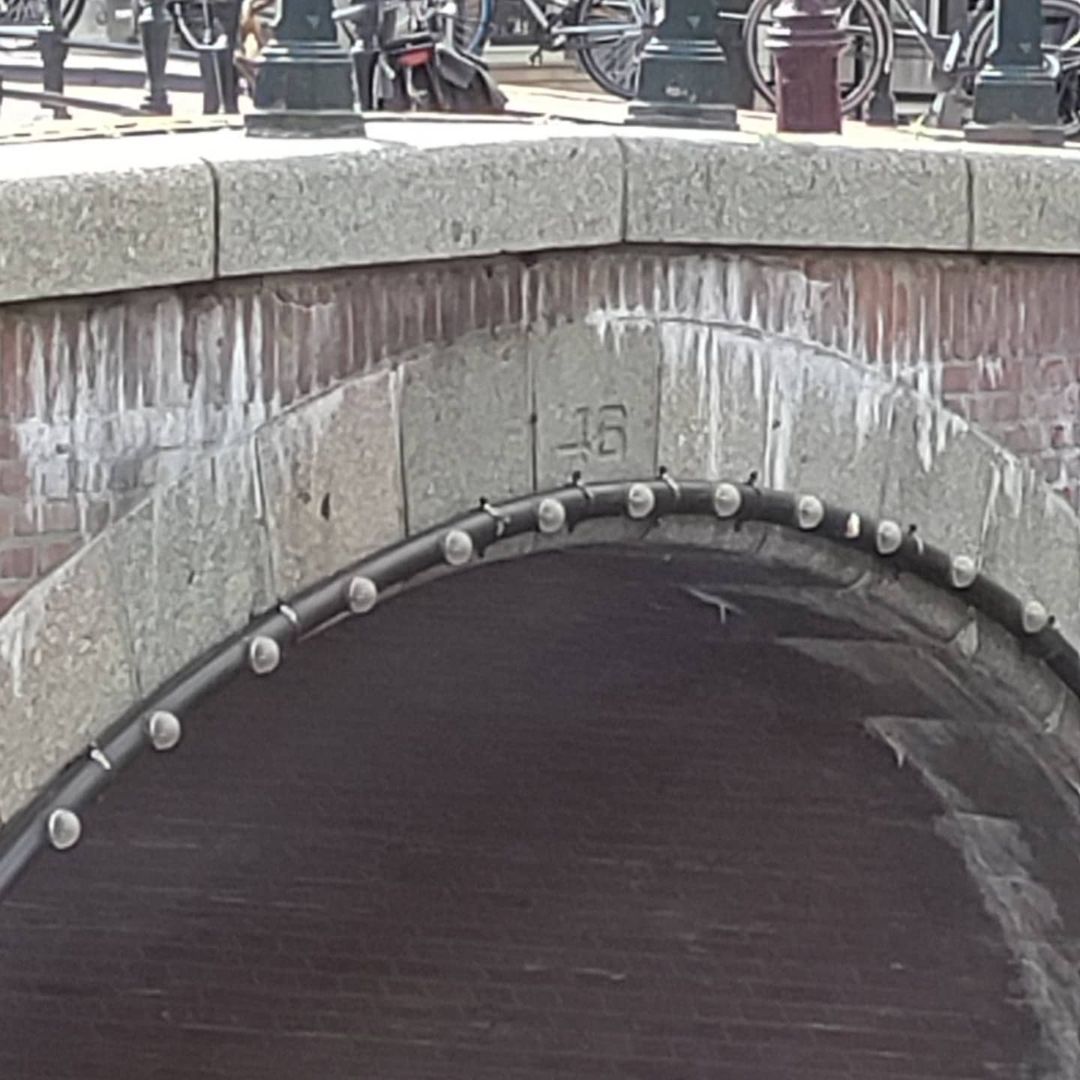
The bridge is situated in the northern quay of the Leidsegracht and spans the Keizersgracht. Around the bridge, on all eight quays, buildings are designated as rijksmonument. The bridge itself could not be declared a monument, as it is too young for that.
3. Architectural Lineage: The Third Member of the 1970s Arch Restoration Trio, Forming Eight Rijksmonument Quays
Bridge 46 completes the trio of Keizersgracht/Leidsegracht arch bridges whose stories are woven together through the 1894 collapse. Where Bridge 44 occupies the southwestern quay and Bridge 45 the northeastern quay of the same crossing, Bridge 46 sits on the northern quay of the Leidsegracht, spanning the Keizersgracht from the other direction.
All three bridges: 44, 45, and 46, were rebuilt as arches in the 1970s for the same reason: to restore visual harmony to a historic canal junction that had suffered nearly a century of plate bridge mediocrity. All three lack individual heritage designation because they are too recent to qualify. And all three are surrounded, on every quay, by rijksmonumenten: the protected 17th and 18th-century canal houses of the Keizersgracht and Leidsegracht that give the junction its celebrated character.
Bridge 46 has the most remarkable specific quay statistic: on all eight quays around the bridge, buildings are designated as rijksmonument. Not seven of the eight. All eight. The bridge sits at the exact centre of a complete ring of protected architecture, a point of maximum heritage concentration, and is itself the only unprotected element within that ring.
4. Urban and Social Context: The Molenpad, the Leidsegracht, and a Junction That Nearly Had a Tramline Run Through It
Bridge 46 sits at the same crossing as Bridges 44 and 45, and its urban context is therefore largely shared with those bridges: the Leidsegracht as the former southern city boundary, the Keizersgracht as the widest inner canal, and the combined effect of three arches framing a junction that was nearly eliminated by the infilling plans of the early 20th century.
The Molenpad, where Quellinus and the Hemony brothers both worked, runs between the Prinsengracht and the Leidsegracht, a short walk south from Bridge 46 along the Keizersgracht. The path still exists, named as it was in the 17th century, though the workshops that made it famous are long gone. Quellinus had his workshop at the Molenpad, around the corner from Bridge 46, where he was a neighbour of Pieter and François Hemony, the bell founders.
Walking from Bridge 46 along the Keizersgracht toward the Molenpad, and then continuing to the Dam Square and the Royal Palace, traces the path that Quellinus and his assistants would have walked, carrying terracotta models and marble off-cuts between the workshop and the building site. That walk, a little over a kilometre along the Keizersgracht and through the canal belt, passes four bridges from this series: 46, 45, 44, and 43, all connected by the story of the sculptor who worked in this neighbourhood and the collapse that redefined it.
The Foam Photography Museum at Keizersgracht 609 is within easy walking distance to the north. The Museum Van Loon is further north on the same canal. Looking west along the Leidsegracht from Bridge 46, the canal stretches toward the Lijnbaansgracht with a view that is, in evening light, one of the most composed in the southern canal belt.
5. Technical Specifications
Based on confirmed sources, the following can be stated:
- Bridge type: Fixed arch bridge (vaste welfbrug), 1970s construction in historical arch form following reconstruction
- Location: Northern quay of the Leidsegracht, spanning the Keizersgracht, Amsterdam-Centrum
- Canals: Keizersgracht (dug from 1615, widest canal in Amsterdam’s inner city at 28.31 metres; UNESCO World Heritage Canal Belt, listed 2010); Leidsegracht (constructed from 1615, southern boundary of Amsterdam until 1658)
- Relationship to Bridges 44 and 45: All three bridges span the Keizersgracht/Leidsegracht junction from different quays; all three were rebuilt as arches in the 1970s; all three are too recent for heritage listing but surrounded by rijksmonumenten
- Cartographic record: Daniël Stalpaert’s city plan, 1662 (surroundings undeveloped); Frederik de Wit’s map, 1688 (completed bridge in developed neighbourhood); plan of stone bridge, 1727
- 11 to 12 November 1894: Middle arch of the then-standing three-arch stone bridge collapsed and sank into the Keizersgracht at 11:20 PM; the bridge had been closed to traffic at 9:45 PM after two cover stones were observed sliding apart; the collapse was photographed by W.J.R. Dreesmann (photo 358 of his 1894 album) and by Jacob Olie (25 November 1894)
- Post-1894: Rebuilt as a plate bridge; same precautionary replacement logic applied to Bridges 44 and 45
- 1970s: Rebuilt as arch bridge to restore visual harmony with the historic canal junction; same programme as Bridges 44 and 45
- Monument status: Not a monument (geen monument), bridge too recent for listing; on all eight surrounding quays, buildings are designated as rijksmonument
- Former informal name: Quellijnbrug (after Artus Quellinus I, 1609 to 1668, sculptor whose workshop was at the Molenpad, around the corner from the bridge, where he was a neighbour of the Hemony brothers); abolished 5 July 2016 as it did not meet the guidelines for the Basic Registration of Addresses and Buildings; there is already a Quellijnstraat in Amsterdam-Zuid (De Pijp)
- Current official name: None; designated in the municipal register as Brug 46
- Cultural connection: Artus Quellinus I worked in this neighbourhood from approximately 1650 to 1665, producing the sculptural programme for the Amsterdam Town Hall (now Royal Palace on Dam Square); the Rijksmuseum and Royal Palace Amsterdam mounted the first major retrospective of his work in 2025
Sources Consulted
- Bruggenvanamsterdam.nl, bridge register entry for Brug 46: www.bruggenvanamsterdam.nl/keizersgracht_hoek_leidsegracht2.htm
- Wikipedia (nl), “Brug 46”: nl.wikipedia.org/wiki/Brug_46
- Bridges.cramberts.com, “Brug Zesenveertig, Bridge 46, History and information”: bridges.cramberts.com/2022/04/05/brug-zesenveertig-bridge-46-history-and-information/
- Wikipedia (en), “Artus Quellinus the Elder”: en.wikipedia.org/wiki/Artus_Quellinus_the_Elder
- Rijksmuseum, “Advance notice: Artus Quellinus, Sculptor of Amsterdam”: rijksmuseum.nl/en/press/press-releases/advance-notice-artus-quellinus-sculptor-of-amsterdam
- Rijksmuseum, “Quellinus at work” (research project): rijksmuseum.nl/en/research/our-research/fine-and-decorative-arts/paintings-and-sculpture/quellinus-at-work
- Royal Palace Amsterdam, “Artus Quellinus”: paleisamsterdam.nl/en/Artus-Quellinus/
- Apollo Magazine, “The mighty sculptures of Artus Quellinus”: apollo-magazine.com/artus-quellinus-royal-palace-amsterdam-rijksmuseum-review/
- Wikipedia (en), “Keizersgracht”: en.wikipedia.org/wiki/Keizersgracht
- Wikipedia (en), “Leidsegracht”: en.wikipedia.org/wiki/Leidsegracht
- PICRYL, “Brug 46 Quellijnbrug, Keizersgracht Amsterdam” (photographs by Rooswinkel A.T., Schouten J.A.): jenikirbyhistory.getarchive.net/topics/brug+46+quellijnbrug/keizersgracht+amsterdam
- Wikimedia Commons, Category: Brug 46 (Amsterdam): commons.wikimedia.org/wiki/Category:Brug_46_(Amsterdam)
- Frank V. Smit, “Bruggen in Amsterdam,” Matrijs 2008 (cited in Wikipedia nl, “Brug 46”)
Public Domain Images

1. Jacob Olie, “Collapsed Bridge 46, Keizersgracht/Leidsegracht, as seen toward Bridge 47 Runstraat (left) and Huidenstraat (right),” 25 November 1894, Stadsarchief Amsterdam Jacob Olie photographed the collapsed Bridge 46 on November 25, 1894, showing the collapsed bridge over the Keizersgracht and Leidsegracht as seen toward Bridge 47 at the Runstraat (left) and Huidenstraat (right). Jacob Olie (1834 to 1905) is fully in the public domain. This is one of the most dramatic historical bridge photographs in the Stadsarchief Amsterdam collection. URL: https://archief.amsterdam/beeldbank (search: “brug 46 ingestort Jacob Olie 1894”) Attribution: “Jacob Olie, 25 November 1894. Collectie Stadsarchief Amsterdam. Public domain.”

2. “Photo 358 from the album of W.J.R. Dreesmann 1894: Bridge 46 collapsed on Sunday 11 November 1894,” Stadsarchief Amsterdam Photo 358 from the album of W.J.R. Dreesmann 1894 shows the bridge collapsed on Sunday 11 November 1894. The Dreesmann album is held in the Stadsarchief Amsterdam and the photographs from it are in the public domain as 19th-century works. This is the earliest photographic record of the collapse, taken within days of the event. URL: https://archief.amsterdam/beeldbank (search: “Dreesmann brug 46 1894 ingestort”) Attribution: “W.J.R. Dreesmann album, photograph 358, 1894. Collectie Stadsarchief Amsterdam. Public domain.”

3. “Keizersgracht gezien in westelijke richting naar de Quellijnbrug (brug 46) voor de Leidsegracht,” photographer A.T. Rooswinkel, c. 1867 to 1883, Stadsarchief Amsterdam Several photographs in the Stadsarchief Amsterdam collection are captioned “Keizersgracht gezien in westelijke richting naar de Quellijnbrug (brug 46) voor de Leidsegracht,” made by photographer A.T. Rooswinkel, with publisher attribution to Gebroeders Douwes and Schouten, J.A. These pre-collapse images show the original three-arch stone bridge that fell in 1894. Available via the Stadsarchief Beeldbank and via PICRYL. URL: https://jenikirbyhistory.getarchive.net/topics/brug+46+quellijnbrug/keizersgracht+amsterdam Attribution: “A.T. Rooswinkel, c. 1867 to 1883. Collectie Stadsarchief Amsterdam. Public domain.”
Brug 46 map and location
Not much to say about the location of Brug 46 as it’s fairly similar to both Bridge 44 and Bridge 45 although this one is located in the northern quay of the Leidsegracht and spans the Keizersgracht.
Both Brug 44 and Brug 45 are also located at this ‘junction’.


Brug 46 AKA Quellijnbrug history and information
This bridge has a very similar history to #brug44 and #brug45 including it being a slab bridge at the end of the 19th century because it collapsed over the Keizersgrachtand and again like #bridge44 and #bridge45 recent renovations in the 1970’s converted it to a more aesthetically pleasing arched bridge. The bridge is drawn on the boundary between the built-up area and his design for the new district south of the Leidsegracht. Frederick de Wits map from 1688 shows the bridge in place.
The unofficial name of the bridge was the Quellijnbrug named after the sculptor Artus Quellinus. He had his workshop on the Molenpad (around the corner from the bridge). He was a neighbour of Pieter and François Hemony the bell founders #bridge44 The bridge is not located near the Quellijnstraat which is in Amsterdam-Zuid and only received its name at the end of the 19th century. This deviation of location from a street is one of the reasons that the Quellijnbrug was discussed in 2016 at the Municipal Executive of Amsterdam. A check of the bridge names showed that the name did not meet the guidelines that apply to be included in the Basic registration of Addresses-Buildings so like #brug44 became unnamed.


Pics from Amsterdam Archive
1 Bridge 46 collapsed on Sunday 11 November 1894. Photo 358 from the album of W.J.R. Dreesmann 1894
2 Bridge No. 46 before restoration April 1974
3 Keizersgracht seen in western direction to the Quellijnbrug (bridge 46) in front of the Leidsegracht 1867 – 1883
4 In the foreground left bridge number 46. Right bridge number 45 and the entrance of the Leidsegracht.
5 Bridge 46 Plan of the stone bridge / map 1727
6 Collapsed bridge 46 Keizersgracht / Leidsegracht, as seen towards bridge nr. 47 Runstraat (left) and Huidenstraat (right) Jacob Olie Jbz. November 25, 1894
7 The bridge collapsed on Sunday, November 11, 1894.
8 Brug nr 46 vóór restauratie April 1974