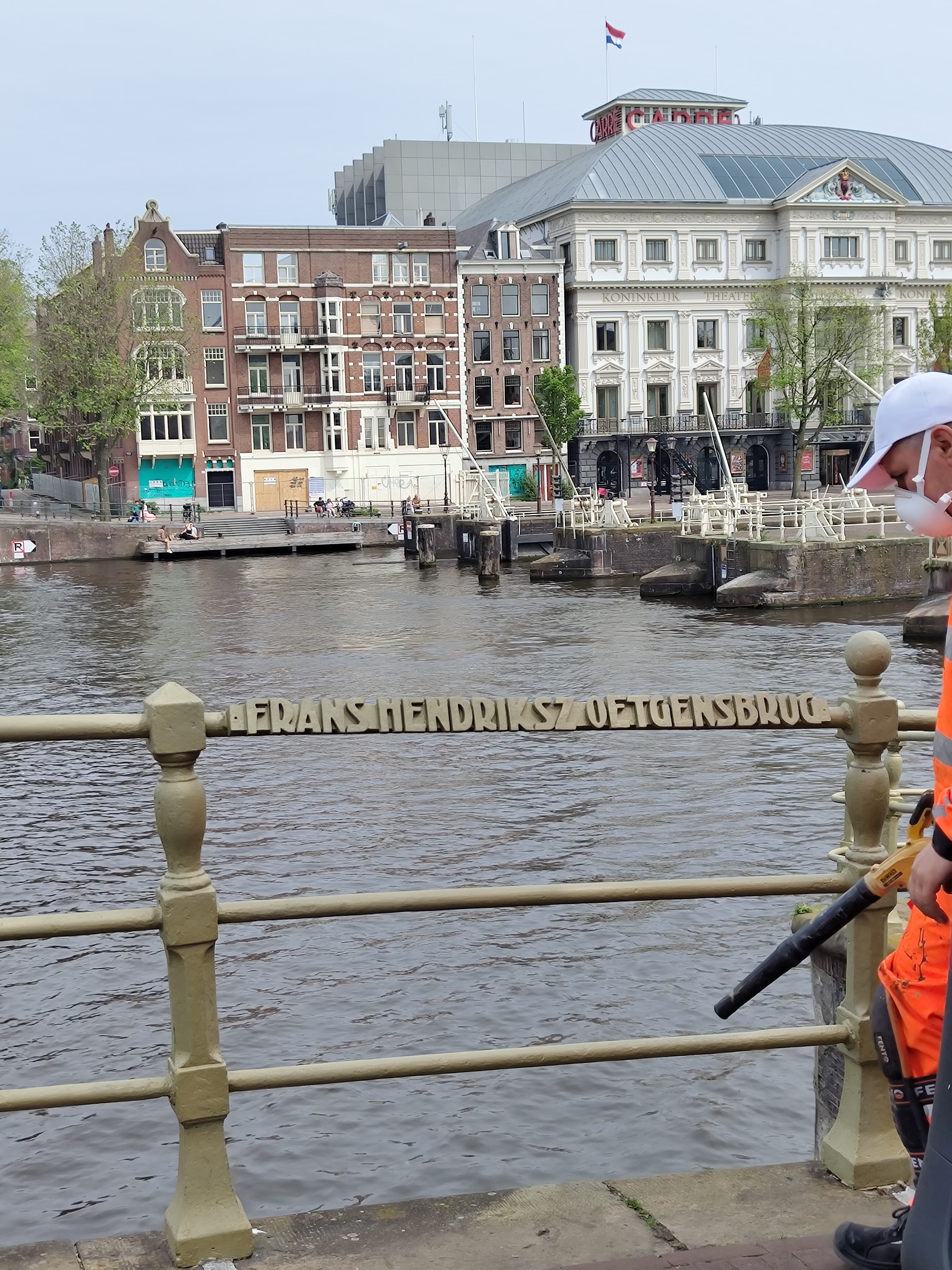
Where the Prinsengracht Ends: The 1773 Bridge Named for the Mayor Who Built the Canal Ring
Last time we looked at Brug 75, the unnamed crossing in the Utrechtsestraat, and noted that it stands second-to-last on the Prinsengracht. This is the last one. The Frans Hendricksz. Oetgensbrug carries the western bank of the Amstel across the mouth of the Prinsengracht, at the exact point where Amsterdam’s outermost planned canal stops being a canal and becomes a river.
It is a boundary marker in the most literal sense: the bridge sits on the south-eastern edge of the canal ring. Everything behind it was drawn on a plan. Everything in front of it is the Amstel, which was there first.


Etymology and Naming: The Mayor Who Ran the Third Expansion
Frans Hendricksz. Oetgens was a burgomaster of Amsterdam, and he is one of four men credited with the preparation and execution of the Third Expansion, the phase of works that produced the western canal ring as we know it. The other three were Hendrik Staets, Lucas Jansz. Sinck and Hendrick de Keyser.
That quartet is worth holding in mind, because Amsterdam has quietly given each of them a bridge, and readers of this site have now met all four:
- Bridge 35: De Hendrick Jacobsz. Staetsbrug, for the city carpenter
- Bridge 36: De Lucas Jansz. Sinckbrug, for the surveyor
- Bridge 76: the Frans Hendricksz. Oetgensbrug, for the burgomaster
- Bridge 77: the Henrick de Keijserbrug, for the architect
Four men, four bridges, one project. It is an unusually complete piece of civic commemoration, and it is almost entirely invisible unless you happen to be walking the numbers in order. The team that planned the canal ring is memorialised on the canal ring, in the form of the thing they built.
Bridge 76 and Bridge 77 stand a short walk apart on the same bank of the Amstel, the burgomaster and the architect, adjacent, at the corner where the planned city meets the river.

Structural Evolution: The Anno 1773 Stones
The bridge standing today dates from 1773, and it says so itself. Two weathered date stones on the Amstel side carry the inscription Anno 1773, worn now, but legible to anyone who knows to look for them.
That date places it a dozen years before Bridge 61, the Leliesluis, whose own stones read Anno 1785, and puts both in the last decades of the Dutch Republic. It is a period easy to overlook in Amsterdam’s story, falling as it does between the Golden Age everybody photographs and the nineteenth-century industrial city that flattened so many of its bridges. But a good deal of what visitors take for seventeenth-century Amsterdam is in fact eighteenth-century masonry, quietly replacing whatever had worn out.
The bridge has been a municipal monument since 1995.
Urban Context: The Corner Where the Ring Stops
Standing on this bridge puts a remarkable amount of Amsterdam’s water engineering within a few hundred metres.
Behind you is the Prinsengracht, running north-west through the whole canal ring to the Brouwersgracht. In front is the Amstel. Downstream sit the Amstelsluizen of 1673, Johannes Hudde’s locks, built to flush the city’s canals and keep the salt out, the structure whose construction stripped three bridges on the Utrechtsestraat, including Brug 75 just upstream, of their original purpose as inner sluices.
So the sequence, walking south-east along the Prinsengracht, is: a bridge that lost its job to the Amstelsluizen, then a bridge named for the man who organised the canal ring, then the Amstelsluizen themselves. Three centuries of water management in the order they happened.
Technical Specifications
- Bridge number: 76
- Name: Frans Hendricksz. Oetgensbrug
- Type: Fixed bridge
- Spans: Prinsengracht
- Carries: The western bank of the Amstel
- Current structure: 1773 (two date stones, Amstel side)
- Status: Municipal monument since 1995
- Position: Last bridge on the Prinsengracht before the Amstel; south-eastern boundary of the canal ring
- Neighbours: Brug 75 upstream on the Prinsengracht; Brug 77 along the Amstel bank
Sources Consulted
- Frans Hendricksz. Oetgensbrug, Nederlandstalige Wikipedia
- Wikidata Q23814879
- Structurae: Frans Hendriksz. Oetgens Bridge (Amsterdam, 1773)
- Wikimedia Commons, Category: Brug 76, Frans Hendricksz. Oetgensbrug
- Amstelsluizen, Nederlandstalige Wikipedia
- Prinsengracht gezien naar de Frans Hendricksz. Oetgensbrug
- Brug 76 naar de Amstel, links Prinsengracht 1129–1131