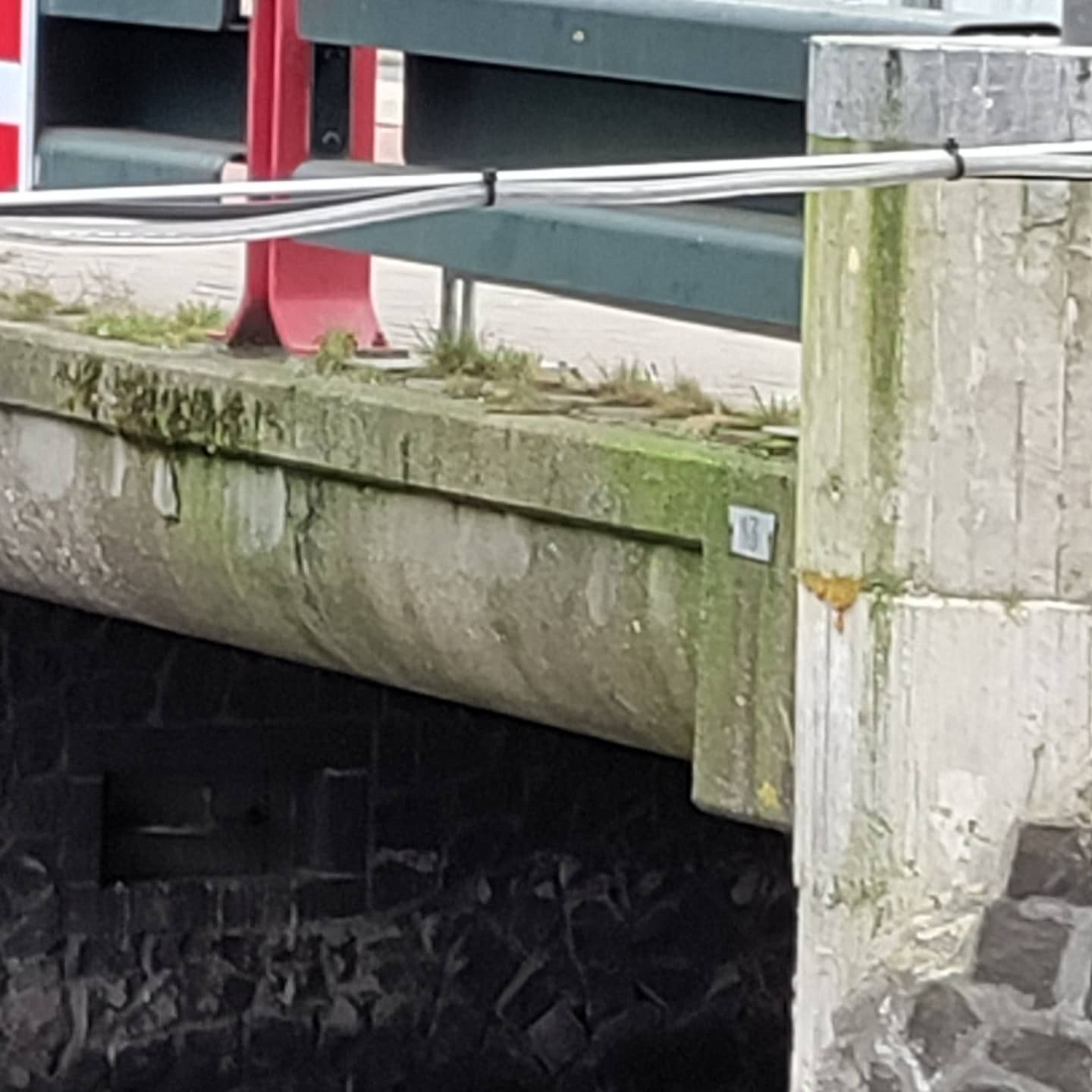
Bridge 13: The Bridge You Cross to Reach Amsterdam
Every day, vast numbers of people pass through Amsterdam Centraal. Most of them, whether they realise it or not, cross Bridge 13 as part of the journey between the station’s western exits and the city. The bridge spans the Open Havenfront, the narrow channel of water that separates the station’s artificial island from the mainland streets of Prins Hendrikkade and the Martelaarsgracht. It is not a scenic destination, not a bridge people seek out by name. It is the crossing that happens at the threshold of the city, and it has been doing that work, in various forms, since before the station was imagined. The bridge carries no official name. For most of its post-station history it was known informally as the Melkmarktsbrug, after the milk market that once operated nearby, or as the Westelijke Toegangsbrug, the Western Access Bridge, a designation that described its role in the station’s approach infrastructure without pretending to anything more poetic. Both names were retired from official use by the municipality in 2016. What remains is the number.The Water the Station Was Built Over: The Open Havenfront
Amsterdam Centraal was built on an artificial island in the IJ, the wide tidal inlet that formed the northern boundary of the historic city. The construction of the island, and of the station designed by P.J.H. Cuypers and A.L. van Gendt (opened 1889), required the creation of a permanent water barrier between the station complex and the city streets to the south. The channel that resulted is the Open Havenfront: a controlled width of water running along the station’s southern face, separating the island platform from Prins Hendrikkade and the western reaches of the Martelaarsgracht. The Martelaarsgracht, whose name translates as the Canal of the Martyrs, was once a genuine waterway running along the western edge of the old city’s northern district. By the twentieth century the canal had been partially filled, reducing it to a street that preserves the waterway’s alignment in name while carrying road and tram traffic in practice. Bridge 13, at the western end of the Open Havenfront, is the crossing between the station island and this part of the city: the link between Stationsplein and Prins Hendrikkade at the point where the Martelaarsgracht terminates.The Milk Market and the Names It Left
The informal name Melkmarktsbrug records a specific feature of the pre-station waterfront. The milk market (melkmarkt) operated in the area of the present Stationsplein during the period before the IJ waterfront was reorganised for the railway. The northern edge of Amsterdam in the seventeenth and eighteenth centuries was not a railway concourse but a working harbour, with the IJ directly accessible and the quaysides used for unloading and trading goods. A milk market at this location was part of the ordinary commercial life of the harbour district, the kind of specialised trading activity that gave informal names to dozens of Amsterdam’s streets and crossings without ever achieving formal registration. The second informal designation, Westelijke Toegangsbrug, was more administrative than evocative. Of the three major pedestrian and cycling bridges that give access to the station island across the Open Havenfront, Bridge 13 is the westernmost; Brug 306 and Brug 285 serve the central and eastern approaches. “Western Access Bridge” described this function precisely and without sentiment, which may explain why it co-existed with the more characterful Melkmarktsbrug rather than replacing it. The 2016 municipal policy that systematically retired informal bridge names from the official record applied to both designations. Bridge 13 lost its informal nomenclature alongside a number of other Amsterdam crossings in the same administrative sweep. The names survive in historical records and in the habits of people old enough to have used them, but they no longer appear on official municipal documentation.The First Bridge Here: 1662 and the Nieuwe Stadsherberg
A crossing at or near this location existed well before the Central Station was imagined. Around 1662, a bridge was built to provide access to the Nieuwe Stadsherberg, the New City Inn, a substantial establishment on the IJ waterfront serving the commercial and social needs of Amsterdam’s harbour district. The Nieuwe Stadsherberg was a public venue in the broader sense: a place for meetings, negotiations, and hospitality at the edge of the city’s most active commercial zone. Providing a bridge to reach it from the city was a practical necessity, and the crossing that served this purpose was the earliest predecessor of Bridge 13. The IJ waterfront of that period was a different kind of edge from the one that stands today. The harbour was the city’s economic spine, and the waterfront was where Amsterdam’s global trading connections were made and maintained. The bridge that reached the Nieuwe Stadsherberg was therefore not a marginal structure serving a peripheral destination: it was an access point to one of the busier zones of a city at or near the height of its international importance. That the inn itself is long gone, absorbed into the infrastructure of a railway terminus that would have been unimaginable to anyone who walked this crossing in 1662, is the kind of layered transformation that characterises the entire northern waterfront’s history.Van Gogh at the Water’s Edge: 1885
In October 1885, Vincent van Gogh visited Amsterdam, primarily to see the recently opened Rijksmuseum. While in the city, he also walked the streets and waterways of the northern quarter, and at some point during that visit he turned his attention to the bridge at the Open Havenfront: a sketch records the crossing and its immediate surroundings as they appeared that year, while the Central Station was still under construction on its new island. The timing makes the sketch particularly significant as a document. Construction of Amsterdam Centraal had begun in 1882; the station did not open until 1889. In 1885, Van Gogh was looking at a bridge in transition: the structure that had served the Nieuwe Stadsherberg and its successors, now flanked by the early stages of a project that would permanently reshape the IJ waterfront and transform the function of the crossing. The sketch captures a moment between two urban eras, neither the working harbour of the seventeenth century nor the fully realised railway gateway the city was becoming. It is one of the few visual records of the bridge before the Central Station’s infrastructure had fully absorbed the approach into its own logic.Iron, Wood, and the Station’s Requirements: The 19th-Century Bridge
The construction of the Central Station fundamentally changed Bridge 13’s operational context. A crossing that had served a harbour inn needed to be reconceived as part of the access infrastructure for a major railway terminus. The reconstruction in the nineteenth century produced a structure with iron beams and a wooden deck: a specification standard for working bridges of the period, functional rather than decorative, and designed to be maintained and replaced rather than to endure unchanged. The iron-and-wood construction reflected the priorities of the time. The new station required reliable crossing points across the Open Havenfront, and those crossings needed to handle the concentrated flows of passengers arriving and departing. A bridge serving a major railway station could not afford to be fragile. The iron beam structure provided the necessary load capacity; the wooden deck was a practical choice that allowed for straightforward replacement as individual planks wore out. The result was a bridge shaped entirely by the demands placed on it.1924, 1946, and the Path to a Complete Rebuild
The twentieth century brought two significant renovations before the bridge’s complete reconstruction. The 1924 intervention addressed accumulated wear on the iron-and-wood structure and updated the bridge to the standards the Dienst der Publieke Werken was applying across its maintained bridge stock in the early interwar period. A second renovation in 1946, in the immediate aftermath of the Second World War, addressed the consequences of wartime neglect and the urgent need to restore functioning infrastructure across a city that had been under occupation. Neither renovation fundamentally changed the bridge’s character. The structure that emerged from the 1946 work was still recognisably a station-access bridge: serviceable, direct, and oriented entirely toward the practical demands of moving large numbers of people across a narrow channel. By the 1970s, the accumulated age of the structure and the continuing intensification of use had made a complete rebuild the most sensible response. Patching a bridge of that age and that level of demand had reached its practical limits.Dirk Sterenberg and the 1978 Bridge: A Total Concept
The complete rebuild of Bridge 13, begun in 1978, was assigned to Dirk Sterenberg of the Dienst der Publieke Werken. Sterenberg approached the project with what has been described as a “total concept” design philosophy: rather than treating the structural, functional, and aesthetic elements as separate problems to be solved independently, he developed them as an integrated whole. The result is a bridge in which the structural logic, the lighting, and the railings form a coherent design rather than an assemblage of separately conceived components. The structural type is the Verbundträger, a composite construction combining steel beams and reinforced concrete in a way that uses the compressive strength of concrete and the tensile capacity of steel together. The Verbundträger was a well-established engineering solution for bridges of this span and load requirement by the 1970s, offering structural efficiency and a relatively shallow deck profile. For a bridge carrying dense cycling and pedestrian traffic at a level crossing on flat ground, the shallow deck was a practical advantage: it minimises the height differential between the bridge and the surrounding roadway, making the crossing as natural and unobstructed as possible. The railings are painted blue, a choice that distinguishes Bridge 13 visually from both the warm-brick Amsterdam School bridges of the canal ring and the utilitarian ironwork of the western-city working bridges. The integrated light masts, designed as part of the total concept rather than added afterward, give the bridge a coherent nighttime profile and serve the practical need for strong illumination at a crossing used continuously from early morning to late at night. The overall effect is a bridge unmistakably of its era, designed with care and consistency, without the historical patina that the older canal bridges carry.The Crossing Between Station and City
Bridge 13 occupies a position that is structurally peripheral to the historic canal belt but functionally central to Amsterdam’s daily life. The Singel bridges to the south carry the heritage weight of the canal ring; Bridge 13 carries the practical weight of the city’s main station approach. These are different kinds of importance, and the bridge makes no claim to be something it is not. What it does is connect the station island to the city for the cyclists and pedestrians who cross the Open Havenfront in both directions, every day, without ceremony. The bridge is the threshold before the city begins, or the last structure before the train. It has held that position, in one form or another, since a man crossed here to reach an inn on the harbour in 1662, and it holds it still.Sources: Dienst der Publieke Werken, bridge renovation and reconstruction records, Bridge 13 (1924, 1946, 1978); Stadsarchief Amsterdam, Beeldbank historical photographs (Open Havenfront, Stationsplein, pre-station IJ waterfront); Stadsarchief Amsterdam, Archief Publieke Werken (Dirk Sterenberg, Bridge 13 design documentation, 1978); Peter Korrel, Bruggen van Amsterdam (bridge register and historical documentation); Van Gogh Museum, Amsterdam (sketch of the Open Havenfront bridge, 1885); municipality of Amsterdam, informal name retirement records, 5 July 2016; P.J.H. Cuypers and A.L. van Gendt, Amsterdam Centraal Station (1889), historical documentation; municipality of Amsterdam, bridge register, Bridge 13 (Brug 13, Open Havenfront).
Key Facts at a Glance
| Official name | None (unnamed); designated Bridge 13 (Brug 13) |
| Bridge number | 13 |
| Location | Open Havenfront; Stationsplein (north) to Prins Hendrikkade / Martelaarsgracht (south) |
| Former informal names | Melkmarktsbrug (Milk Market Bridge); Westelijke Toegangsbrug (Western Access Bridge); both retired 5 July 2016 |
| Origins | Ca. 1662; first bridge built to provide access to the Nieuwe Stadsherberg (New City Inn) on the IJ waterfront |
| 19th-century reconstruction | Iron beam and wooden deck construction; access infrastructure for Amsterdam Centraal (station opened 1889) |
| Van Gogh | Sketch of the bridge and surroundings, 1885; recorded the crossing during the Central Station construction period (1882-1889) |
| 20th-century renovations | 1924; 1946 (post-war restoration) |
| 1978 rebuild | Complete reconstruction; Dienst der Publieke Werken |
| Architect | Dirk Sterenberg (Dienst der Publieke Werken) |
| Construction type | Verbundträger (composite steel beam and reinforced concrete) |
| Design approach | “Total concept”: structural elements, blue-painted railings, and integrated light masts designed as a coherent whole |
| Station access bridges | One of three bridges across the Open Havenfront: Bridge 13 (west), Brug 306 (centre), Brug 285 (east) |
| Martelaarsgracht | Former canal, now a street; the southern terminus of Bridge 13’s city-side approach |
| Heritage note | Working station-access bridge; not part of the canal ring gemeentelijk monument designation of 1995 |


.jpg/1200px-00_8723_Amsterdam_(NL).jpg)

Brug 13 over Open Havenfront voor het Centraal Station
Die in 1978 in twee fasen gesloopt en vernieuwd werd. Rechts op de achtergrond Prins Hendrikkade 33.
archief.amsterdam

Stationsplein, het Centraal Station met daarvoor de tramhaltes
Links het water van het Open Havenfront en brug 13, de Westelijke Toegangsbrug
archief.amsterdam

Open Havenfront en omgeving
Luchtfoto in westelijke richting. In het midden het Open Havenfront met daarover de Melkmarktsbrug (brug 13), brug 306 en de Kamperbrug (brug 285) (van boven naar onder). Daaronder het Oosterdok. Van rechtsboven naar midden onder de spoorlijn Amsterdam Utrexht met de overkapping van het Centraal Sat…
archief.amsterdam

Panorama-opname van de Droogbak en het Open Havenfront, gezien in oostelijke richting
Links de Westertoegang en het Stationsplein met het Centraal Station. Midden: Brug 13. Rechts de Prins Hendrikkade met in het verschiet de rooms-katholieke Sint Nicolaaskerk.
archief.amsterdam

Stationsplein en omgeving
Luchtfoto in noordoostelijke richting. In het midden het Centraal Station aan het Stationsplein. Daaronder het Open Havenfront met daarover de Melkmarktsbrug (brug 13), brug 306 en de Kamperbrug (brug 285) (v.l.n.r.). Rechts daarvan het Oosterdok en de Oostertoegang met daarover brug 486 in de De Ru…
archief.amsterdam

Centraal Station en Stationsplein gezien vanaf de Prins Hendrikkade. Op de voorgrond Brug 13 over het Open Havenfront
Het Stadsarchief Amsterdam is het historisch documentatie- centrum van de stad Amsterdam met 50 kilometer archieven, een historisch- topografische collectie met miljoenen kaarten, tekeningen, en prenten, een bibliotheek en omvangrijke geluids-, film- en fotoarchieven.
archief.amsterdam
Sources and Further Reading
- Brug 13, Nederlandstalige Wikipedia
- Bruggen van Amsterdam
- Stadsarchief Amsterdam, Beeldbank and Publieke Werken archives
- Frank V. Smit, Bruggen in Amsterdam (2008), Uitgeverij Matrijs