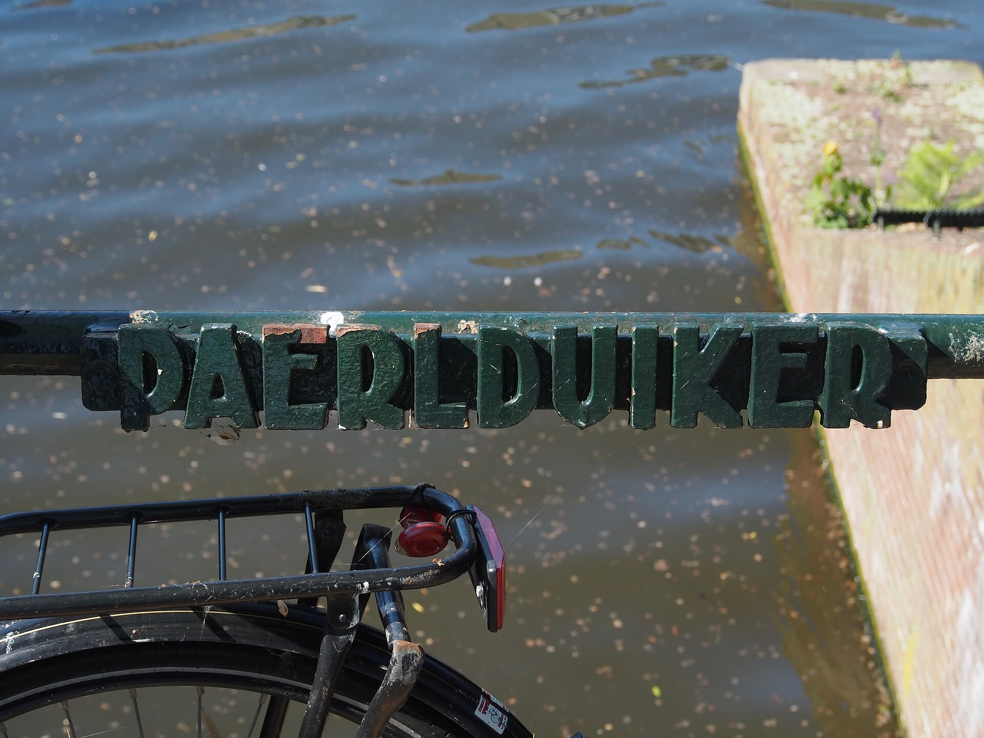
The Brewery Between Two Islands: Brug 91, the Paerlduiker
Brug 91 links Kattenburg to Wittenburg, two of the three artificial islands Amsterdam built in the seventeenth century to hold its shipyards. It is called the Paerlduiker, and both halves of that name are worth unpacking, because neither means what a visitor would guess.
Etymology: A Pearl That Was a Brewery
The Paerl is De Paerl, a brewery that stood on this spot in the seventeenth century. Amsterdam breweries took names like jewels and animals and hung them on gable stones, and the name outlived the building by three hundred years and more.
The duiker is the more interesting half. A duiker is a culvert, a covered channel carrying water under a road, and it is not quite the same thing as a bridge. The distinction matters here because this structure sits genuinely between the two categories: it reads from above as a piece of street, and only from the water is it obviously a crossing. It has also been called the Paerlbrug, which is the same object filed under the other heading.
It carries the Kattenburgergracht and Wittenburgergracht over the southern outlet of the Kattenburgervaart.
The Eastern Islands
Kattenburg, Wittenburg and Oostenburg were made, not found. Amsterdam raised them out of the IJ in the 1650s because the shipbuilding industry had outgrown the Lastage and needed deep water, long slipways and room for timber. By the late seventeenth century the islands appear on the maps as Katten burgh and Witten burgh.
This was the industrial engine of the Dutch Golden Age. The Dutch East India Company built its ships and warehouses on Oostenburg, the Admiralty worked from Kattenburg, and for two centuries this was among the most productive shipbuilding districts in the world.
A crossing has stood on this line throughout. Daniel Stalpaert drew one on his map of 1662, and photographs from around 1860 show a wooden drawbridge, the kind that opened to let masted vessels through between the islands.
What Stands There Now
The present structure is concrete, fixed, and styled in the manner of the Amsterdamse School. The giveaway is on the south-facing abutments: twisted decorative ironwork, of exactly the kind that Piet Kramer and his colleagues used across the city between the wars.
It is worth noticing what that combination means. A working industrial crossing between two shipyard islands was rebuilt in the period when Amsterdam had decided that even its utility infrastructure should be designed. The bridge does not need decorative ironwork. It has it anyway.
Urban Context: The Oosterkerk and the Neighbours
The bridge stands among monuments without being one. The Oosterkerk of 1671, built to serve the shipyard population, is a rijksmonument a short walk away, and the surrounding quays carry both municipal and national listings.
The district today is residential and quiet, which is a complete inversion of what it was for. The shipyards closed, the naval activity moved out, and the islands became housing. The same story runs a few hundred metres east at Brug 80, the Entrepotdoksluis, where a customs dock became flats.
Amsterdammers of a certain age know these streets from the television series Baantjer, several of whose locations sit within sight of the bridge.
Breweries, Gable Stones and the Naming of Things
Amsterdam had well over a hundred breweries at its seventeenth-century peak, and almost none of them had a street address in the modern sense. Buildings were identified by a carved gevelsteen, a gable stone, showing an object, an animal or a trade, and the brewery took its name from the stone: De Paerl, the pearl.
That system is why so much of the Amsterdam map sounds like a bestiary or a jeweller’s window. The names were addresses first and became history afterwards, and they survive on bridges long after the buildings are gone because a crossing is the one thing in a district that nobody renames when the tenant changes.
It also explains a small oddity of this series: a striking number of Amsterdam bridges are named after businesses that failed centuries ago. The Bakkerijbrug had a bakery, the Berensluis had bear hides, the Haringpakkersbrug had herring packers, and Brug 91 had a brewery. The trade is always the thing that disappears first.
Technical Specifications
- Bridge number: 91
- Name: Paerlduiker, also Paerlbrug
- Type: Fixed bridge, between a bridge and a culvert (duiker)
- Carries: Kattenburgergracht to Wittenburgergracht
- Spans: Southern outlet of the Kattenburgervaart
- District: Amsterdam-Centrum, the Eastern Islands
- Coordinates: 52.3703 N, 4.9173 E
- Material: Concrete, with decorative twisted ironwork
- Style: Amsterdamse School
- Name origin: De Paerl brewery, seventeenth century
- Earliest record: Stalpaert’s map of 1662
- Earlier structure: Wooden drawbridge, photographed circa 1860
- Status: Not a monument, flanked by monuments
Sources Consulted
- Featured image: Paerlduiker, Bridge 91, Amsterdam by Alf van Beem, 2017, via Wikimedia Commons, Public domain
- Paerlduiker, Nederlandstalige Wikipedia
- Kattenburg, Nederlandstalige Wikipedia
- Wittenburg, Nederlandstalige Wikipedia
- Oosterkerk, Nederlandstalige Wikipedia
- Bruggen van Amsterdam
- Stadsarchief Amsterdam, Beeldbank
- Frank V. Smit, Bruggen in Amsterdam (2008), Uitgeverij Matrijs