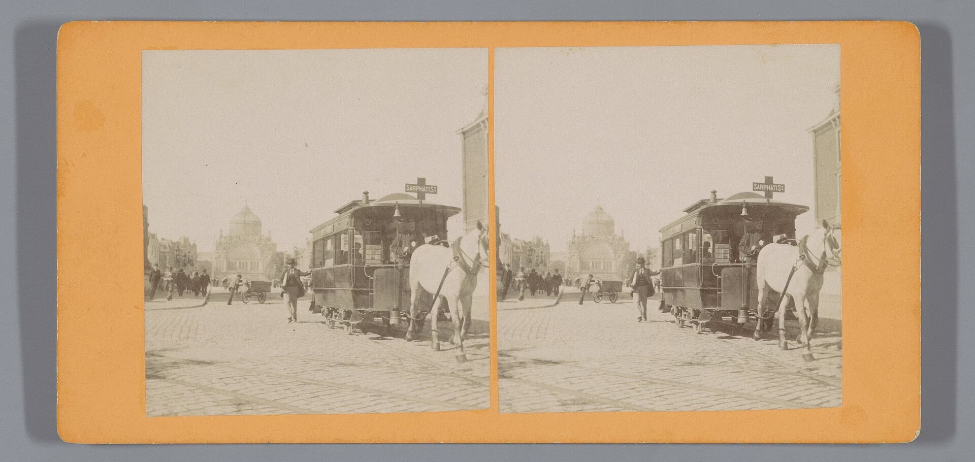
The Flattening: How the Tram Took Amsterdam’s Arches
Look at any seventeenth or eighteenth-century view of an Amsterdam canal and you will notice something missing from the modern city. The bridges arch. They rise from the quay in a curve, high enough for a laden barge to pass beneath, and they come down again on the other side.
Walk the same canals today and most of those arches are gone. The bridges are flat. This did not happen gradually or by accident. It was a deliberate programme, carried out over roughly fifty years, and it represents the moment Amsterdam stopped being a city organised around its water and became one organised around its streets.
The Trade-off
An arched bridge and a flat bridge are answers to two different questions.
The arch serves the water. Height at the centre of the span means clearance underneath, and clearance means a barge can pass fully laden. In a city where goods arrived by canal and were stored in waterside warehouses, that clearance was the whole point.
The flat deck serves the road. Anything on wheels has to climb an arch, and a horse pulling a loaded cart has to climb it twice a trip. As land traffic grew heavier and more frequent, the arch stopped being a feature and became an obstacle.
You cannot have both. Every bridge in the city was a small, permanent decision about which kind of traffic mattered more, and from the middle of the nineteenth century Amsterdam changed its mind.
De Greef and Springer, 1856 to 1890
The programme has two names attached to it: Bastiaan de Greef (1818 to 1899) and Willem Springer (1815 to 1907), the city architects whose tenure at Publieke Werken ran from roughly 1856 to 1890.
Those years are precisely the period in which Amsterdam converted from a water city to a land city. From around 1860 the high arched bridges began to be lowered, and in many cases replaced outright with flat plate or beam bridges in iron. De Greef and Springer are also responsible for the two grandest crossings of the era, the Blauwbrug and the Hogesluis, both completed in 1883.
Their names recur constantly in the histories of individual bridges on this site. They designed the crossing at the Leidsegracht that is now Bridge 67, contracted in 1889 and finished in February 1890. De Greef designed a bridge at the Aalmoezeniersbrug site around 1860. A single municipal office, over about three decades, reshaped the profile of the entire canal ring.

The Tram Decided It
What turned a gradual preference into a programme was rail. The Amsterdamsche Omnibus Maatschappij began laying tram lines in 1872, and a tram is far less forgiving than a cart. It cannot climb a steep arch, it needs a consistent gradient, and its rails must be laid on a continuous surface.
The consequences were drastic and are worth stating plainly: shipping routes through the city were relocated, arched bridges were lowered, and lifting bridges were replaced with fixed ones. The water was rearranged to suit the rails.
You can still read this on individual crossings. Bridge 66 at the Runstraat was lowered and widened at the end of the century, and the nineteenth-century supports added for that widening are still visible on the piers, plainly narrower than the deck they carry. The bridge never hid the alteration.

The Skippers Objected, and Lost
It was not uncontested. At Bridge 62, where the Prinsengracht’s eastern bank crosses the Leliegracht, the municipality proposed lowering the bridge at the end of the nineteenth century and the ships’ captains formally protested. Less clearance means smaller cargo, or a longer route, or no route at all for the tallest vessels.
The council voted for the lowering, in favour of land traffic.
That vote is the whole story in miniature. The same argument was had at bridge after bridge through the same decades, usually with the same outcome. The skippers were not being unreasonable. They were simply on the losing side of a structural change in how a city moved its goods, and they could see it happening one bridge at a time.
What the Arches Looked Like
We know, because artists recorded them.
At Bridge 64, the Reesluis, a painting by Reinier Nooms from around 1664 and a drawing by Willem Hekking from around 1845 both show an arched bridge with three passages. Nooms was working at the height of the Golden Age, Hekking nearly two centuries later, and the bridge kept the same form throughout. Then, within a few decades of Hekking’s drawing, it was gone.
That is the useful thing about the flattening as a historical marker. Structures that had been stable for two hundred years were altered within a generation. If a canal bridge in Amsterdam looks older than the 1860s, check it, because it very probably is not.

The One That Got Away
Not every bridge was flattened, and the survivor is worth the walk and is part of the famoous 7 bridges along the Reguliersgracht.
Bridge 74, the Kerksluis, carries the Kerkstraat over the Reguliersgracht and still has its stone arch, rising gently (it doesn’t feel gentle on a bike trust me) out of the water as it has for more than two centuries. Locals call it the Ronde brug, the round bridge, because on a still day the arch and its reflection close into a perfect circle.
It survived for a rather unglamorous reason: it sits on a quiet side canal that no tram route needed. The bridges that were flattened were the ones on the through routes. The ones that escaped were, almost without exception, are the ones nobody needed to drive over.
Amsterdam’s most photographed piece of bridge geometry exists because a quirk of tram routes that went somewhere else.
Sources Consulted
- Featured image: A horse tram on the Hogesluis, about 1896 by Rijksmuseum, 1896, via Wikimedia Commons, CC0
- Bruggen van Amsterdam, Nederlandstalige Wikipedia
- H. Rowaan, Oude en nieuwe bruggen over het water, Vereniging Vrienden van de Amsterdamse Binnenstad
- Guido Hoogewoud, De bruggen van de Burgwallen: vernieuwing versus traditie
- Reinier Nooms (Zeeman), painting of the Reesluis, c. 1664
- Willem Hekking, drawing of the Reesluis, c. 1845
- Stadsarchief Amsterdam Beeldbank