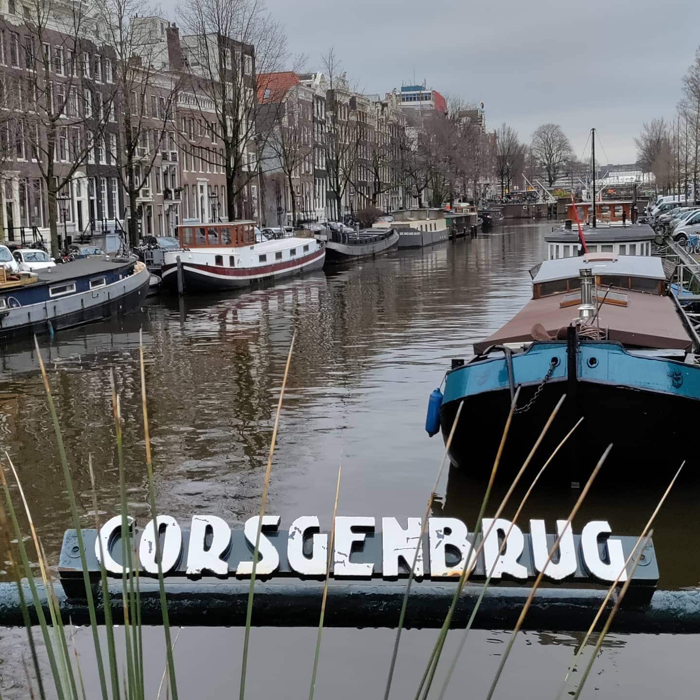
Corsgenbrug (Brug 12) was named after wood buyer Corsgen Jacobsz,
who in the 15th century had an orchard on the Singel, which was at that time just outside the city. It is another bridge that spans over the Singel, Bridge 12 is just to the north of Bridge 11.
It is the location of what is sometimes referred to as the Queer Garden a peculiar usage of random objects such as broken mannequins or toilet bowls used as pots for plants and flowers. Tiny but makes the city a little more quirky.
Corsgenbrug has been a national monument (rijksmonumenten) since 1995.
It was redesigned by Wichert Arend de Graaf and rebuilt between 1913 and 1914.
Architect
1913: Wichert Arend de Graaf
Dienst der Publieke Werken – Department of Public Works

The Corsgenbrug (Bridge 12): A 15th-Century Orchard, a Timber Merchant, and 50 Tons of Iron
There is a quiet crossing on the Singel that most visitors to Amsterdam walk straight past on their way to somewhere busier. It carries no famous name in the tourist guides. It does not swing open for boats, and it does not announce itself with fanfare. But Bridge 12, the Corsgenbrug, has been connecting two sides of this ancient waterway for centuries, and its story reaches further back into Amsterdam’s past than almost any structure you will encounter on a canal walk.
A Name Rooted in an Orchard
Every bridge name in Amsterdam tells a story, and the Corsgenbrug tells one of the most human ones. The bridge was named after wood buyer Corsgen Jacobsz, who in the 15th century had an orchard on the Singel, at that time just outside Amsterdam. Prabook Picture what this spot would have looked like then: not a densely packed canal district of tall merchant houses and cobbled streets, but open ground just beyond the city’s edge, where a timber merchant named Corsgen kept his fruit trees.
The name “Corsgen” is itself a diminutive form, a softened, familiar version of the name Cors, of the kind that would have been used by neighbours and friends. The bridge over the Singel took its name from him, and subsequently so did the alley on the other side of the Singel. Wikipedia So a single man’s orchard gave a name to a bridge, and the bridge gave a name to a street, and that street still carries the memory of Corsgen Jacobsz today in the form of the Korsjespoortsteeg and Korte Korsjespoortsteeg. This is how Amsterdam’s urban geography works: layer upon layer of personal history compressed into everyday place names that most people repeat without ever pausing to wonder where they came from.
The bridge also went by the names Korsjesbrug and, for a time, took on associations with the Korsjespoort, a gate that once stood in this part of the city. Wikipedia The name Corsgenbrug was in informal use for many years but, in April 2016, the municipality of Amsterdam decided to make the unofficial name Corsgenbrug official. Revolvy It took the city five centuries, but Corsgen Jacobsz finally got his name on the sign.
Centuries on the Maps
One of the most striking facts about this modest bridge is how long it has been documented. The bridge is shown on the map by Pieter Bast dating from 1599, and Balthasar Florisz. van Berckenrode also drew the bridge in his map of a quarter of a century later, where it appears in the Korsjes-poort-steech over the Cingel. Revolvy To appear on two of the most important cartographic records of early modern Amsterdam is to confirm that this was a recognised and well-used crossing point long before the Canal District reached its Golden Age peak.
For most of those centuries, the crossing here was a drawbridge, allowing boat traffic to pass through the Singel. In 1866, the wooden drawbridge that stood here was replaced by an iron drawbridge. Wikipedia That iron structure served the neighbourhood for decades, until it too reached the end of its useful life.
The 1913 Reconstruction: 50 Tons of Iron and a Budget of 26,000 Guilders
The modern history of Bridge 12 begins in 1883, when the drawbridge was out of service due to lengthy construction work. Revolvy By the early twentieth century, it was clear that a permanent fixed bridge was needed to serve the growing demands of a modernising city. Drawbridges, however charming, created delays for the trams and carts and bicycles that were increasingly defining Amsterdam’s street life.
In 1913, a tender was issued for “the demolition of the existing bridge and the construction of a new permanent bridge no. 12 over the Singel in front of the Korsjespoortsteeg.” A contractor agreed to carry out the work for 26,000 guilders. Revolvy That sum, in the currency that preceded the Euro, bought something that still stands today. The construction took place from October 1913 to April 1914, during which 50 tons of iron had to be processed. Rather than the earlier five spans, the new bridge was built with three. Revolvy
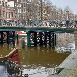
The design was provided by engineer Wichert Arend de Graaf of the Public Works Department (Dienst der Publieke Werken). Revolvy It is worth pausing on that detail. De Graaf was a municipal engineer, not a celebrated architectural name, and the Corsgenbrug is a quietly competent piece of early twentieth-century civic infrastructure rather than a monument of expressive design. Its iron piers, visible from the canal, speak of function and durability. A lantern sits on each of the four abutments Wikipedia, giving the bridge a measured, symmetrical dignity that suits its role as a neighbourhood crossing rather than a grand boulevard statement.
Location and Urban Context
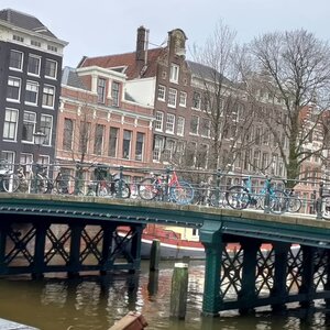
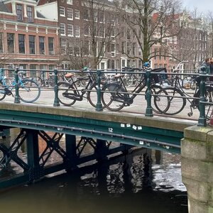
The Corsgenbrug connects the Korte Korsjespoortsteeg with the Korsjespoortsteeg, spanning the Singel. Architectuul In practical terms, this places it on a quiet pedestrian route through one of the older and less trafficked parts of the inner city, a stretch of the Singel that retains much of its intimate residential character.
One of the great incidental pleasures of crossing the Corsgenbrug is the view it offers. Historical photographs held in the Stadsarchief Amsterdam, including a stereo glass slide from the archive’s collection, show the bridge in the foreground with the Ronde Lutherse Kerk (the Round Lutheran Church, also known as the Koepelkerk) rising directly behind it across the water. The caption of one archival image reads: “Het Singel gezien naar de Ronde Lutherse Kerk met op de voorgrond de Korsjesbrug (Brug 12) voor de Korte Korsjespoortsteeg.” Revolvy Approaching the bridge from the side streets, the church’s copper dome fills the end of the view almost perfectly, a piece of accidental urban composition that photographers have been drawn to for well over a century.
Monument Status
The Corsgenbrug has been a national monument (Rijksmonument) since 1995. Prabook That designation recognises the bridge not only as a functional piece of infrastructure but as part of the irreplaceable fabric of the historic canal city, a fabric that in this neighbourhood is dense with protected buildings and quaysides. The bridge sits modestly within that landscape, as it always has, doing its job and carrying its old name.
For a city that is always at risk of being experienced only through its most famous landmarks, the Corsgenbrug offers a quieter invitation. Stand on it for a moment. Look east toward the dome of the Koepelkerk. Think of Corsgen Jacobsz and his orchard, of the iron drawbridge that once opened here for sailing barges, and of the engineer who replaced it all with three spans and 50 tons of iron in the winter of 1913. This is Amsterdam at its most layered and most itself.

There has been a bridge at the location of Corsgenbrug for centuries. The bridge is shown on the map by Pieter Bast dating from 1599. Balthasar Florisz. van Berckenrode has also drawn the bridge in his map of a quarter of a century later. There the bridge lies in the Korsjes-poort-steech over the Cingel.
The modern history of bridge 12 begins in 1883, when the drawbridge was out of service due to lengthy construction work. In 1913, “the demolition of the existing bridge and the construction of a new permanent bridge no. 12 over the Singel in front of the Korsjespoortsteeg” was put out to tender. A contractor wanted to do it for 26,000 guilders (the currency used before the Euro). The construction took place from October 1913 to April 1914; 50 tons of iron had to be processed. Instead of five canals, three were built. Engineer Wichert Arend de Graaf of the Public Works Department provided the design. In 2017, that iron can still be seen on the outside; the two bridge pillars are made from it.
For a while, the bridge went through life under the name Corsgenbrug, Korsjesbrug or Korsjespoort, a name named after Corsgen Jacobsz., a timber merchant who had an orchard nearby. In April 2016, the municipality of Amsterdam decided to make the unofficial name Corsgenbrug official.


Architect
1913: Wichert Arend de Graaf
Dienst der Publieke Werken – Department of Public Works
Like many of the previous 11 bridges Corsgenbrug is shown on the map by Pieter Bast dating from 1599. Balthasar Florisz. van Berckenrode had also drawn the bridge on his map of a quarter of a century later. There the bridge lies in the Korsjes-poort-steech over the Cingel.
https://w3w.co/runs.returns.crowd
https://w3w.co/speeltuin.huifkar.kusje
///runs.returns.crowd
///speeltuin.huifkar.kusje
52.377035, 4.892033
This what3words address refers to a 3 metre square location. Tap the link or enter the 3 words into the free what3words app to find it.